Storm Chances For Thursday, Still Watching Cristobal
SUMMARY: Showers and storms will be around as we end the workweek along with the warm & humid summer temperatures. We’ll have drier weather for the weekend, but we’ll need to continue to watch Tropical Storm Cristobal closely as it could still affect our area early next week with locally heavy rain and an isolated tornado threat. Stay tuned to WCBI!
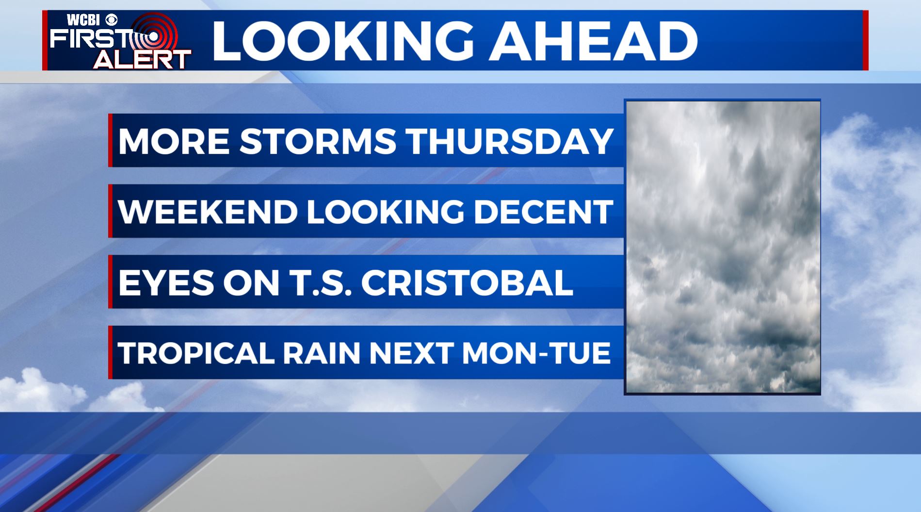
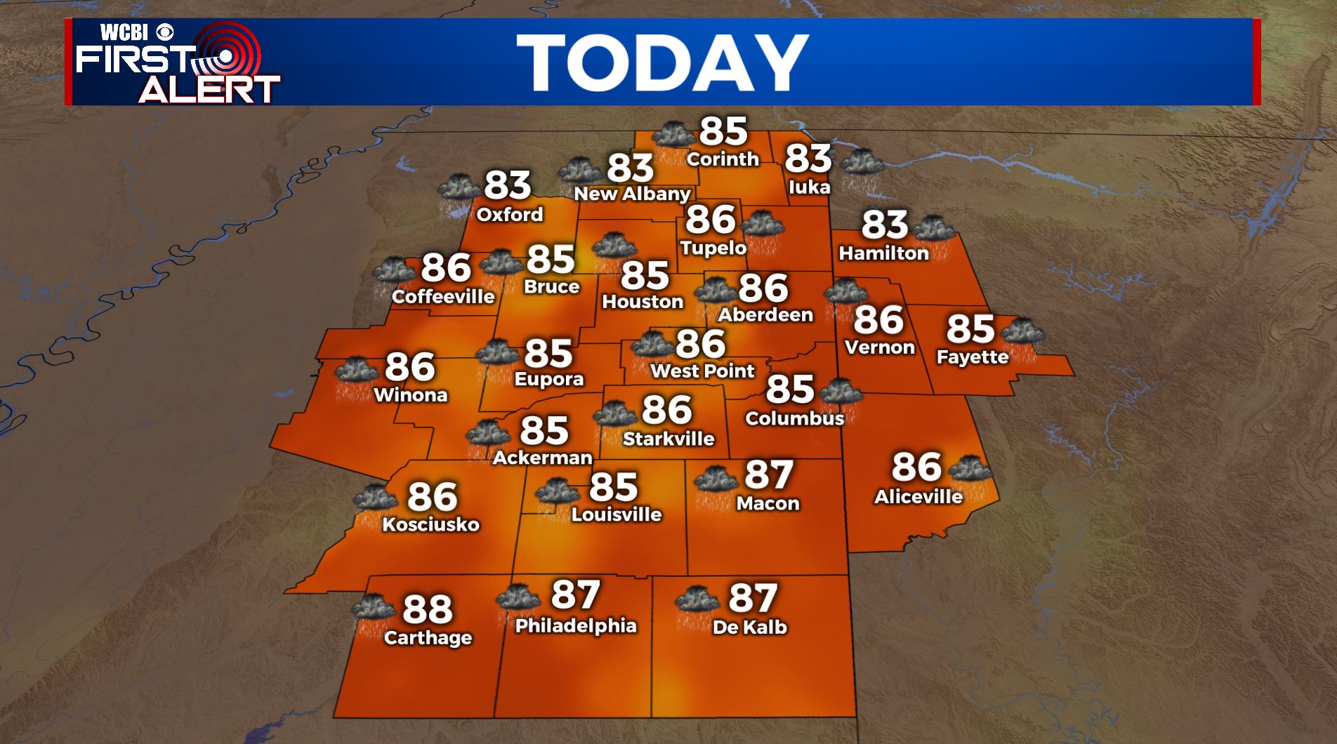
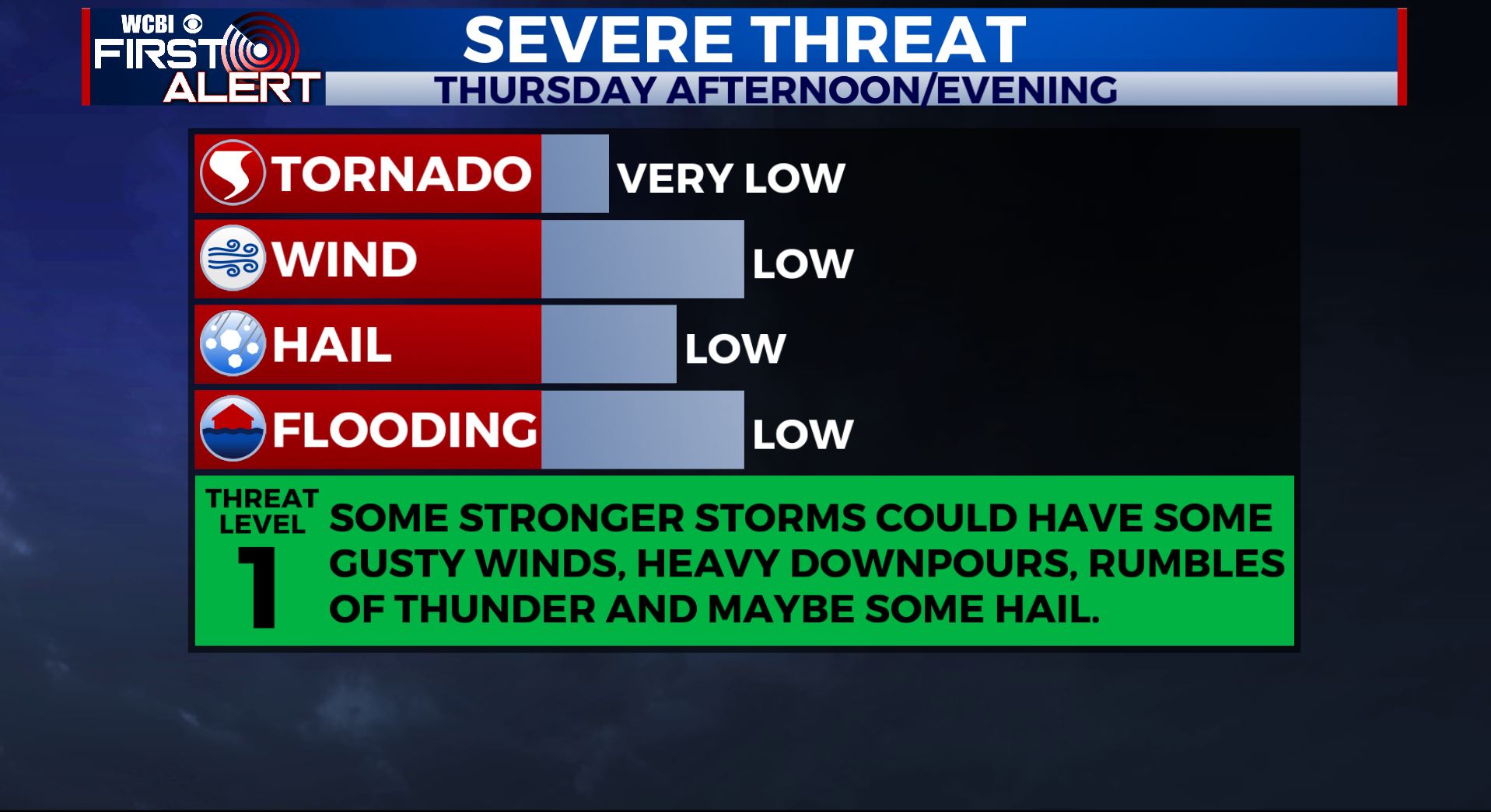
THURSDAY: We are watching closely showers & storms over Missouri & Arkansas this Thursday morning. Some of this activity could reach the WCBI Viewing Area later on today, that will bring us better chances of showers & storms especially in the afternoon when we get the peak heating of the day. Some storms could be on the strong side with some gusty winds, hail, heavy downpours and lightning. Highs in the mid 80s. SW winds 5-10 mph.
THURSDAY NIGHT: Mostly cloudy skies with maybe a stray shower & storm possible. Muggy overnight lows near 70.
FRIDAY: Pop-up showers and storms possible once again with a mix of sun & clouds. Staying warm and humid as high temperatures top out in the upper 80s.
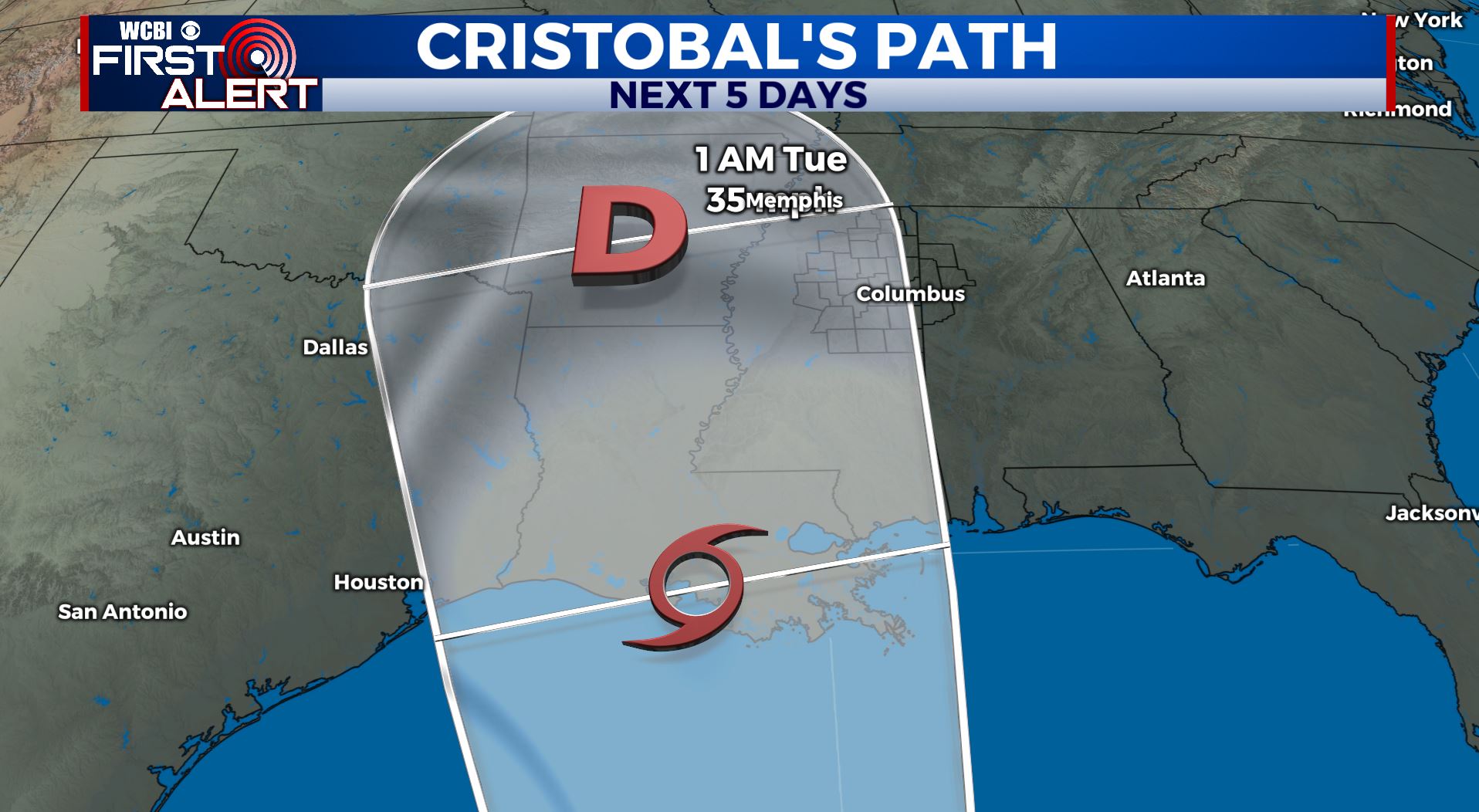
WEEKEND: Overall a mix of sun and clouds, but some stray shower or storm can’t be ruled out. Tropical Storm Cristobal will approach the Gulf coast by late Sunday. Highs temperatures continue to be very warm & humid in the upper 80s to lower 90s.
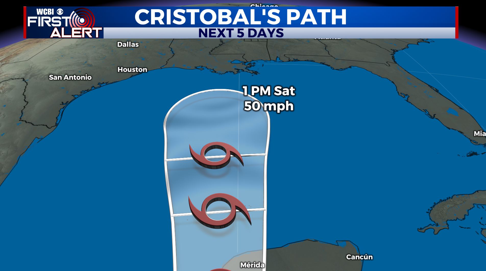
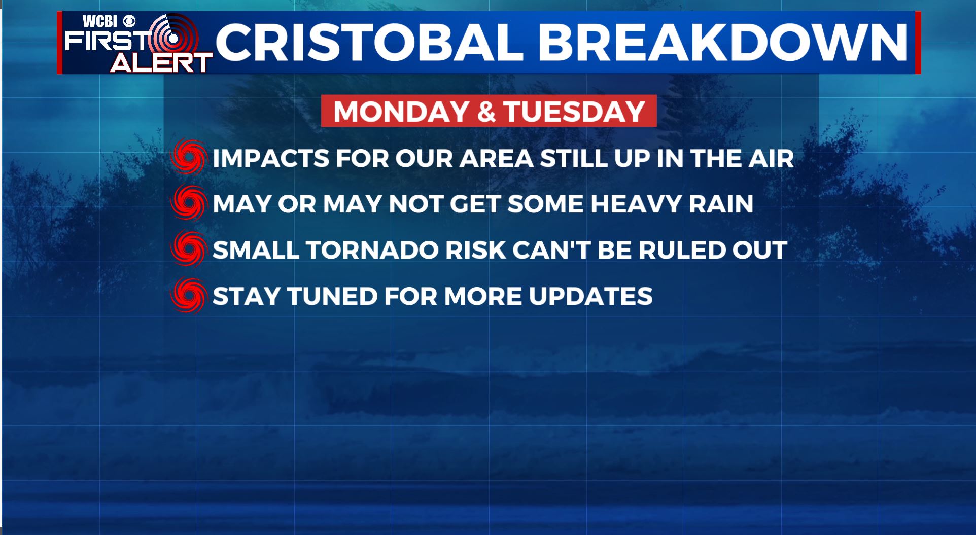
MONDAY-TUESDAY: It’s looking more like Tropical Storm Cristobal may make landfall on the Louisiana coast early Monday and then track to the west of our area. This would put the WCBI coverage area on its eastern (more active) side, which could heavy rainfall and a small isolated tornado threat. Be sure to check back with us for updates heading into the weekend.
Stay connected with @WCBIWEATHER on Facebook, Twitter, Instagram, and the WCBI News App


Leave a Reply