Storm Chances Thru Thursday Then Quiet
WEDNESDAY NIGHT: While a shower or storm is still possible across the WCBI coverage area, new information suggest the heaviest rain and storms will stay just to our northwest into parts of northwestern Mississippi and west Tennessee. Breezy southeasterly winds will continue between 15 and 25 mph with higher gusts. Temperatures are expected to drop only into the mid 60s for lows.
THURSDAY: Look for more wind in the form of SSW breezes between 15 and 25 mph with higher gusts. Mild 70s should return for high temperatures but the trade off will continue to be a threat of rain and storms, mainly from about midday through sunset. A few strong to severe storms are still possible with damaging wind gusts being the main concern. A brief tornado can never be ruled out but it just doesn’t look like enough ingredients will come together for much of a widespread threat.
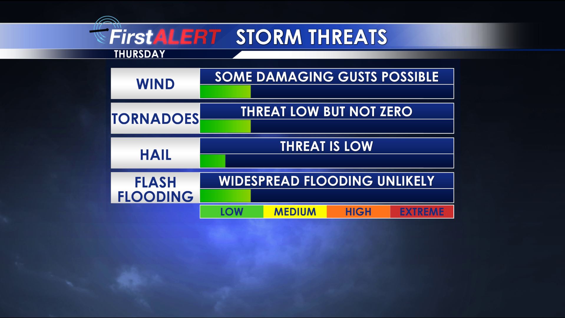
Severe Threats Thursday
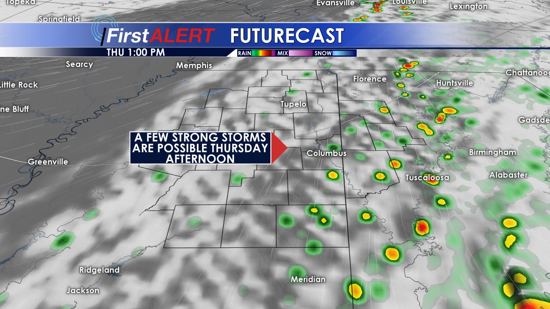
Thursday’s Futurecast
THURSDAY NIGHT: Cooler, drier air settles back in. Temperatures by sunrise Friday may be back into the upper 40s.
FRIDAY: Partly cloudy to mostly sunny with highs from the upper 50s to lower 60s. It’ll be a great way to close out the work week:
SATURDAY-TUESDAY: Mostly sunny conditions hang on. Highs in the 50s are likely Saturday with 60s returning for Sunday, Monday, and Tuesday. Overnight lows tumble back into the 30s and some frost potential will exist both Saturday and Sunday morning.
Follow @WCBIWEATHER on Facebook, Twitter, and Instagram


Leave a Reply