Storms coming on back
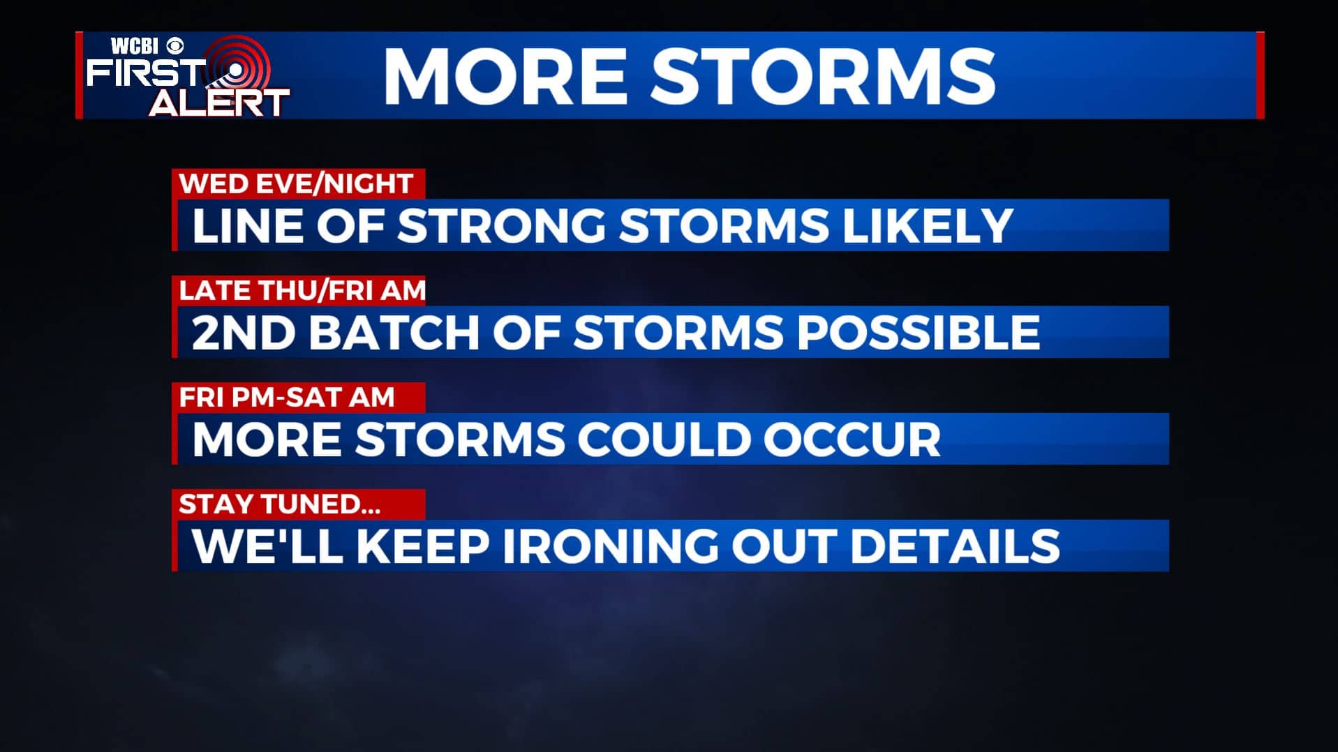
SUMMARY: Unsettled weather is coming back after a needed reprieve. A few showers are possible Tuesday afternoon but a much higher chance of rain and severe storms exists for Wednesday evening/night. Additional rain and storms could linger through the end of the week and into the start of the weekend.
MONDAY NIGHT: Mostly clear to partly cloudy. Lows in the low 50s. Light southerly winds.
TUESDAY: Partly cloudy. A 10% chance (or less) of an afternoon shower. Highs in the upper 70s to around 80. Southerly winds 5-15 mph.
TUESDAY NIGHT: Increasing clouds and milder. Lows in the upper 50s.
WEDNESDAY: Breezy and warm. Highs around 80. Southerly winds 10-20 mph with gusts to 25 mph.
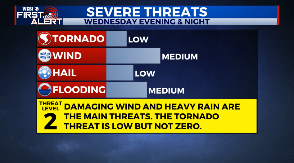
WEDNESDAY EVENING/NIGHT: A line of strong to severe storms could push across our area. Damaging wind gusts and heavy rain appear to be the main concerns. The tornado threat in this setup is low but not zero so we’ll continue to monitor. Some flooding in possible, especially in areas that had all the heavy rain last week. Lows in the 50s.
THURSDAY: Partly cloudy. Highs in the low 80s.
THURSDAY NIGHT: Chance of rain and storms. Lows in the upper 50s to around 60.
FRIDAY: Chance of rain and storms. Highs in the upper 70s.
FRIDAY NIGHT: Chance of rain and storms. Lows around 60.
SATURDAY: Rain and storms possible during the morning. Drying out during the afternoon. Highs in the mid 70s.
SUNDAY: Partly cloudy. Highs in the mid 70s.
Follow @WCBIWEATHER on Facebook, Twitter, Instagram, and the WCBI News App.


Leave a Reply