Some Storms Friday, Severe Weather Saturday
We’ll be in an active weather pattern over the next seven days with multiple chances for showers and storms. Our main focus right now is on Saturday, when severe weather is looking likely.
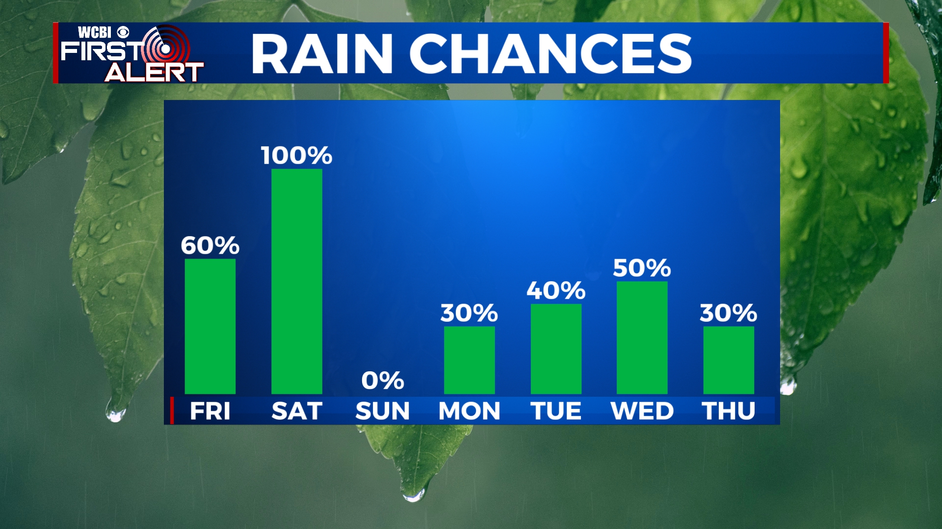
FRIDAY: As our storm system approaches, we’ll start to see some areas of showers develop through the day. A few rumbles of thunder are possible by the afternoon and evening. No severe weather is expected with this batch. Highs will be in the upper 60s.
FRIDAY NIGHT: Mostly cloudy with areas of showers. We’re expecting the worst weather to hold off until after sunrise on Saturday, so enjoy a good night’s rest. Temperatures will stay rather warm overnight with lows in the mid 60s.
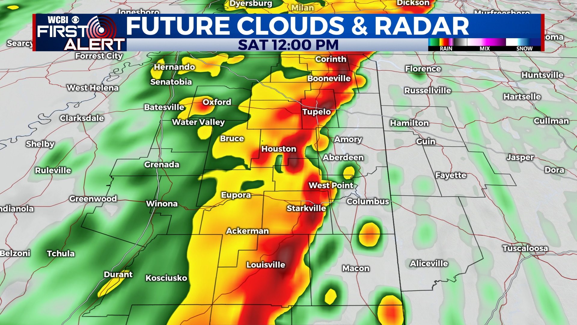
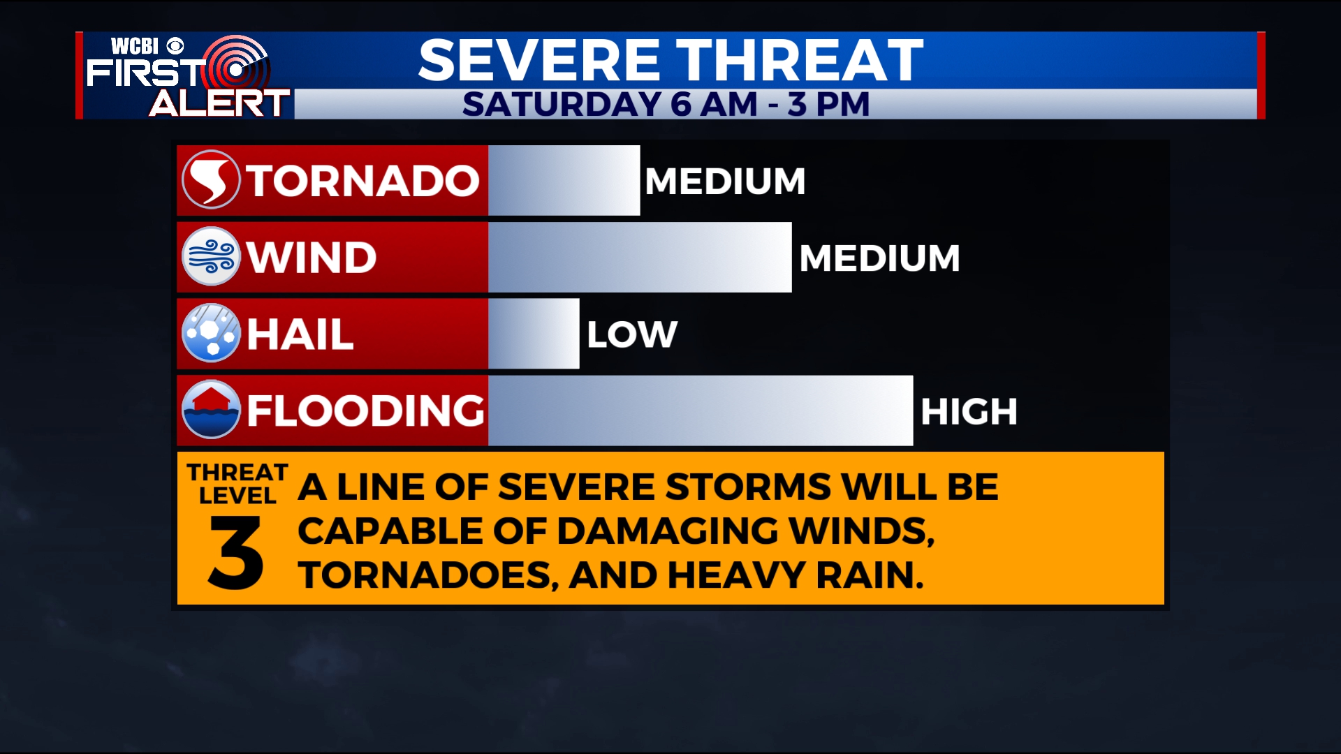
SATURDAY: A line of strong to severe storms will move across the area in the morning and into the early afternoon. As of now, the timing for the worst weather across our area is 6am to 2pm. This line of storms will have the potential to produce damaging winds in excess of 75 mph, heavy rain, and tornadoes. If any storms are able to develop ahead of the line, the tornado threat would increase. This is something we will keep an eye on. Temperatures will be unseasonably warm with highs near 70. It looks like storms will exit the area by the afternoon hours, with most of us being dry by sunset.
What you need to know to prepare for severe weather
SUNDAY: The only guaranteed nice weather day for the next seven days. Seriously, enjoy it. Temperatures will be in the upper 50s under mostly sunny skies.
MONDAY-THURSDAY: We’ll be in another active weather pattern through next week with some showers and storms possible each day. As of now, the best chance for storms looks to be on Tuesday and Wednesday. Temperatures will stay above average with highs in the 60s and morning lows in the 40s and 50s.


Leave a Reply