Storms tonight & Easter Sunday
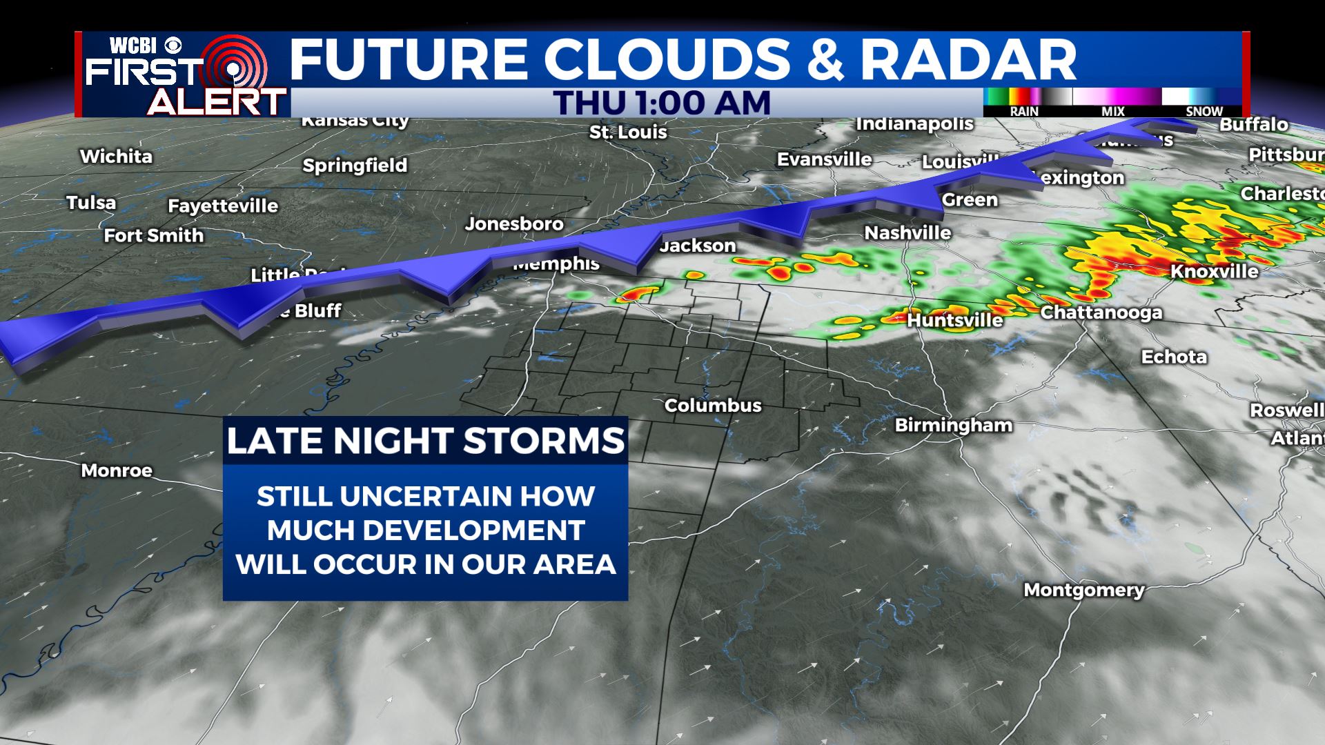
SUMMARY: A few isolated storms are possible early this evening. A bigger line of storms may move in from Tennessee after midnight. Damaging wind gusts and hail will remain the primary concerns with the late night storms. Another system is expected to move through the region late Saturday into Sunday. Additional strong to severe storms and heavy rain may occur with that one so we’ll keep on watching it.
WEDNESDAY NIGHT: A few evening storms followed by a lull. A batch of additional storms after midnight with a cold front. Wind and hail are the main concerns if severe weather does occur. Lows in the low 60s. Winds SW 5-15 mph.
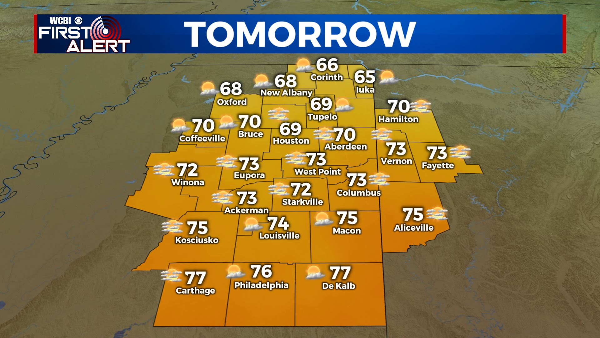
THURSDAY: A mix of clouds and sun. Cooler highs in the low 70s. Northerly winds 10-20 mph.
THURSDAY NIGHT: Partly cloudy and cool. Lows in the mid to upper 40s.
FRIDAY: Sun & clouds. Cooler highs in the low to mid 60s.
FRIDAY NIGHT: Chilly. Lows in the upper 30s to lower 40s.
SATURDAY: Variably cloudy. Some showers are possible late in the day and into the evening. Highs in the low 70s.
SATURDAY NIGHT: Rain & storms possible. Lows in the mid to upper 50s.
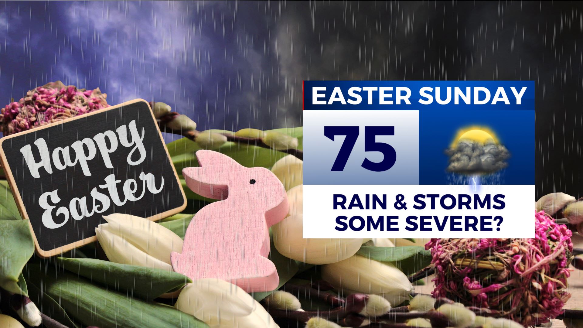
EASTER SUNDAY: Areas of rain and storms. Some strong to severe weather is possible in the region. Stay tuned for updates as we get closer for more specifics. Highs in the 70s.
Follow @WCBIWEATHER on Facebook, Twitter, Instagram, and on the WCBI News App


Leave a Reply