Stormy Tuesday coming our way
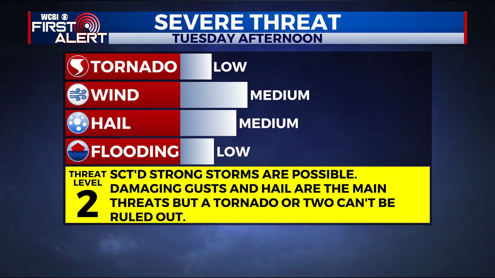
SUMMARY: Additional showers are storms are possible later tonight and Tuesday morning. A few strong to severe storms may occur Tuesday afternoon and evening. Quiet and warm weather looks to build back in for the middle to end of the work week.
MONDAY NIGHT: Mostly cloudy during the evening. Some rain and storms are likely by sunrise. A few of the storms could produce hail. Lows around 60.
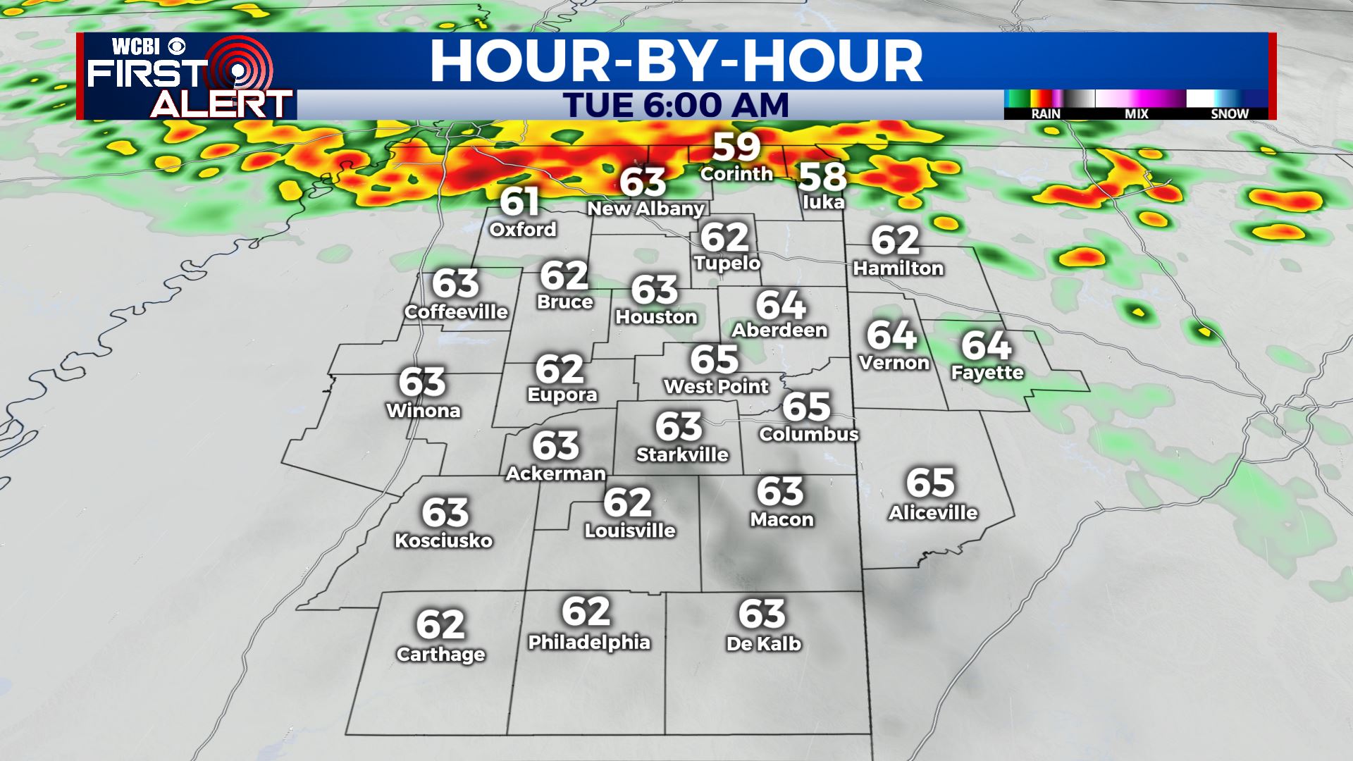
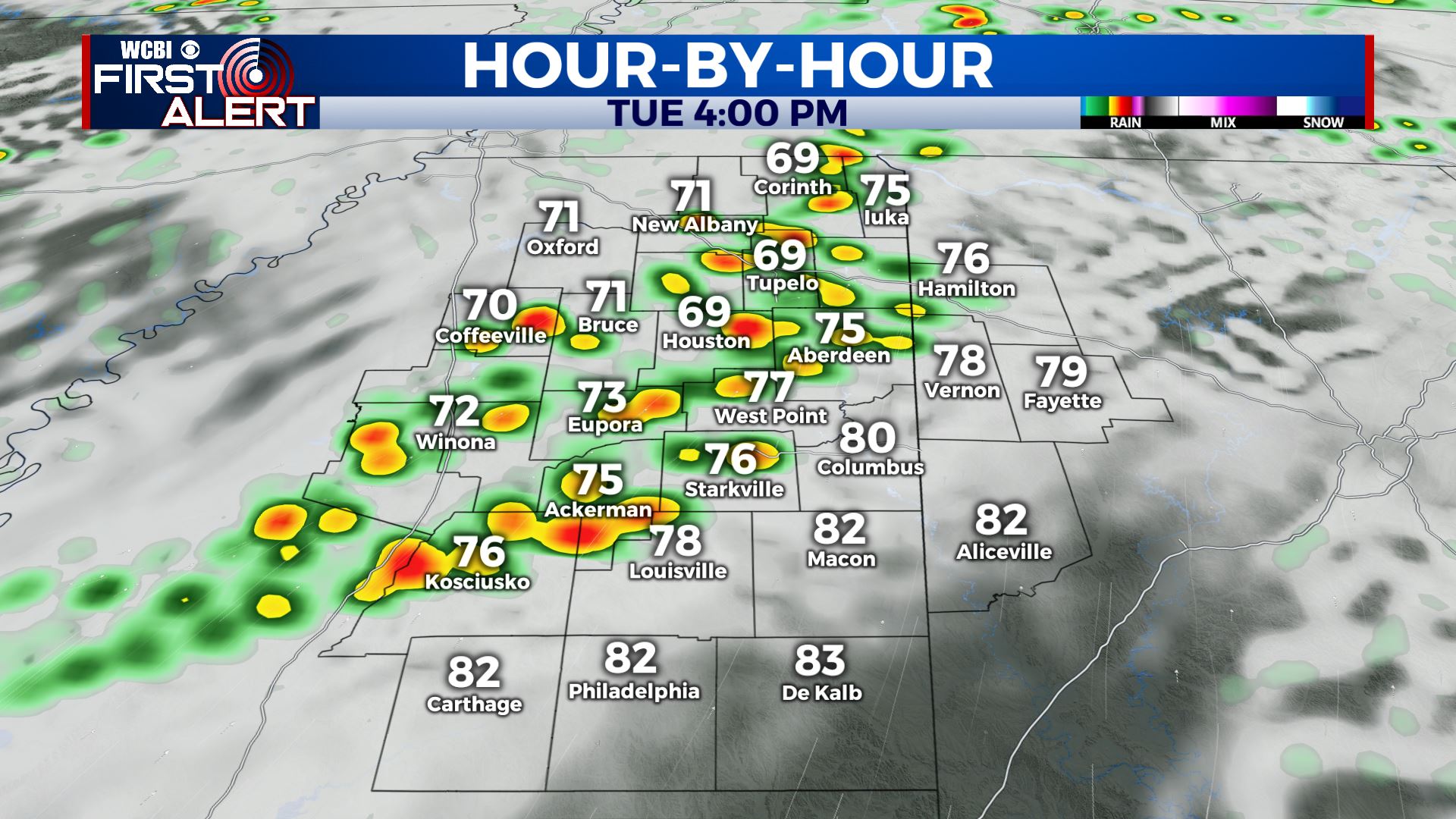
TUESDAY: A batch of morning showers and storms followed by a lull. Southerly winds boost temperatures to around 80 by early to mid afternoon. Additional storms are expected after 2 p.m. and some of them may be strong to severe with damaging wind, hail, and perhaps even an isolated tornado. The threat will diminish by mid evening. Strong SSW winds 10-20 mph with gusts to 25.
TUESDAY NIGHT: Partly cloudy. Lows in the 50s.
WEDNESDAY: Turning partly cloudy. Highs in the low 70s.
WEDNESDAY NIGHT: Clear and quiet. Cooler lows in the upper 40s.
THURSDAY & FRIDAY: Partly cloudy and warm. Highs well into the 80s. Some new record highs can’t be ruled out. Lows in the 60s.
SATURDAY: Staying warm with more highs in the 80s. Additional showers and storms are possible during the afternoon and evening with another cold front heading our way. Some strong storms can’t be ruled out and it’s something we’re going to continue monitoring.
Follow @WCBIWEATHER on Facebook, Twitter, Instagram, and on the WCBI News App


Leave a Reply