Cold & dry end to the week
WEDNESDAY NIGHT: Rain and embedded thunder and lightning will gradually taper off during the night. Colder 40s will settle in by daybreak as gusty NW winds set up.
THURSDAY: Mostly cloudy for most of the day with clearing late. Temperatures holding mainly in the 40s for most of the day. Gusty NW winds 10-20 mph develop.
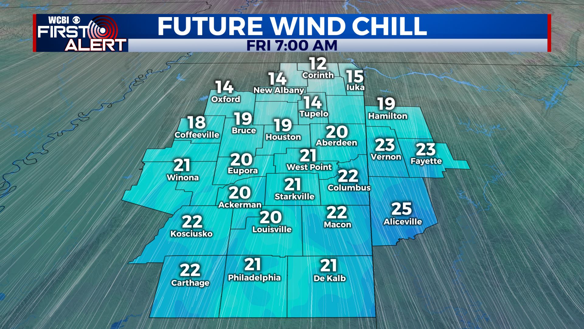
THURSDAY NIGHT: Clearing skies, breezy, and cold. Actual temperatures fall into the mid to upper 20s with wind chill values tumbling into the teens and low 20s. Winter coats will be a must.
FRIDAY: Sunny and dry. Highs in the 40s. A northerly breeze will keep a winter chill going all day long. Baseball gets going at MSU and Ole Miss and the weather will be good, just cold.
FRIDAY NIGHT: Clear and cold. Lows in the mid 20s.
SATURDAY: Mostly sunny. Highs in the mid to upper 50s.
SATURDAY NIGHT: Increasing clouds. Lows in the mid 40s.
SUNDAY: Mostly cloudy with the chance of showers. Highs in the low 60s.
MONDAY: Mostly cloudy. Showers possible. Highs in the mid to upper 60s.
TUESDAY: Mostly cloudy. Areas of rain and storms are possible. Highs in the low 70s.
WEDNESDAY: Mostly cloudy. Highs in the 40s. Lingering showers possible.
Follow @WCBIWEATHER on Facebook, Twitter, Instagram, and the WCBI News App


Leave a Reply