Strong storms possible New Year’s Eve
It appears we will be rounding out 2020 with the chance of strong to severe storms late on New Year’s Eve. Sunshine and cooler air returns for the first weekend of 2021.
TUESDAY: Clouds will continue through the day today, but we are expecting a little sun to peek through at times. Highs will be in the low 60s with winds shifting from the northeast to southeast through the day.
TUESDAY NIGHT: Mostly cloudy and cool conditions will continue tonight with lows near 50 and a southeasterly wind 5-10 mph.
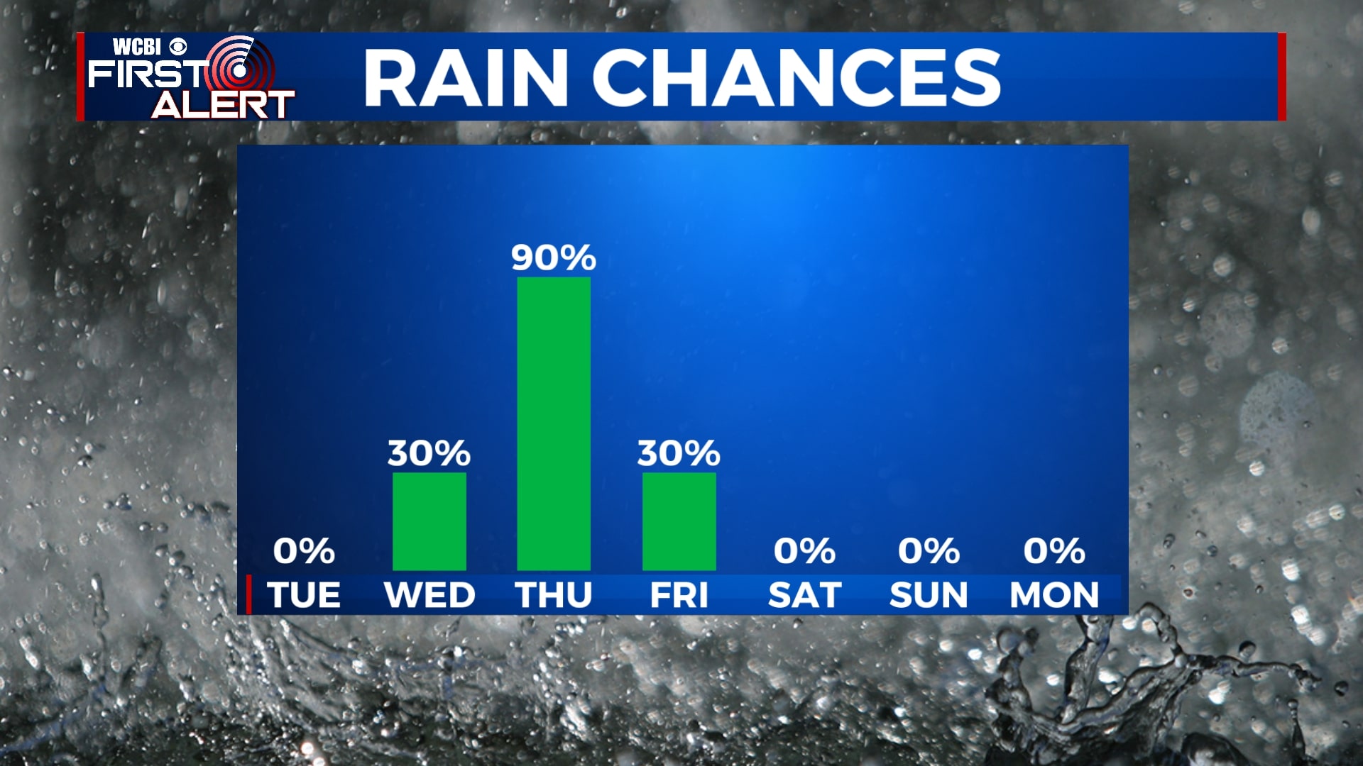
WEDNESDAY: Skies will remain mostly cloudy on Wednesday with a few showers possible, especially in the evening. Temperatures will continue to be well above average with highs in the mid 60s.
THURSDAY: It appears that most of New Year’s Eve will be dry and unseasonably warm with highs near 70 in many locations. Rain will begin Thursday evening and will last into the overnight hours. Storms are likely after sunset, some of which could contain heavy rain, gusty winds, or even an isolated tornado. It appears the best threat for severe weather will be during the nighttime hours of Thursday into Friday. Since this is moving in overnight, you’ll want to make sure you have a way to be woken up if a weather alert is issued for you area.
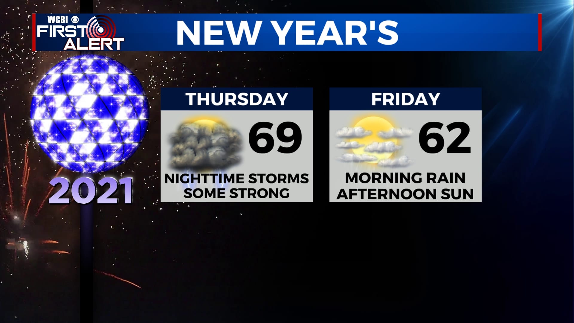
FRIDAY: Storms will continue into the pre-dawn hours of New Year’s Day, but rain will slowly end through the morning. We could even see a few peeks of sunshine through the afternoon with highs in the low 60s.
SATURDAY-TUESDAY: Cooler weather will return for the weekend and early next week with highs back into the 50s and lows in the 30s. Skies will remain mostly sunny to partly cloudy.
Follow WCBI Weather on Facebook, Twitter, and Instagram
Follow Meteorologist Trevor Birchett on Facebook and Twitter


Leave a Reply