Some Strong Storms Possible Today
SUMMARY: The remnants of Barry will influence our weather through Tuesday. Another 1/2″ to over 2 1/2″ of rain are possible. In addition, we still can’t totally rule out a stray strong storm or two with damaging wind gusts and a brief tornado. Standard Southern summer weather returns by the end of the week.
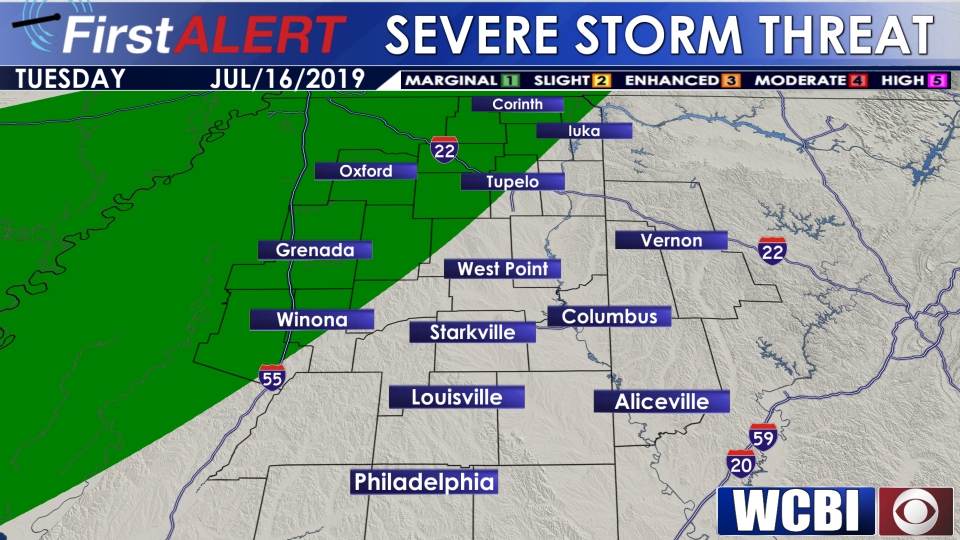
TUESDAY: Scattered storms with highs in the upper 80s. There is still some wind in the atmosphere from Barry that could lead to a few strong storms with isolated damaging wind gusts and a brief tornado; however, that threat remains marginal. Winds SW 10-15 mph.
TUESDAY NIGHT: A few showers and storms can’t be ruled out. Lows in the 70s.
WEDNESDAY: Barry’s influence should just be about gone, but some rain and storms are possible once again. We’re keeping a 40% chance of rain in the forecast. Highs should generally be around 90°. Low to mid 70s are on tap for Wednesday night.
THURSDAY-FRIDAY: The big story will be increasing heat with afternoon highs climbing back into the low to mid 90s. The heat index may push above 105° at times. We’re dropping rain chances to 20%.
WEEKEND: Look for a warm and humid weekend. Daytime highs in the low to mid 90s remain likely along with heat indices in the 100s. Lows stay in the 70s. There should be a daily 30% chance of those standard pop-up showers and storms during the daytime heating.
Follow @WCBIWEATHER on Facebook, Twitter, and Instagram


Leave a Reply