Strong storms possible tonight, more rain on the way
A line of heavy rain and storms will move through the area tonight with rain lingering behind it for the next few days. Temperatures will return to near normal with more chances for showers by the end of the week.
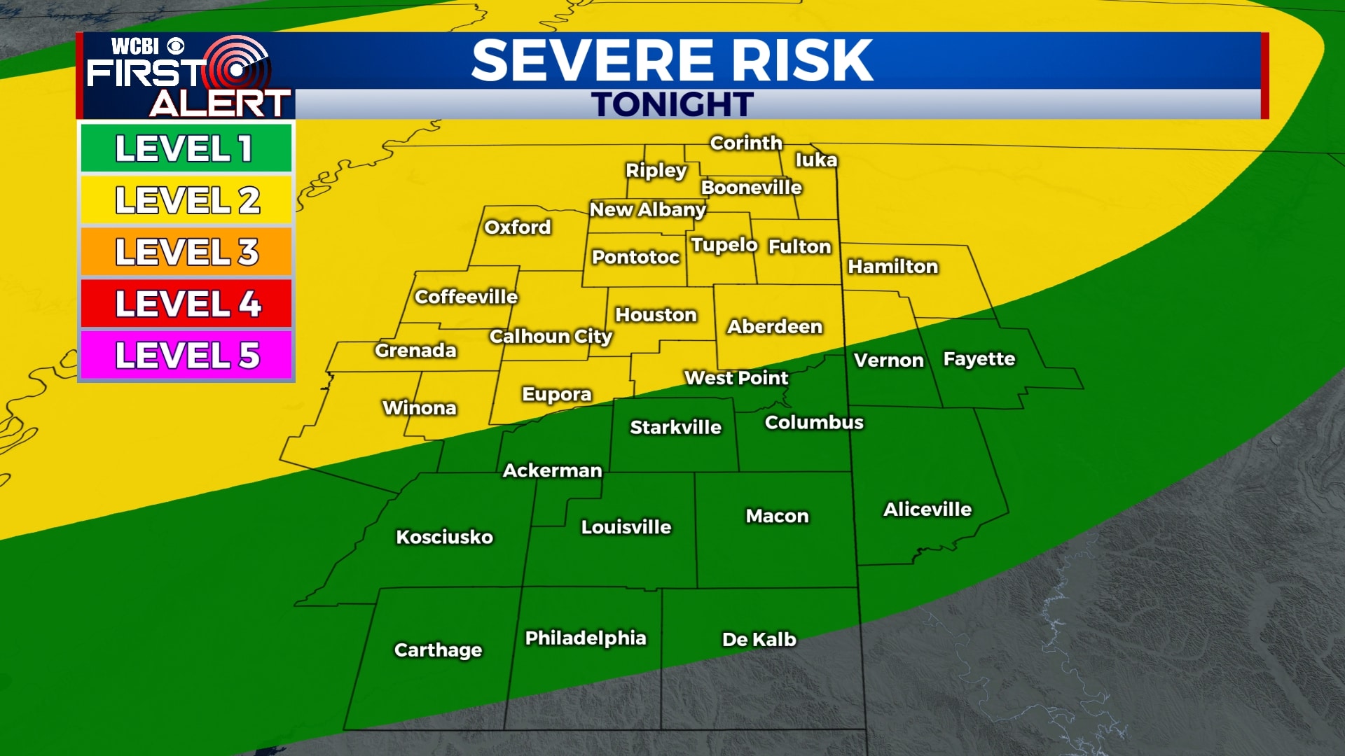
SUNDAY NIGHT: Rain and storms will develop by 8 pm and slowly move through the area. These storms could produce gusty winds, heavy rain, and lightning. A tornado can’t be completely ruled out but the threat is low, especially south of I-22. Storms will likely be weakening as they approach the Golden Triangle. The severe weather threat will end by 2 am, but rain will continue off-and-on for the rest of the night. Temperatures will stay in the mid 50s. 1-3″ of rain is possible.

MONDAY-TUESDAY: Off-and-on showers are likely on both Monday and Tuesday with temperatures remaining in the mid 50s. Clouds will continue as well.

WEDNESDAY-THURSDAY: Temperatures will warm back up for the middle of the week with highs in the 60s and a mix of sun and clouds. It appears we won’t have to worry about rain on Wednesday or Thursday.
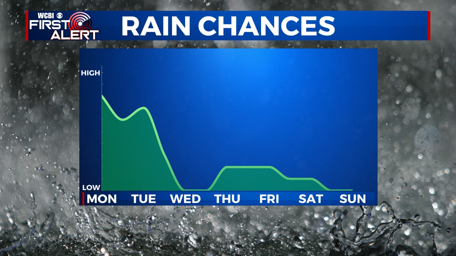
FRIDAY-SUNDAY: There were some indications that we would see another round of rain late in the week, but it looks like that may be fizzling out. For now, we’ll leave in a slight chance of rain for Friday and Saturday but we think most of us will be dry. Highs will be back into the 60s with lows in the 40s.
Follow WCBI Weather on Facebook, Twitter, and Instagram
Follow Meteorologist Trevor Birchett on Facebook and Twitter


Leave a Reply