More Strong to Severe Storms Expected on Saturday
WATCH THE LATEST WCBI WEATHER WEBCAST HERE.
TODAY: Look for a mostly cloudy day with highs ranging in the middle 50s to the north to the middle 60s to the south. Winds will generally remain out of the NE 3-8 mph, though by this evening southeast winds will start to kick in. A sprinkle or two is possible during the day somewhere, but a few showers are expected in the I-22 corridor late this evening.
TONIGHT: We’ll see a range of sky cover from mostly cloudy to mostly clear at times. A few showers are expected early along the I-22 corridor towards the Tennessee State line, but they will be brief and bring little to no impacts to Friday Night Football games. Lows fall into the upper 40s and low 50s with winds turning out of the south and east 3-8 mph.
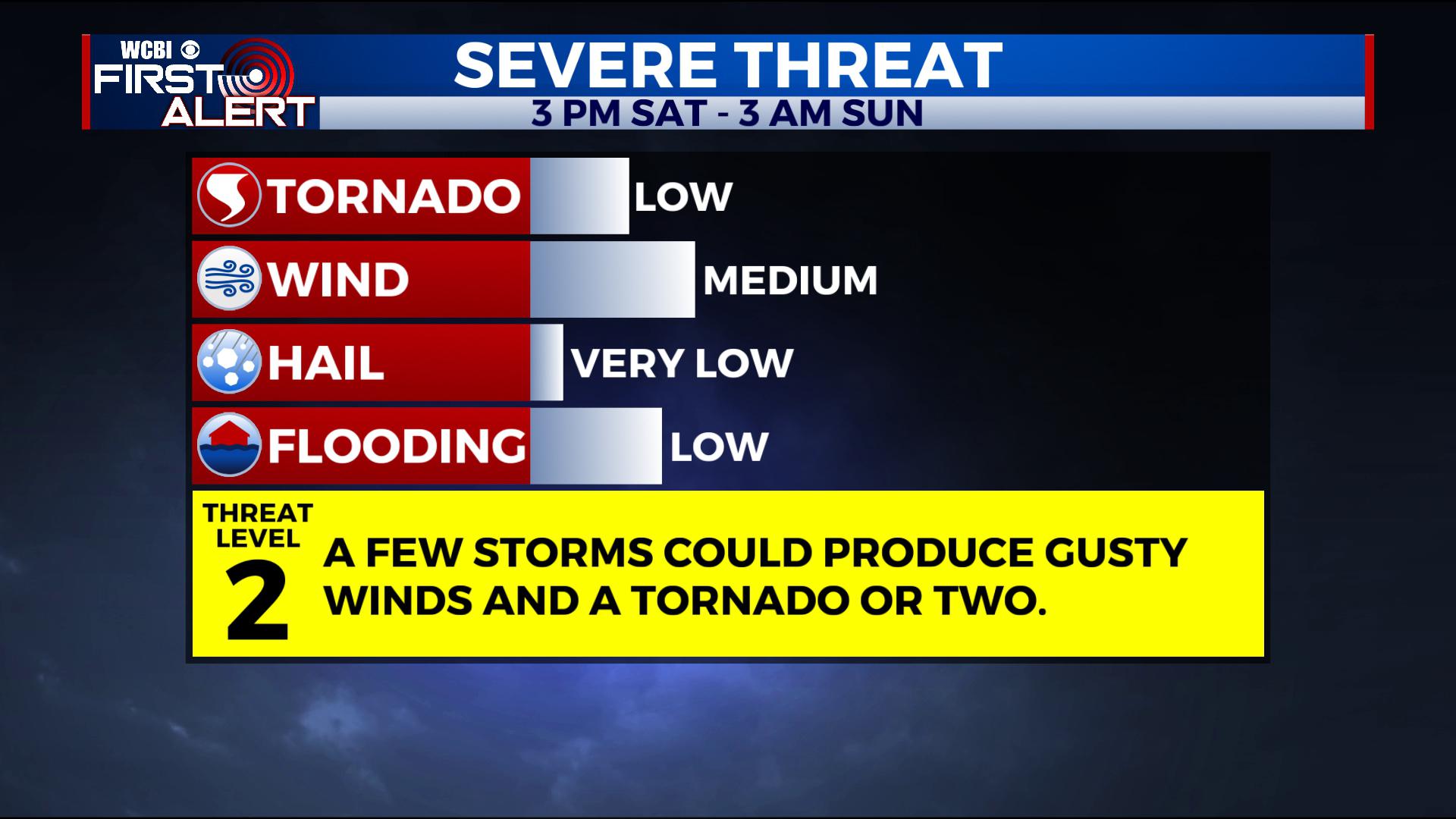
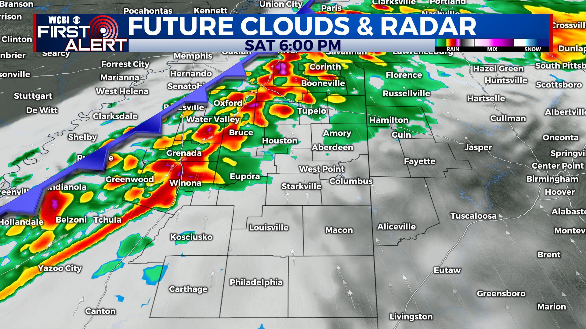
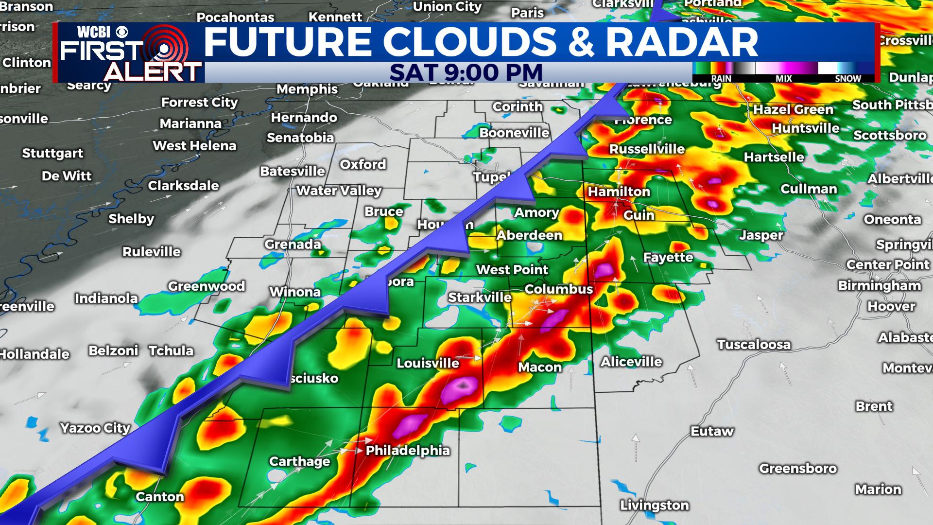
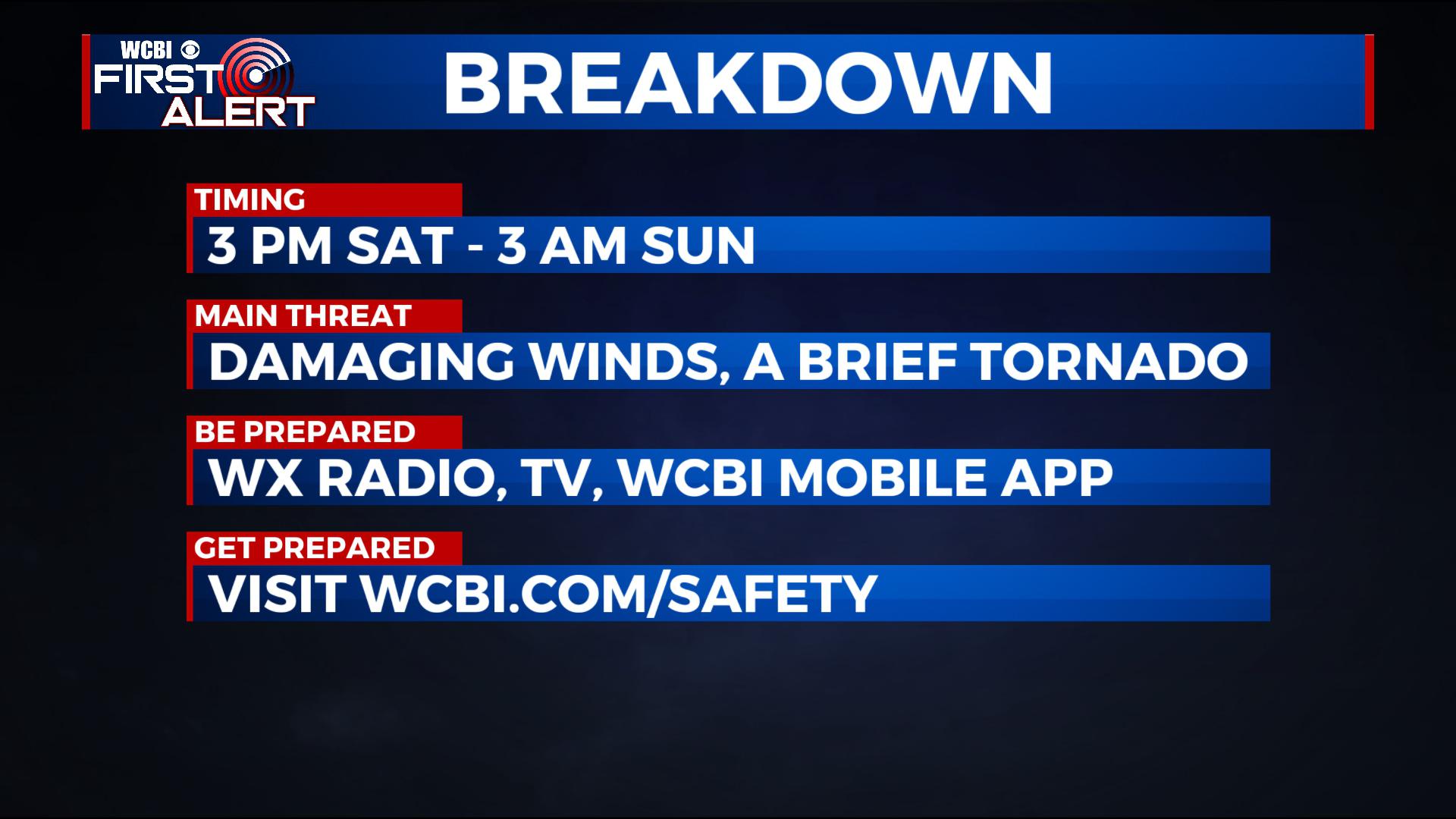
SATURDAY: We’ll advertise a mostly cloudy sky to start Saturday with south winds between 5-15 mph. By the late morning hours, showers and thunderstorms will approach our region. As we head into the afternoon, a line of strong to severe storms is expected to push in from west to east. The prime window of opportunity for storms will be 3 PM to 3 AM, with the threat wrapping up as the cold front passes on through. Main threats will be for strong damaging winds and perhaps a tornado or two somewhere in the region. We’re advertising a level 2 threat for the WCBI viewing area. Highs ahead of the front climb into the 60s and even low 70s. Behind it, winds will kick in from the west.
SATURDAY NIGHT: Once the front passes, the chance for storms will diminish rapidly and strong north and west winds kick in, likely 10-20 mph with gusts perhaps a bit higher. Look for temperatures to fall into the 40s and low 50s overnight. Clouds are also expected to clear out pretty quickly.
SUNDAY: Highs will only remain in the 50s into the afternoon with most seeing abundant sunshine, though a few clouds are expected still in the morning. Look for breezy north and west winds 10-20 mph, slowly diminishing during the daytime hours.
MONDAY – WEDNESDAY: We’ll have a quiet and cool stretch of weather, with highs slowly warming through each day. Highs range from the 40s to the 50s, with lows at night in the 20s and 30s.
THURSDAY – NEXT WEEKEND: Another storm system looks to head our way by Friday, with a few isolated showers by Thursday evening possible. We’ll keep you advised on timing and more.
STAY WITH @WCBIWEATHER ON FACEBOOK, TWITTER AND INSTAGRAM, AS WELL AS THROUGH THE WCBI MOBILE APP.


Leave a Reply