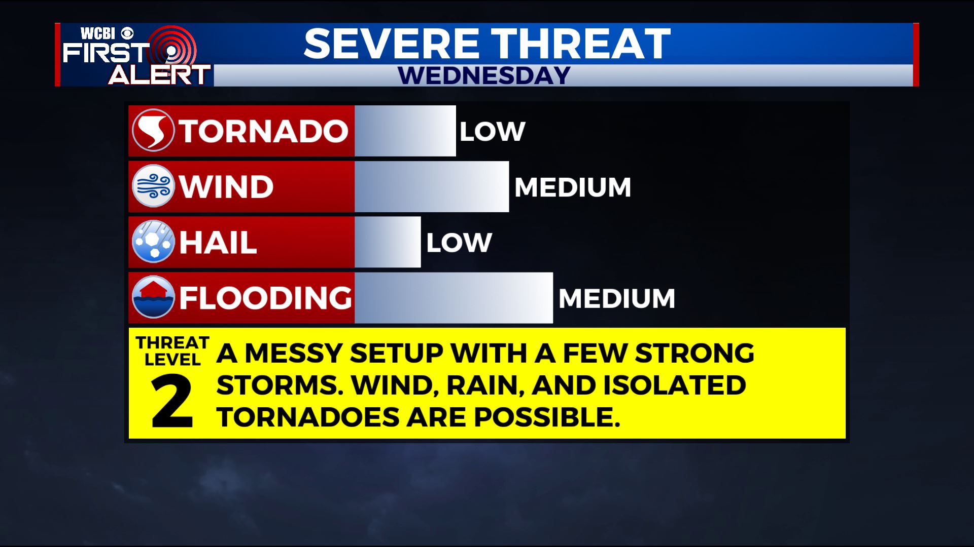
Strong storms Wednesday
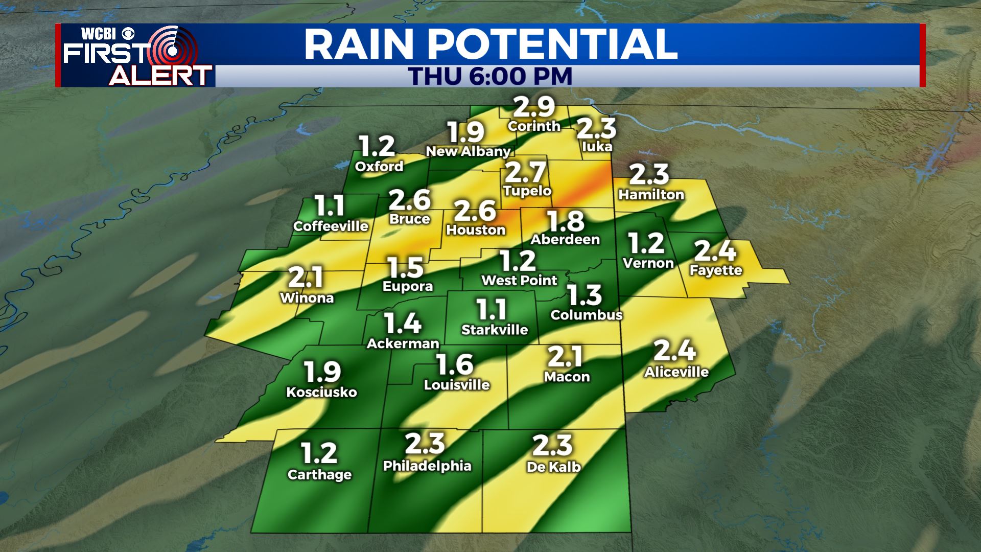
SUMMARY: Showers and a few storms are possible tonight with a few gusty storms possible across our northwestern counties. A bigger round of rain and storms is expected Wednesday afternoon and evening. There may be some severe storms with damaging wind gusts, heavy rain, and even an isolated tornado or two. It’s something we’re watching closely. Total rainfall between tonight and Thursday may be in the 1 to 3 inch range. Check out our new Severe Weather Center page for the latest on the storm threat.
TUESDAY NIGHT: Mild lows in the 60s. Scattered showers with the best chance for a few storms across our northwestern counties. While a strong, gusty storm can’t be ruled out most locations should be OK. Southerly winds continue between 5 and 15 mph.
WEDNESDAY: Areas of showers during the morning with higher odds of rain and storms from mid afternoon through the evening. Some storms could be strong with gusty winds, heavy rain, and even an isolated tornado or two. Limiting factors for severe weather in the WCBI coverage area include the amount of unstable air available and the possibility that storms in southern Mississippi could deter development this far north. Highs may warm into the low 70s with southeasterly winds between 10-15 mph.
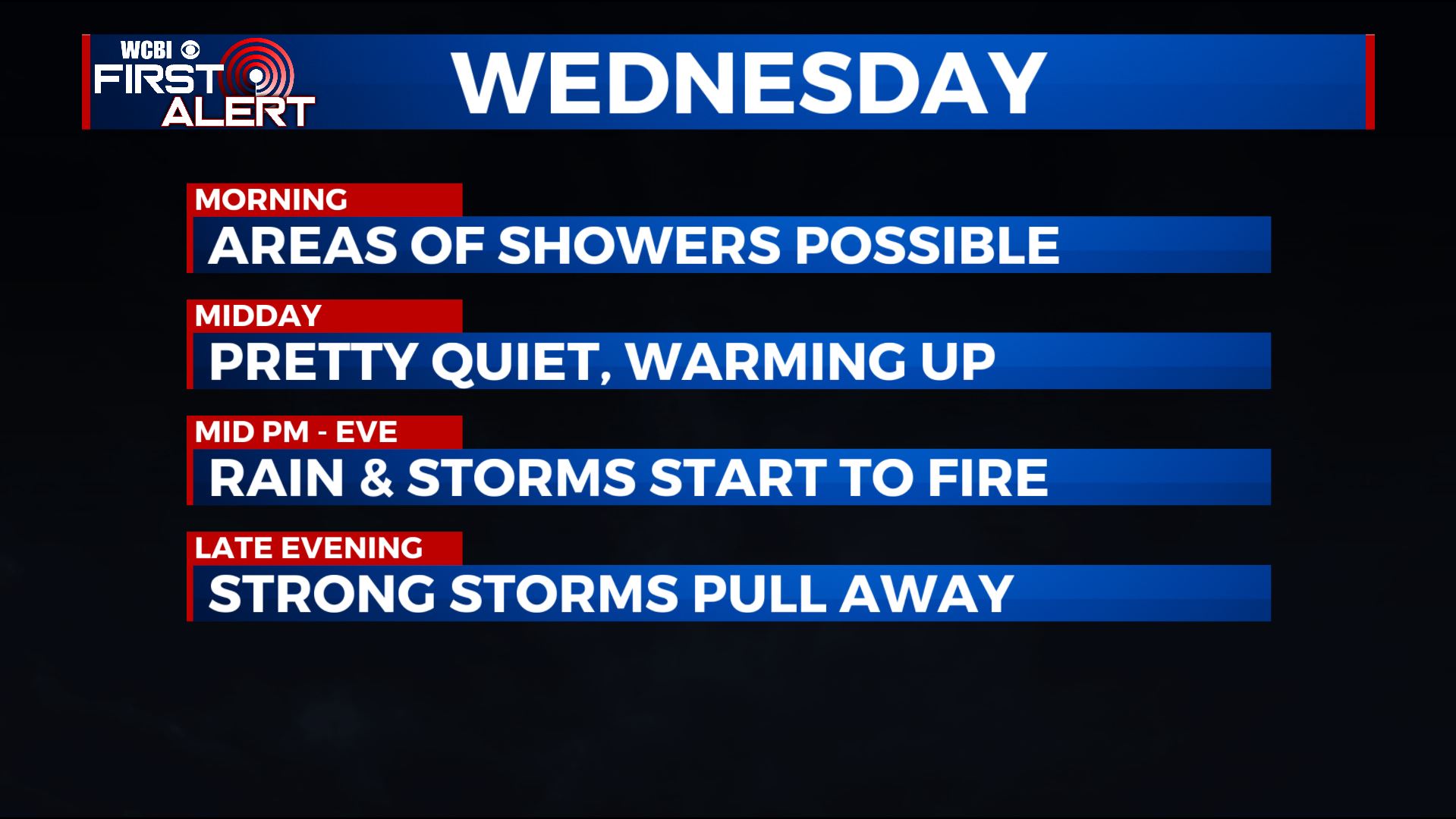
WEDNESDAY NIGHT: Rain and storms during the evening with the strongest activity pulling away after midnight. Temperatures fall down to around 50.
THURSDAY: Mostly cloudy with lingering showers. Highs near 50.
THURSDAY NIGHT: Variably cloudy and colder. Lows in the 30s.
FRIDAY: A mix of sun and clouds. Highs in the low 50s. Around 40 Friday night with increasing clouds.
SATURDAY: Mostly cloudy with a 40-50% of showers. Highs in the low to mid 50s. Cooler upper 30s for lows Saturday night.
SUNDAY: Clouds & sun. Milder highs around 60. Lows in the mid 40s Sunday night.
MONDAY: Areas of rain and thunder. Highs in the 60s.
Follow @WCBIWEATHER on Facebook, Twitter, Instagram, and the WCBI News app


Leave a Reply