SUMMER IS HEADED OUR WAY!
We have had a nice stretch of weather the past few days. That will come to on end on Sunday as our next storms system moves in, bringing us more showers and storms. A few of those could be on the strong to severe side. Once we head into next week, high pressure will build into our area, bring us back the sunshine, and warming our temperatures into the lower 90s!
SATURDAY NIGHT: Gusty winds will continue as we head into the overnight hours Saturday night. Gusts as high as 25 MPH will be possible. Clouds will also begin to increase across the area. Western portions of the region could even see a shower or storm overnight tonight. Overnight lows will drop down into the upper 60s.
SUNDAY: Widespread showers and storms will develop across the region as we head into the late morning/early afternoon hours on Sunday. A few of these storms could be on the strong to severe side. The main concern with these storms will be damaging winds and hail. An isolated tornado cannot be completely ruled out. Expect rainfall amounts to vary from 1/4th of an inch to 3/4th of an inch. Some areas could see higher totals in heavier downpours. Showers and storms are expected to exit the region Sunday night. Highs on Sunday will top out in the lower 80s, and overnight lows will drop down to the upper 60s.
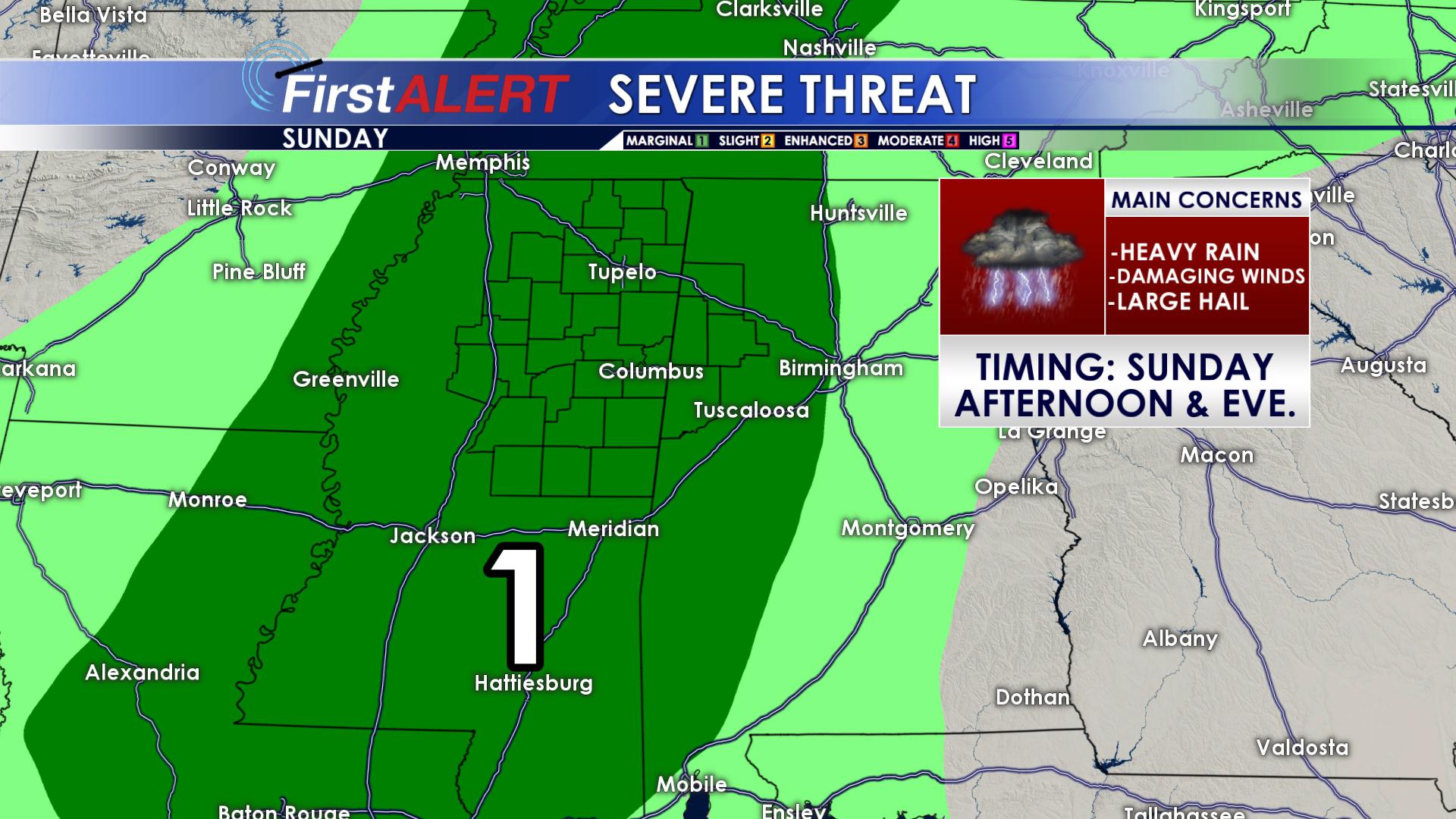
Severe Threat for Sunday
MONDAY & TUESDAY: We could see a few lingering storms and showers across the area on Monday and Tuesday, but most of us will remain dry. Clouds will decrease in coverage on both days as well, bringing more sunshine back to our region. Highs on both days will top out in the upper 80s, with overnight lows remaining in the upper 60s.
WEDNESDAY, THURSDAY, FRIDAY & SATURDAY: Our old friend “High Pressure” will pay us a visit as we head into the middle of next week. Skies will become mostly clear, with just a few passing clouds, and temperatures will begin to warm. Average highs this time of year range throughout the middle and upper 80S. As we head into the middle of next week, highs will warm into the lower 90s, with overnight lows in the upper 60s. As of now, it looks as if things will also remain dry through next week, on into your Memorial Day weekend.
FOLLOW US ON Facebook, Twitter and Instagram @WCBIWEATHER!


Leave a Reply