Summer humidity and afternoon storms making its return
SUMMARY: Here’s your top weather headlines as you’re waking up! A typical summer weather pattern will be returning & staying with us. Daily afternoon storm chances will also be returning so keep the rain gear handy. Plus, watching Elsa out in the Gulf as it nears Florida.
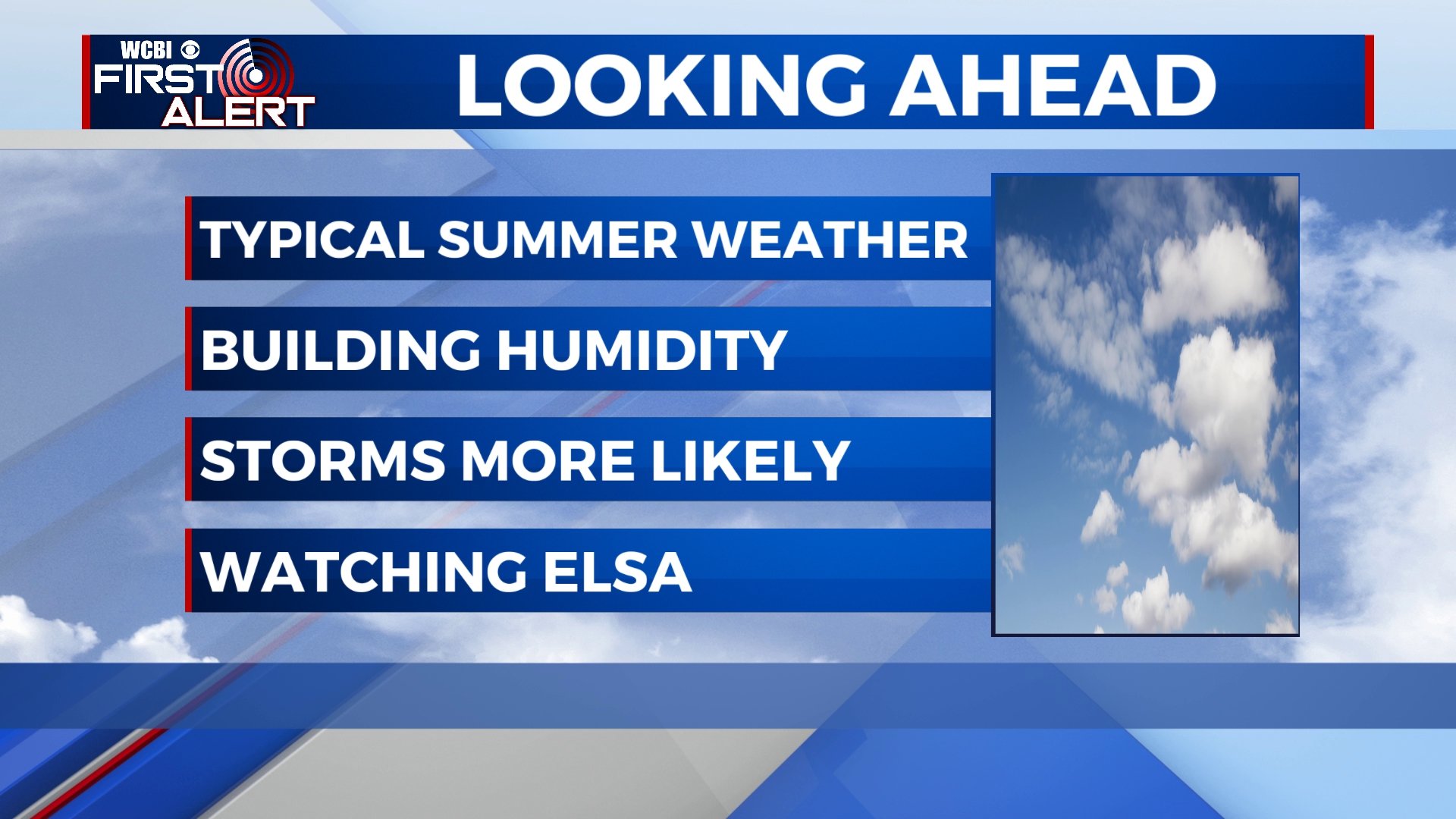
TUESDAY: A mix of sun & clouds with a few chances for afternoon summertime showers & storms. Highs in the mid to upper 80s. Winds SE 5-15 mph.
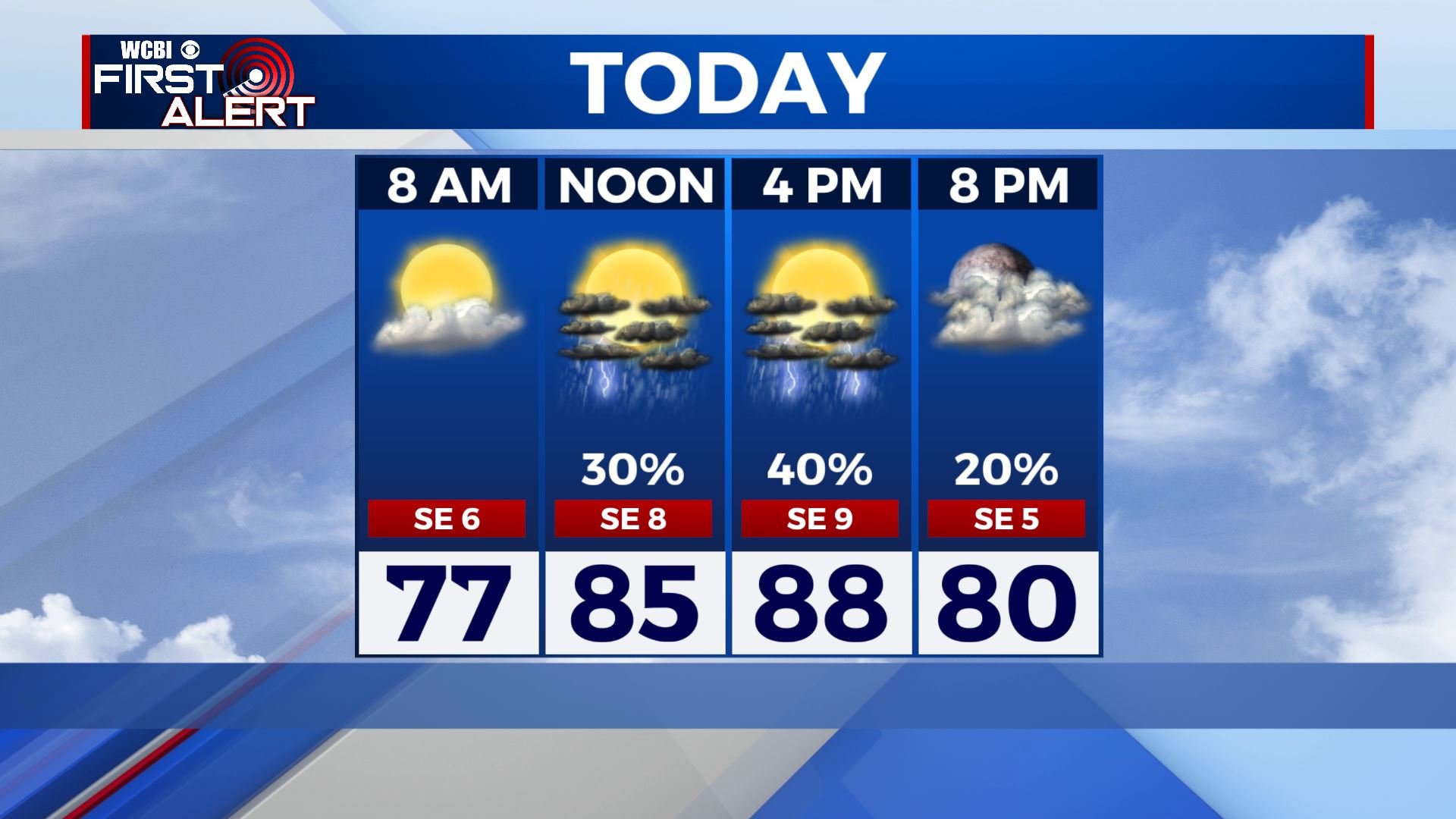
TUESDAY NIGHT: Mostly cloudy skies with a shower possible overnight. Lows in the lower 70s.
WEDNESDAY & THURSDAY: Mostly cloudy with scattered showers and storms each and every day, primarily during the daytime heating. Highs in the mid to upper 80s with overnight lows in the 70s.
FRIDAY – MONDAY: A few summertime showers & storms are possible each day. Highs in the upper 80s to lower 90s. Overnight lows in the lower 70s.
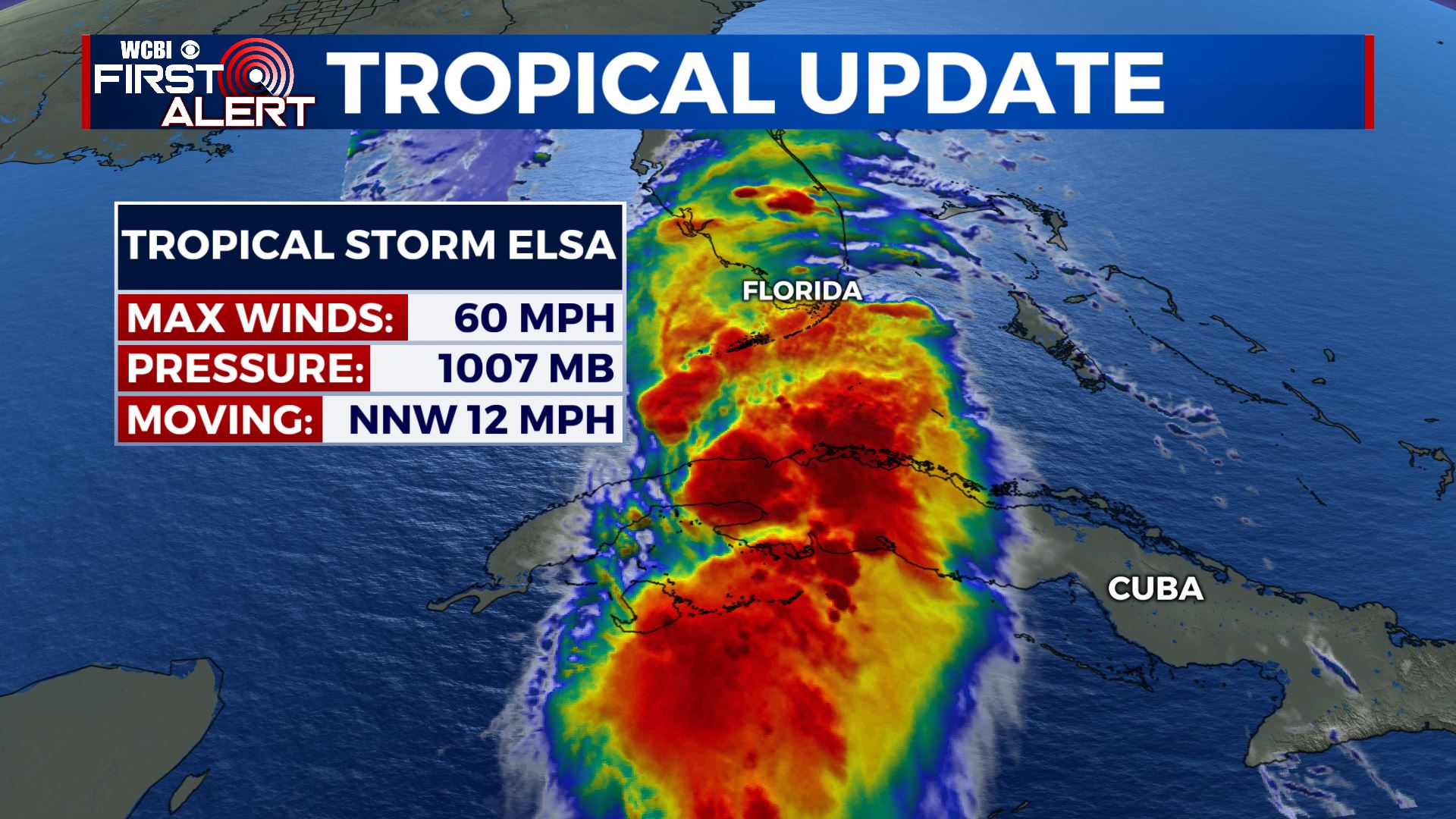
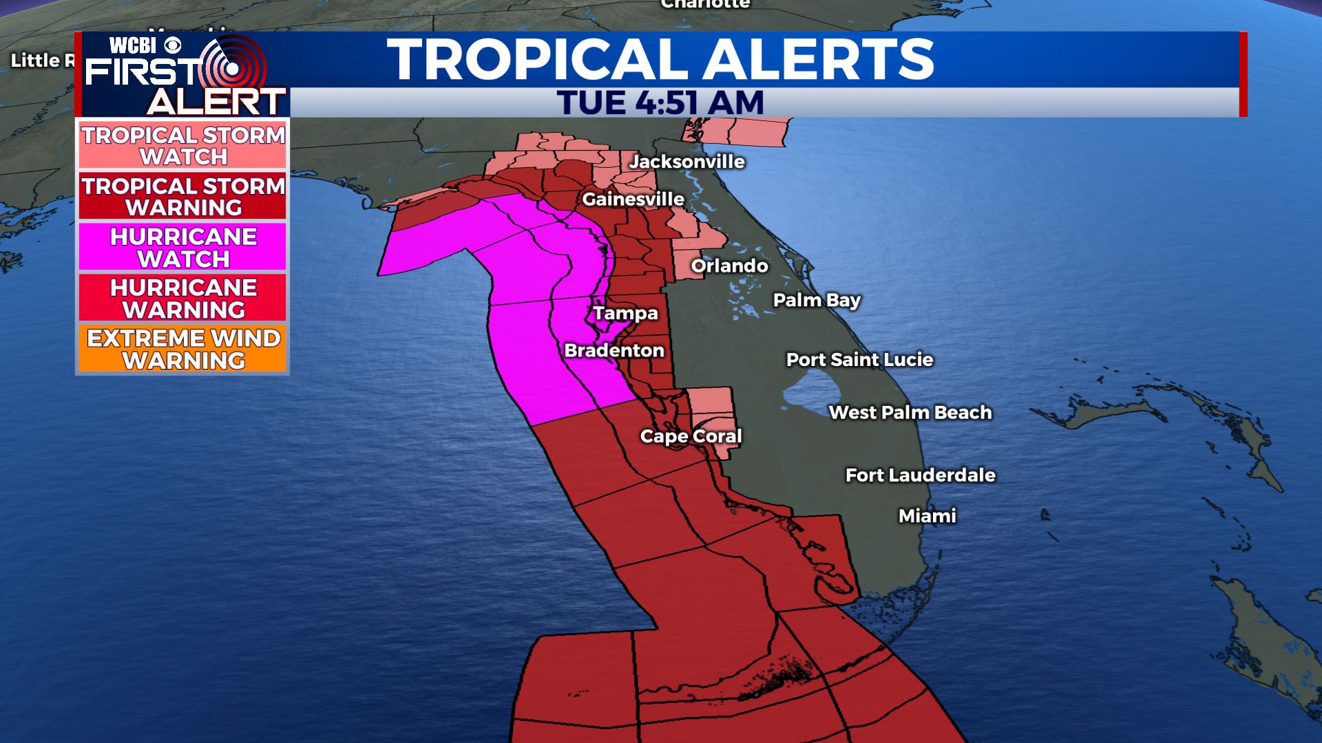
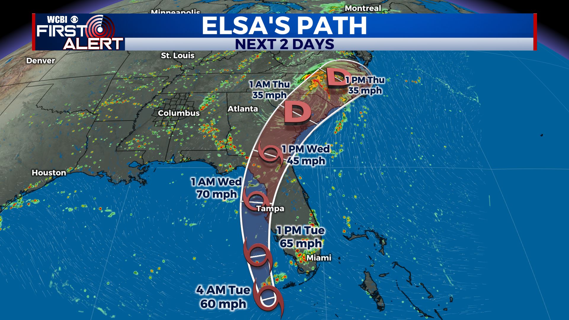
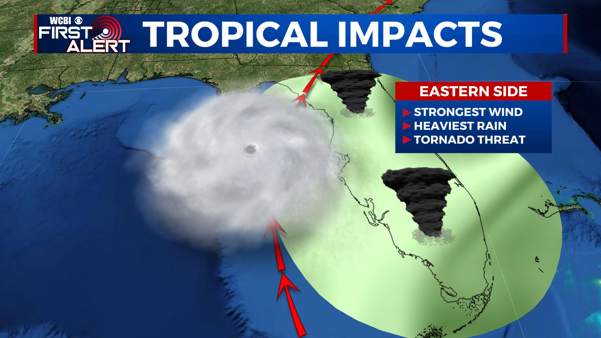
TROPICS: Tropical Storm Elsa now over the Florida Straits. Conditions beginning to deteriorate across the Florida Keys as of Tuesday morning. Tropical Storm Warnings and Hurricane Watches extended northward along the west coast of Florida. The potential for heavy rain, a few tornadoes & tropical storm force to possible hurricane force winds are possible into Wednesday for coastal west Florida as its forecast to make landfall over the Big Bend region.
Stay connected with @WCBIWEATHER on Facebook, Twitter, Instagram and the WCBI News App


Leave a Reply