Summer returns as we begin the month of June
SUMMARY: As we start the month of June, the summer heat & humidity will make a comeback along with those chances for pop-up afternoon showers & storms this upcoming week.
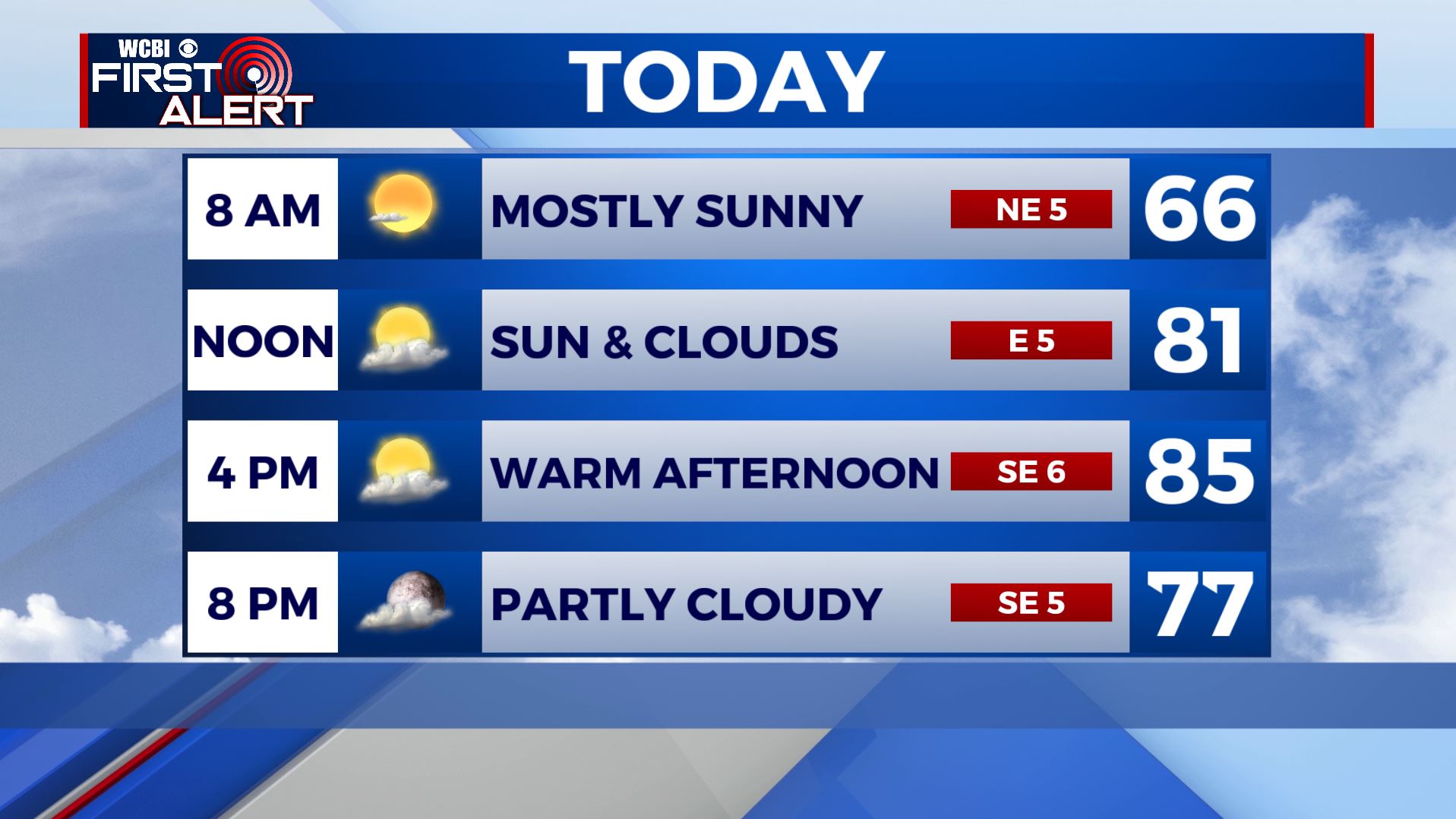
MONDAY: Hoping you have been enjoying the comfortable and less humid weather these last few days. We’ll have one more day of it for our Monday before the summer heat and humidity makes a comeback this upcoming week. Temperatures in the mid 80s for highs with a mix of sun & clouds. Winds will be switching from the NE to the SE at 5-10 mph as high pressure moves off to the east.
MONDAY NIGHT: Partly cloudy skies. A quiet night overall with a light SE wind. Overnight lows in the 60s.
TUESDAY: An isolated shower or two can’t be ruled out as we start getting that warm & humid air from the Gulf of Mexico pumping back into the region. Most of us will just see a mix of sun and clouds with highs in the upper 80s to near 90. S winds 5-10 mph.
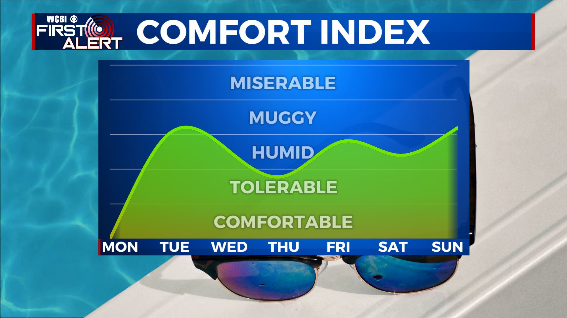
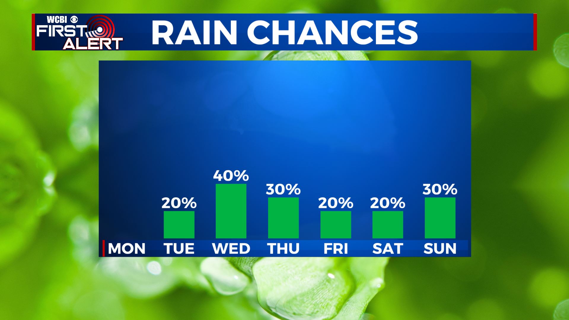
WEDNESDAY-FRIDAY: Scattered afternoon pop up showers & storms will return for the middle to end part of the work week each day. Highs will above average in the lower 90s with overnight lows near 70. It will be humid and muggy as well.
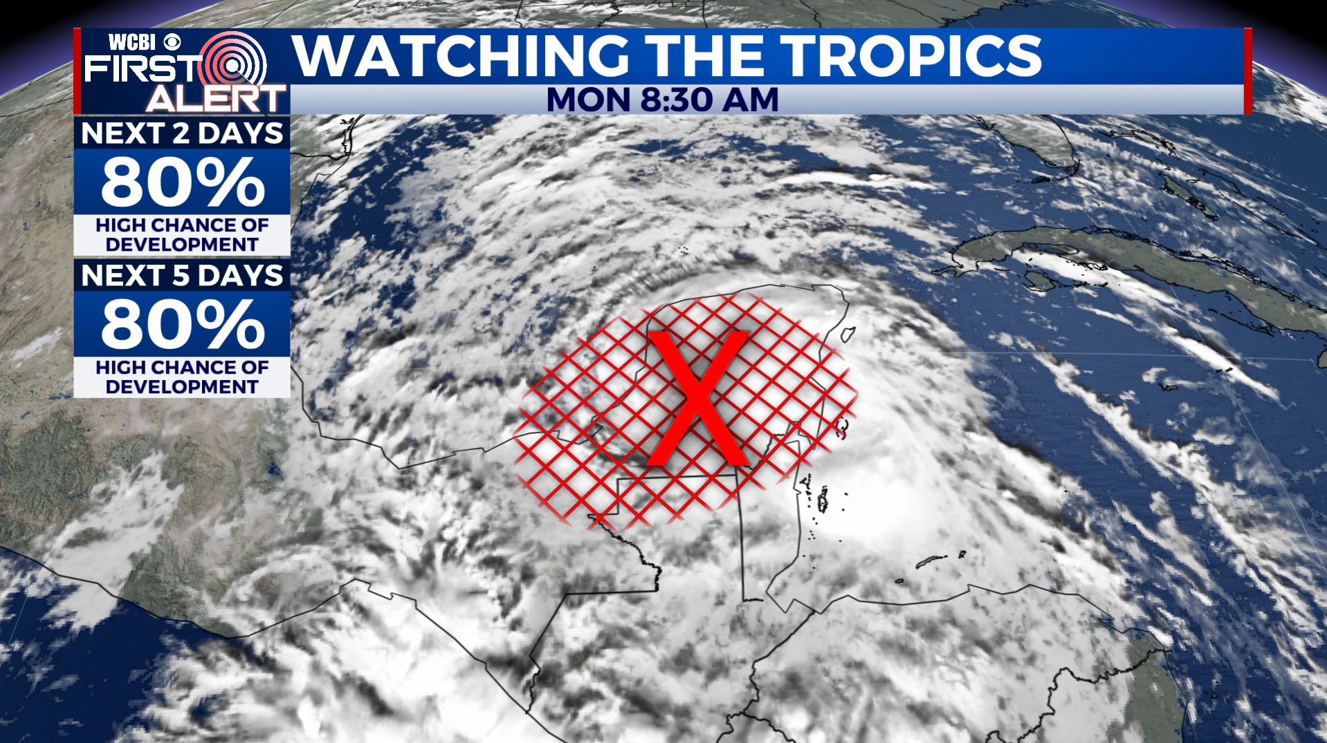
SATURDAY-SUNDAY: Highs in the low to mid 90s. As of right now, a mix of sun and clouds with isolated chances of a stray shower or storm in the afternoon, but that could change. June also marks the official start of the Atlantic Hurricane Season. We’ve already had two named storms in May and we could have our third named storm later on this week as we are watching closely a tropical wave over the Gulf of Mexico. We’ll keep you updated! This could bring us some rainfall this weekend, depending on when and where it makes landfall.
Stay connected with @WCBIWEATHER on Facebook, Twitter, Instagram, and the WCBI News App


Leave a Reply