Summertime rain & storm chances continue for Wednesday
SUMMARY: Summer storm season is back as over the next few days we’ll have good chances of showers and storms popping up in the afternoon/early evening hours. Most storms will not be severe but a few strong storms with gusty winds, heavy downpours, lightning and small hail are possible. Highs remain very warm & humid in the upper 80s to lower 90s.
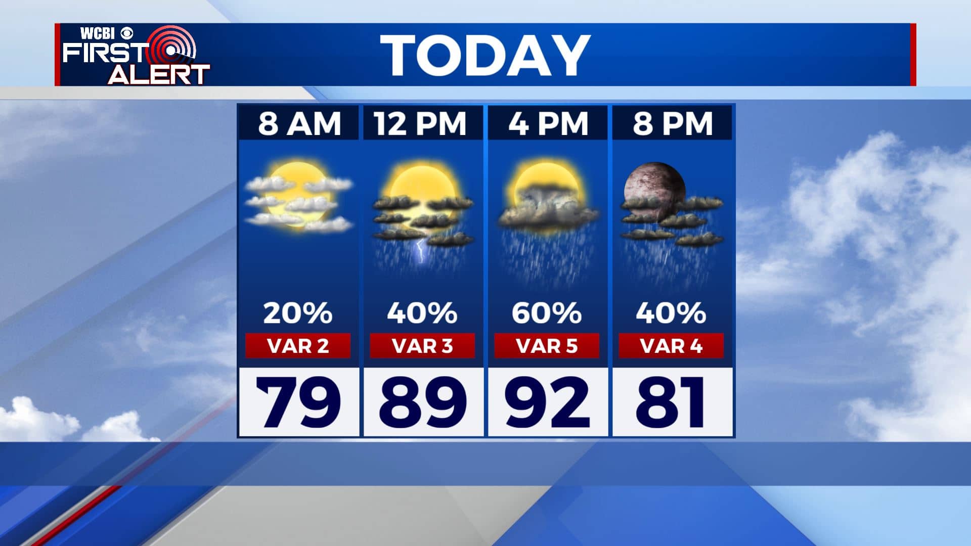
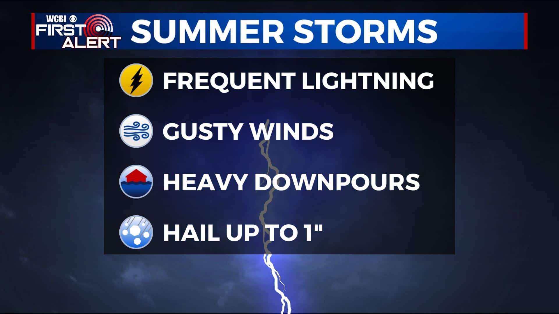
WEDNESDAY-FRIDAY: Afternoon showers and storms will remain possible through the second half of the workweek. Some storms could produce locally heavy rainfall and gusty winds at times. Afternoon highs will remain in the lower to mid 90s, but any rain will help to cool you down a bit. Overnight lows will be in the mid 70s.
WEDNESDAY NIGHT: Showers and storms should come to an end early evening as we lose the heating of the day once the sun sets. Partly cloudy skies Lows in the lower 70s. Light and variable wind.
WEEKEND: Pop-up storms will remain in the forecast for the weekend and even into early next week as temperatures will also remain hot and humid. Highs will climb to the lower and mid 90s each afternoon with overnight lows in the low 70s. Heat index values nearing 100.
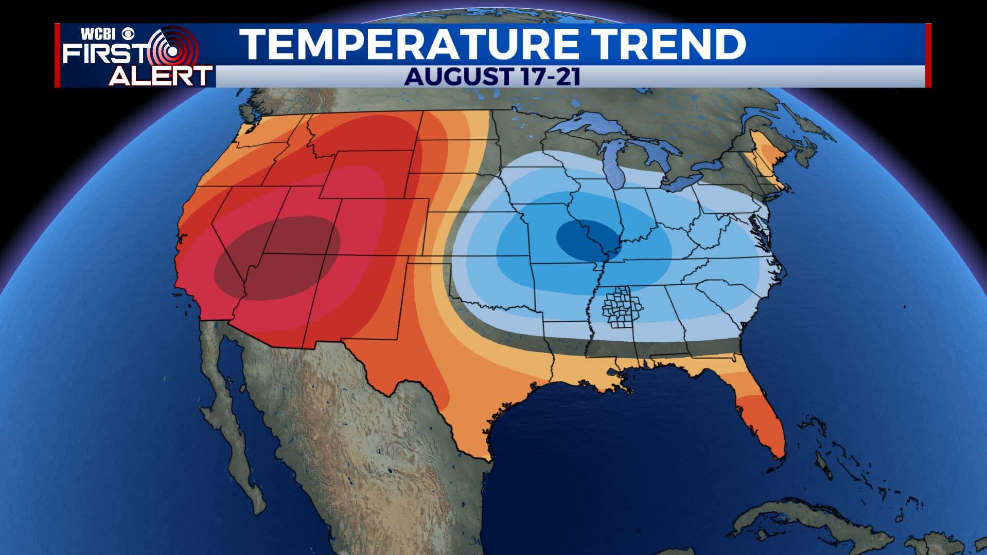
EARLY NEXT WEEK: A cold front may possibly pass through, helping us to provide some relief from the summer heat. Stay tuned!
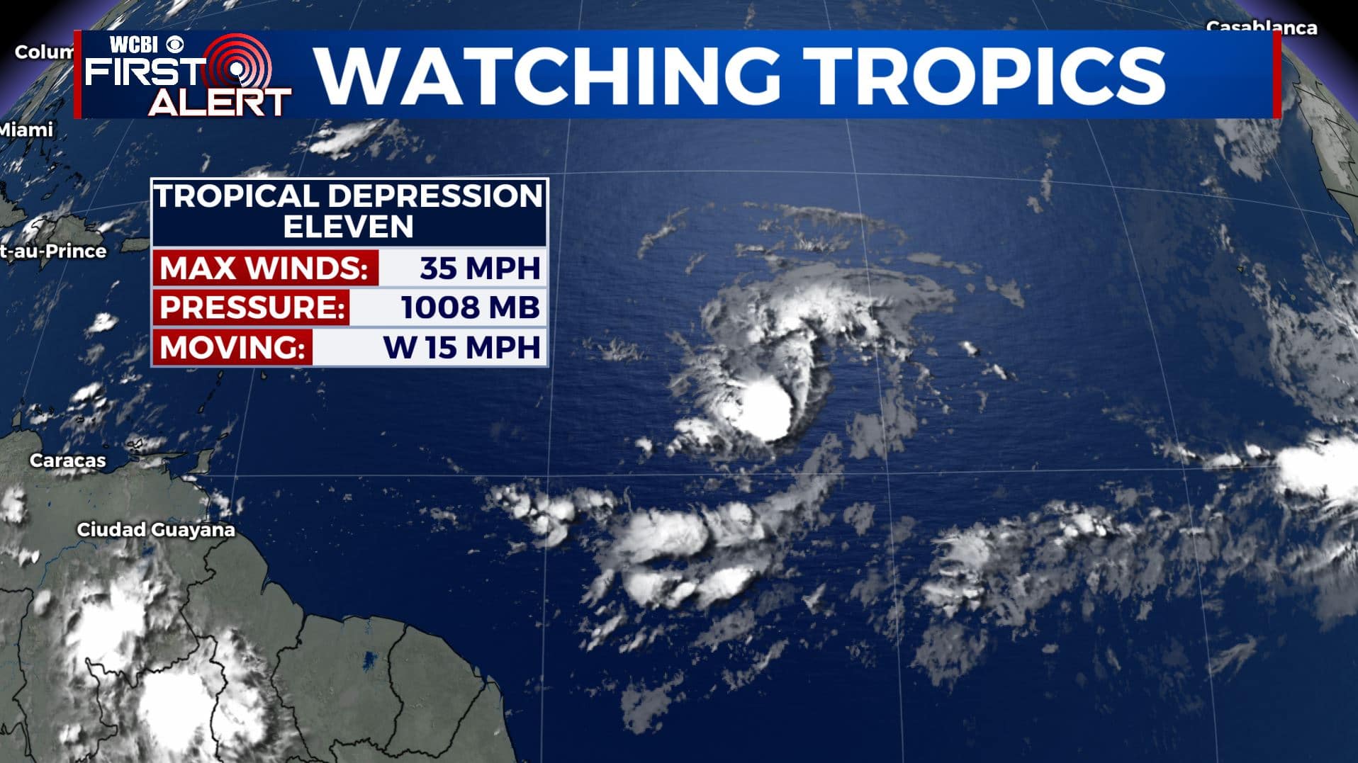
TROPICS: We have Tropical Depression 11 out in the Atlantic. Most likely will become Josephine over the next couple of days.
Stay connected with @WCBIWEATHER on Facebook, Twitter, Instagram, and the WCBI News App


Leave a Reply