Sun takes over today
SUMMARY: Breezy and much cooler weather is the story for today in the wake of a cold front. Some patchy frost could develop tonight as high pressure builds back in. Lots of sunshine is on tap for the weekend with gradually warming temperatures.
FRIDAY: Morning clouds with full sun developing as the day wears on. Breezy northerly winds 10-15 mph with gusts to 20 mph. Cooler highs in the 60s. Pack your coats for high school football with evening temperatures in the low 50s and upper 40s.
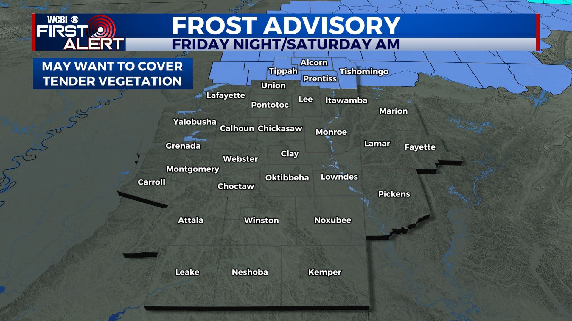
FRIDAY NIGHT: Clear, quiet, and chilly. Lows in the upper 30s. Areas of frost are possible, especially in those traditionally cool & low lying spots.
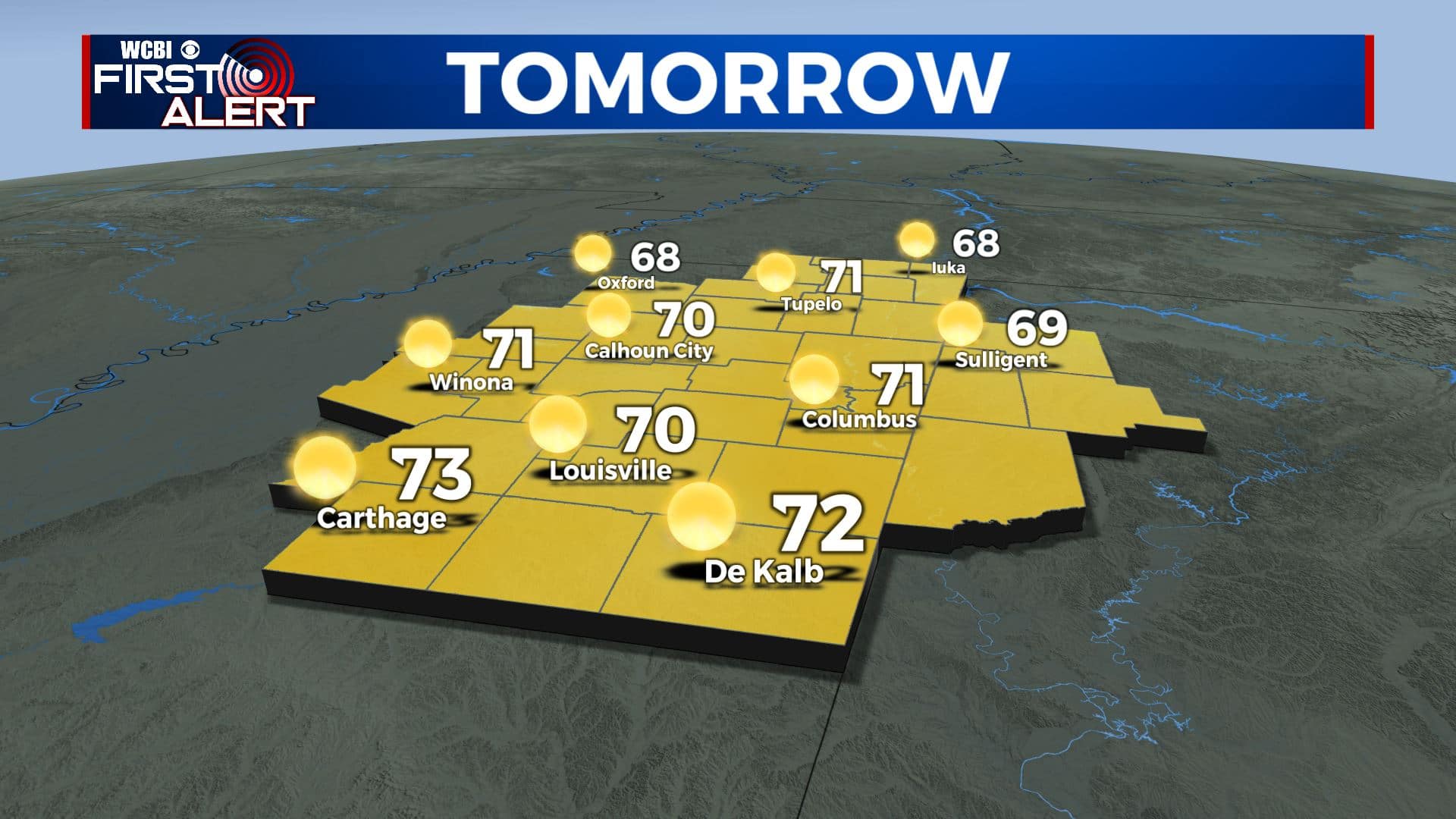
SATURDAY: Bright sunshine. A chilly start with morning temperatures in the 30s. Afternoon highs around 70. Winds SE 5-15 mph.
SATURDAY NIGHT: Clear and not as cool. Lows in the mid to upper 40s.
SUNDAY: Mostly sunny to partly cloudy. Seasonably mild highs in the upper 70s.
NEXT WEEK: Mild air builds back into the region once again. Above average highs in the 80s are expected along with lows in the 50s and 60s. A few showers are possible but it’s still too early tell exactly how much activity will develop. Another cold front could move through on Friday.
Follow @WCBIWEATHER on Facebook, Twitter, Instagram, and the WCBI News App


Leave a Reply