Sunny, cooler end to the work week
SUMMARY: Winter-like air will settle back in for the end of the work week. Overnight lows will be dipping back below freezing while afternoon highs top out only in the 40s and low 50s. Some rain is possible late Saturday into early Sunday. This system at first glance doesn’t appear to have all the variables needed for strong weather but we’ll continue to monitor for any possible changes over the coming days.
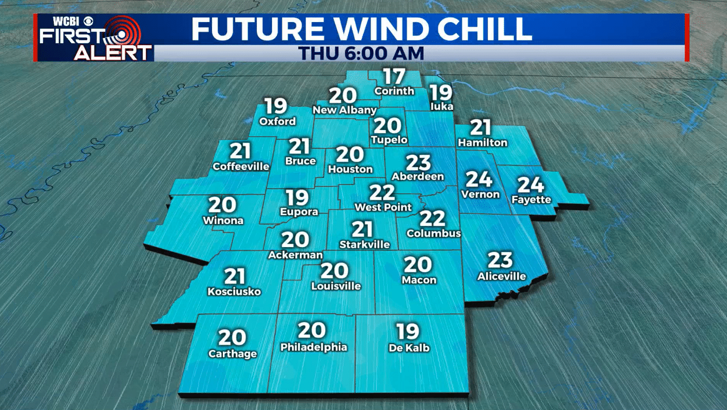
WEDNESDAY NIGHT: Mostly cloudy with lows around 30. Winds NW 10-15 mph will produce wind chill values in the low 20s by sunrise.
THURSDAY: Early morning clouds then sunny. Highs in the mid to upper 40s. Brisk N winds 10-15 mph.
THURSDAY NIGHT: Clear, calm, and cold. Lows in the mid 20s.
FRIDAY: Mostly sunny. Highs in the low 50s.
FRIDAY NIGHT: Variably cloudy. Lows in the mid 30s.
SATURDAY: Increasing clouds with a chance of rain during the afternoon and evening. Some thunder is also possible. Highs in the upper 50s to around 60.
SATURDAY NIGHT: Areas of rain. A storm is also possible. Lows around 50.
SUNDAY: Early day showers then partly cloudy. Highs in the low 60s.
Follow @WCBIWEATHER on Facebook, Twitter, Instagram, and the WCBI News App


Leave a Reply