Sunny & quiet weekend coming
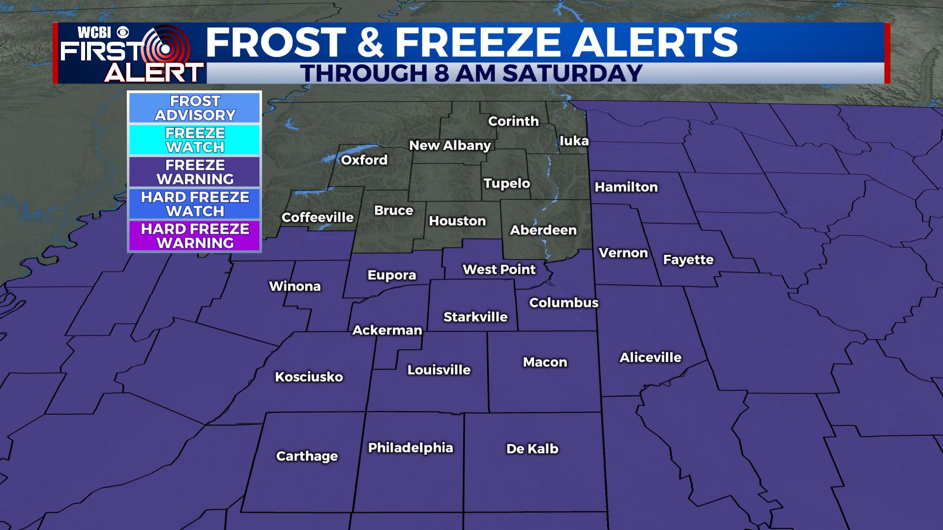
SUMMARY: A widespread freeze is on track for Saturday morning with temperatures cooling into the 20s. The weekend will feature plenty of sun with 50s on tap for Saturday and 60s on Sunday. Another strong cold front will pass late Monday.
FRIDAY NIGHT: Mainly clear and cold. Lows in the mid to upper 20s.
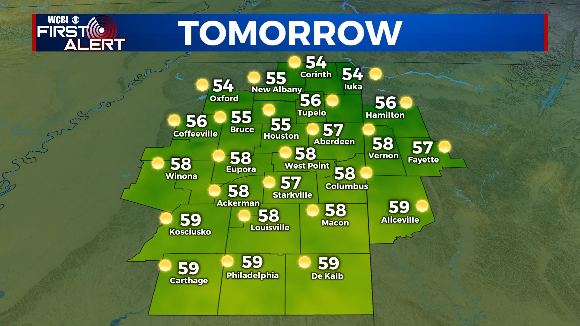
SATURDAY: Sunny. Highs in the mid to upper 50s. Winds light and variable. Weather looks great for the football games in Tuscaloosa and Oxford, just bring a coat because it will cool into the 40s by the end of both games.
SATURDAY NIGHT: Clear and quiet. Lows in the mid to low 30s.
SUNDAY: Bright sunshine and warmer. Highs in the mid to possibly upper 60s. You may want to take advantage of the nice weather to get some outdoor chores accomplished.
MONDAY: Variably cloudy and mild with highs staying in the mid to upper 60s. A strong cold front will move in during the late afternoon and evening and that means increased cloud cover and showers.
MONDAY NIGHT: Areas of showers with temperatures falling into the mid to low 30s. Northerly winds develop.
TUESDAY: Areas of showers may linger early in the morning but a gradual clearing trend should take place. A very chilly day is likely with highs only in the upper 30s to lower 40s.
TUESDAY NIGHT: Clear and cold. Lows in the low 20s. Some new record lows are possible.
WEDNESDAY: Mostly sunny to partly cloudy. Highs in the upper 40s to around 50.
Follow @WCBIWEATHER on Facebook, Twitter, Instagram, and the WCBI News app


Leave a Reply