Sunny start to next week brings mild temperatures back
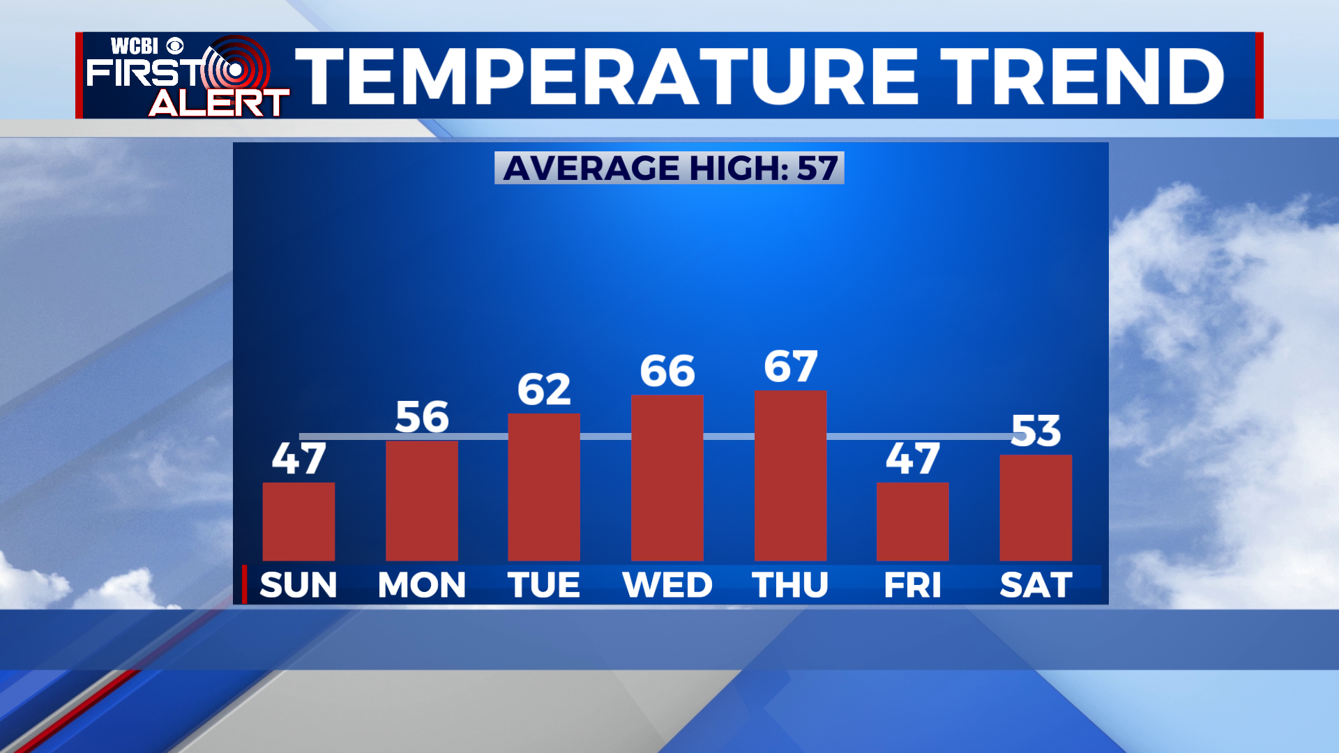
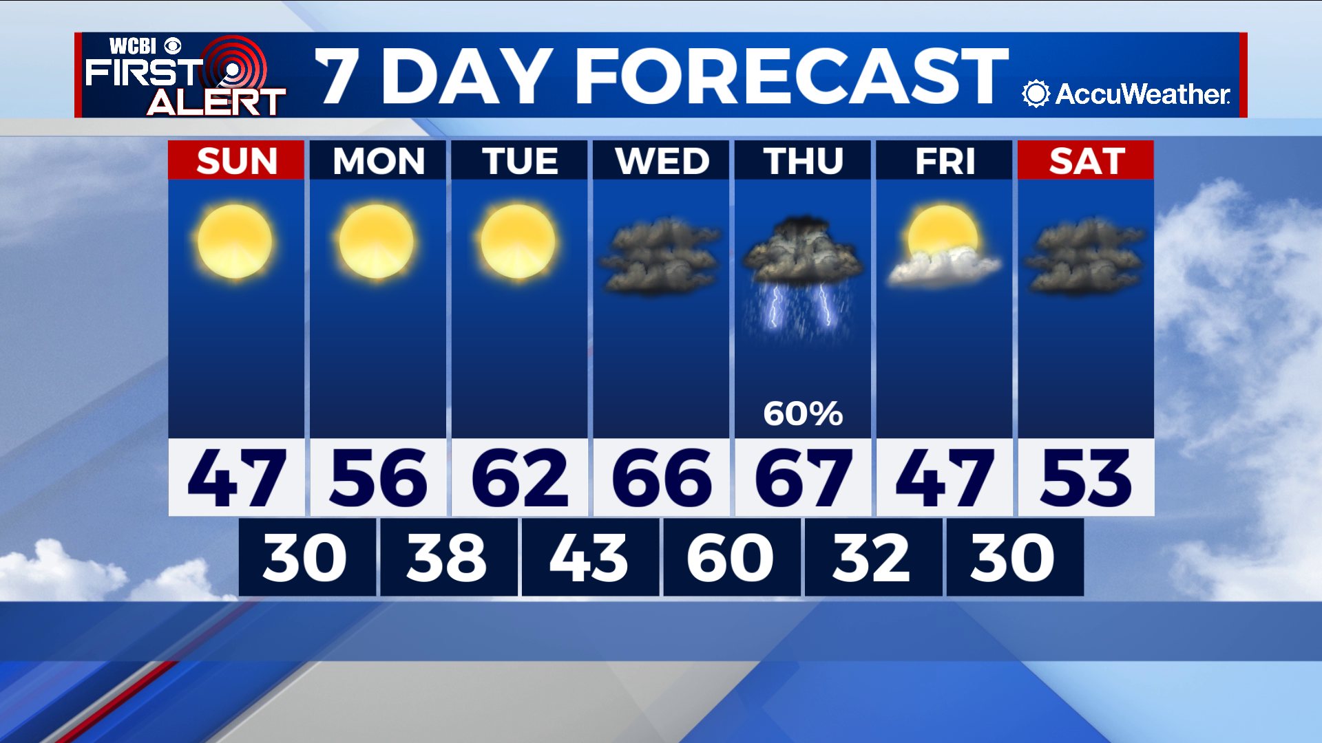
SUNDAY: Saturday’s cold front leaves us with a chilly, albeit sunny Sunday. Highs generally top out in the upper 40s as we begin our slow trek back to mild temperatures. Lows break into the 30s overnight but remain below freezing.
NEXT WEEK: Our sunny pattern to start the week allows for a robust warming trend to set in, a trend which will last through Wednesday. Clouds moving in on Wednesday does slow this trend a bit but does not stop highs from approaching the 70s. Our cold front on Thursday brings the largest and only rain maker of the week and a possible severe chance to boot. Right now it seems that thunderstorms can virtually be penciled in but at this point there is a big question mark surrounding the severe threat. For now, the ingredients for severe weather are looking rather lopsided; Energy for strong vertical motions is looking meager at best while the “spin” in the atmosphere needed for supercells and tornadoes is off the charts. Given how far out the forecast is, it is more than likely that conditions will change as we move closer to Thursday, and we will keep you updated as the forecast evolves.


Leave a Reply