Sunny weather returns, frost/freeze threat
SUMMARY: Rain, storms, and severe weather will take a back seat to sunny and quiet weather over the next week. A frost/freeze threat will continue for the next 3 mornings as cool, dry air invades the Deep South.
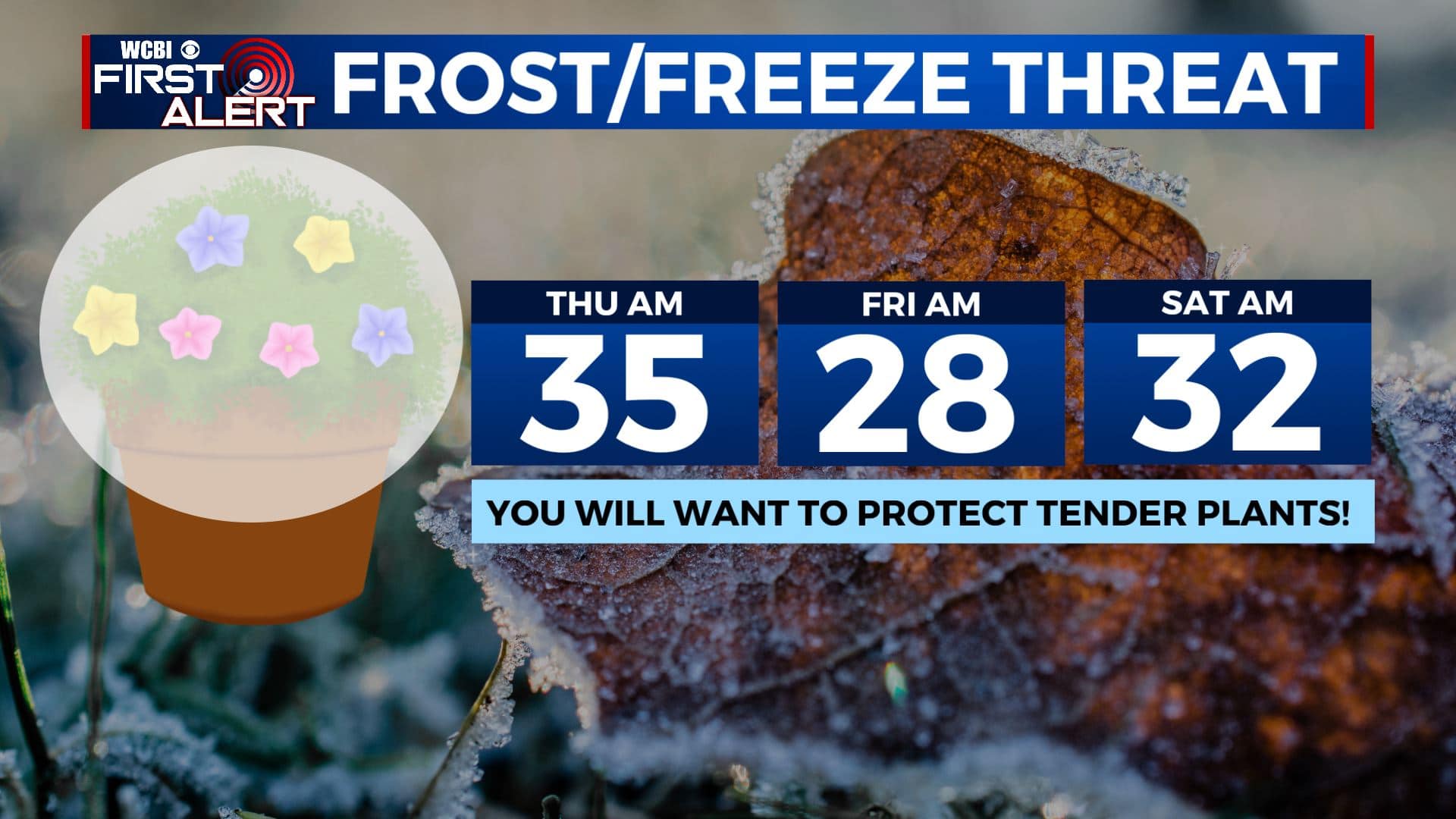
WEDNESDAY NIGHT: Clearing skies with much colder lows in the mid to low 30s. Some patchy frost is possible in any spot that is sheltered from the wind. Winds NW 5-15 mph.
THURSDAY: Sunny and cool. Breezy NW winds 10-25 mph. Highs in the mid 50s.
THURSDAY NIGHT: A widespread freeze is expected with lows in the upper 20s. Cover any tender plants you care about.
FRIDAY: Sunny and cool. Highs in the upper 50s.
FRIDAY NIGHT: Clear and chilly. Lows in the low 30s. Areas of frost are possible again.
SATURDAY: Mostly sunny. Highs in the mid 60s.
SATURDAY NIGHT: Mainly clear. Lows in the upper 30s to around 40.
EASTER SUNDAY: Mostly sunny. Highs in the low 70s.
Follow @WCBIWEATHER on Facebook, Twitter, Instagram, and the WCBI News App


Leave a Reply