Some sunshine for Friday; Some rain and seasonable temperatures this weekend
SUMMARY: We’ll have a mix of sun and clouds for your Friday. Temperatures will remain seasonable in the 50s through the weekend. More rain is possible Saturday and through next week. Much colder air could still invade the region by the middle to end of next week. It’s something we’ll keep watching.
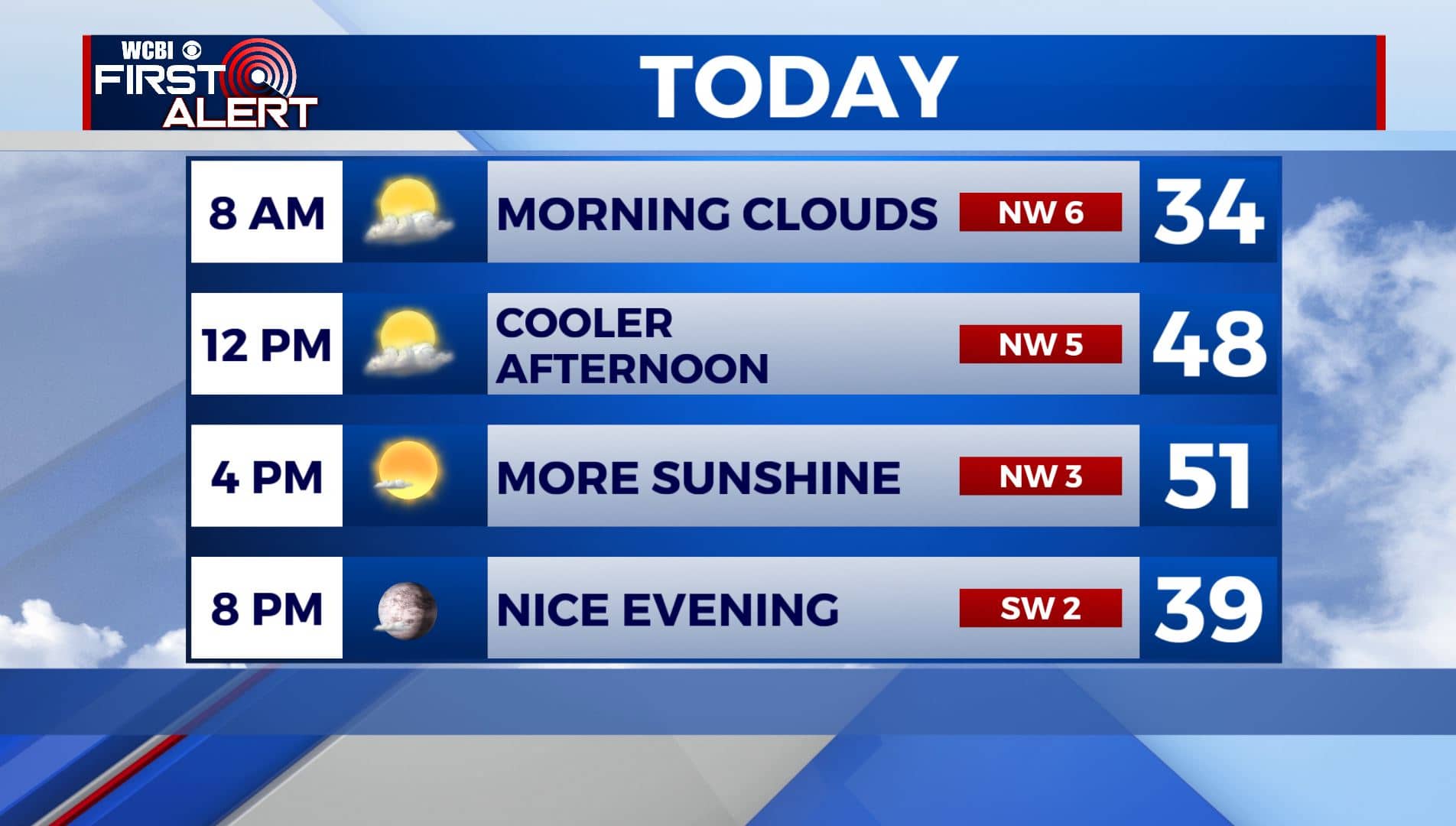
FRIDAY: We have some clouds out there this Friday morning, but we’ll have a nice afternoon with more sunshine. It will be a bit cooler with highs in the lower 50s. Winds NW 5-10 mph.
FRIDAY NIGHT: Mostly clear and cold. Overnight lows in the upper 20s to lower 30s.
SATURDAY: More clouds than sun with some isolated afternoon showers. Highs in the lower 50s.

SATURDAY NIGHT: Mostly cloudy. A slight chance of a shower. Lows in the mid 30s.
SUNDAY: Mostly sunny skies. Seasonable temperatures mainly in the mid 50s.
SUNDAY NIGHT: Partly cloudy. Lows in the mid 30s.
MONDAY: Increasing clouds with showers possible late afternoon into the evening. Mild highs in the lower 60s.
MONDAY NIGHT: Mostly cloudy. Overnight lows in the 40s. Some showers could linger.
TUESDAY: Mostly cloudy. Showers possible. Highs in the 50s.
MIDWEEK: Another storm system will approach the area by the middle and end of next week. Temperatures will be colder with highs in the 40s and lows in the 20s and 30s. There is a potential for maybe some winter weather as we go into next weekend. There are a lot of question marks in this part of the forecast…so stay tuned for changes.
Stay connected with @WCBIWEATHER on Facebook, Twitter, Instagram, and the WCBI News App


Leave a Reply