SUNSHINE HAS RETURNED!
It has been a glorious start to our weekend! Sunshine has returned area-wide, and it is here to stay for the next couple of days! Make the most of this weekend, because next weekend is looking wet and cold.
SATURDAY NIGHT: Saturday night will start off clear. As we head into the overnight hours, fog will begin to develop area-wide. Overnight, lows will drop down into the upper 30’s. Dense fog will develop after midnight.
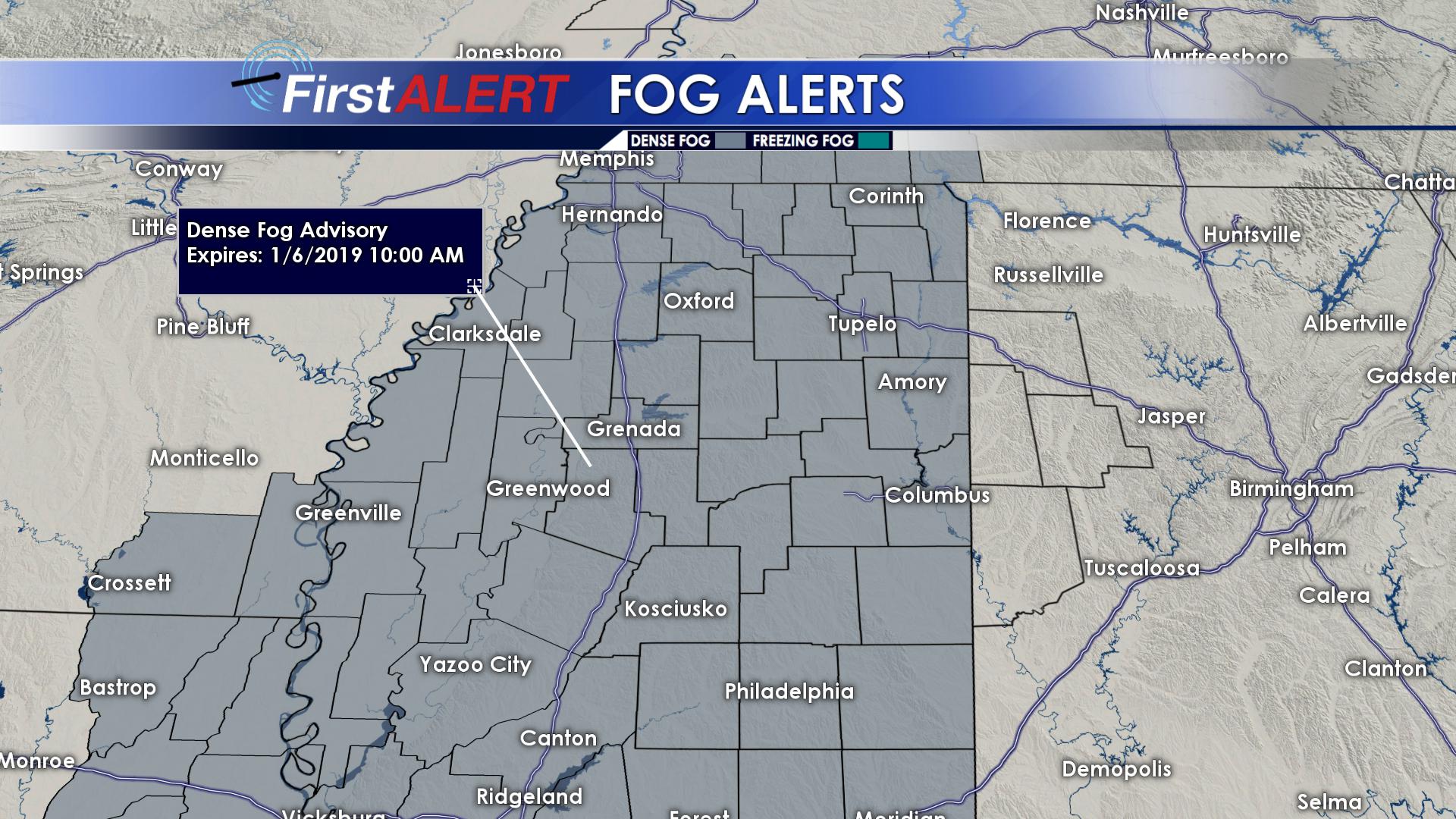
Dense Fog Advisory
SUNDAY: A Dense Fog Advisory is in effect for the entire WCBI viewing-area until 10 AM on Sunday. Visibility will be down to 1/4th of a mile in the advisory area Sunday morning. Fog should begin to mix out by noon on Sunday. Sunday afternoon will be a windows down kind of day. Highs will top out in the lower to middle 60’s, with abundant sunshine across the region. Sunday night, lows will only drop down into the lower 40’s. Fog will develop once again late Sunday night.
MONDAY & TUESDAY: Monday will start out with dense fog once again. By Monday afternoon, skies will become partly cloudy as a weaker upper level disturbance begins to approach our area. Highs on Monday will reach the middle 60’s across the region. Monday night, scattered showers will begin to push through the area.
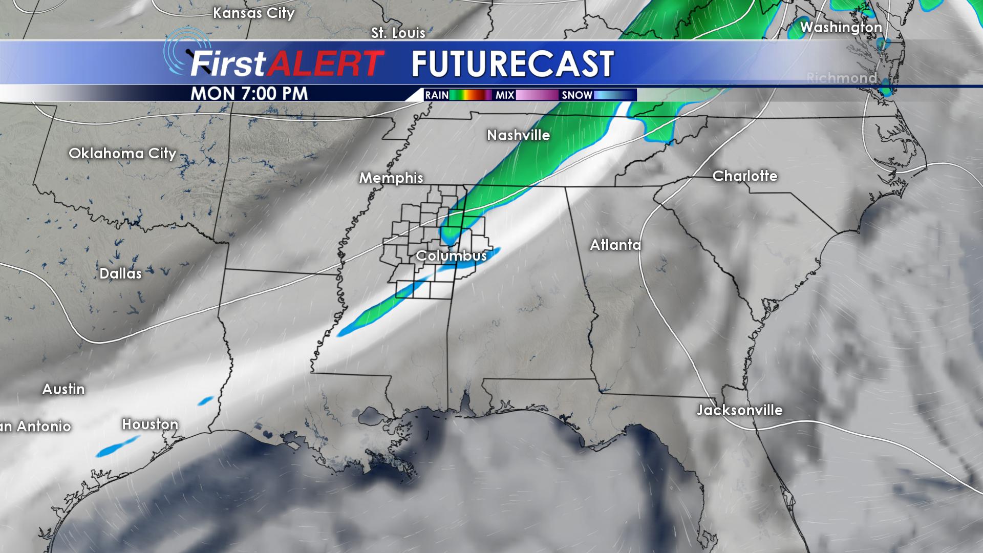
Isolated Showers Monday Evening
Overnight lows will be much warmer thanks to the clouds, only dropping down to the middle 50’s. On Tuesday, clouds will thin out throughout the day, giving us mostly sunny skies! Tuesday will be our last day of above average temperatures. Highs on Tuesday will top out in the middle and upper 60’s! As we head into the overnight hours on Tuesday, we will cool off by a good 20 degrees. Overnight lows on Tuesday will bottom out in the upper 30’s and lower 40’s.
WEDNESDAY & THURSDAY: Wednesday will be noticeably cooler, as highs drop by a good 10 to 15 degrees. Although it will be sunny, highs on Wednesday will struggle to climb into the lower 50’s and upper 40’s. Winds will also be blowing around 5 to 10 MPH out of the northwest, making it feel even colder. Wednesday night will be bone chilling as lows drop into the middle and upper 20’s!
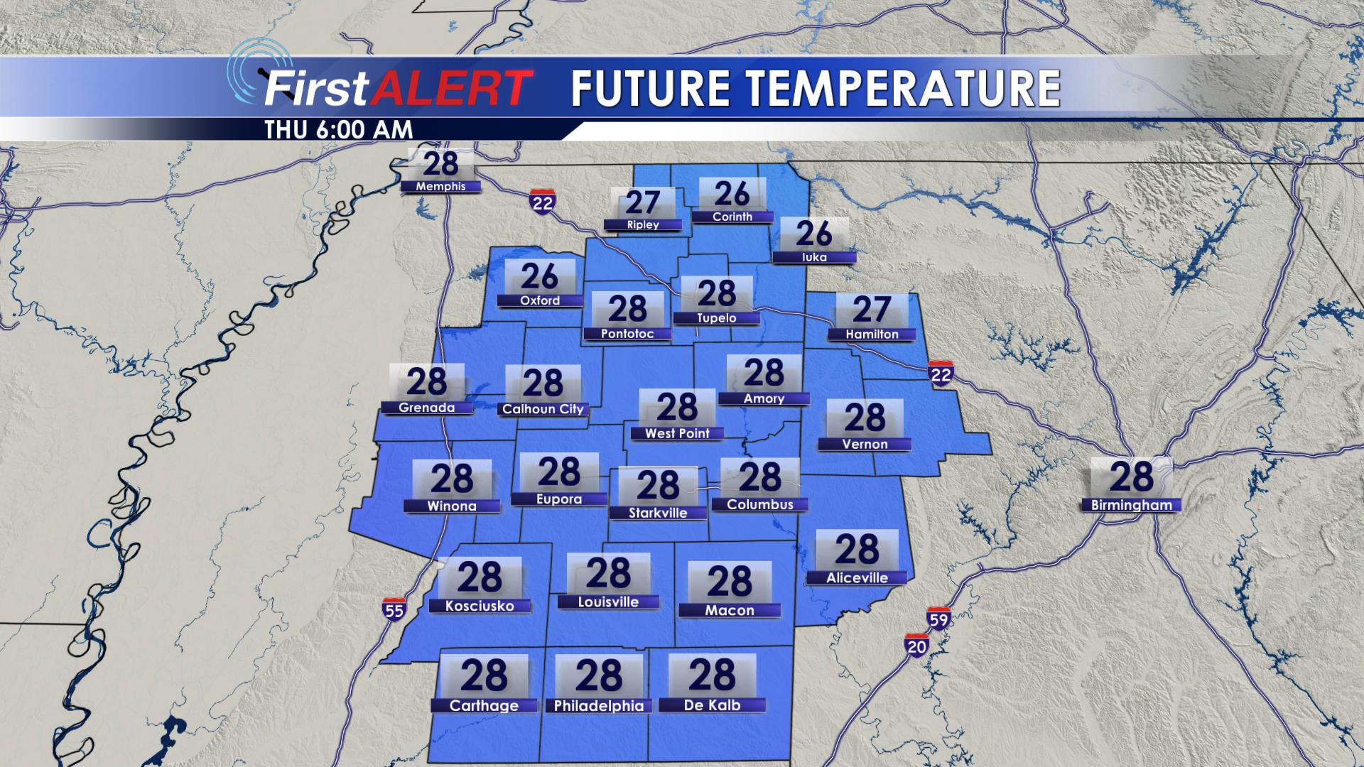
Thursday Morning Temperatures
It has been a while since we’ve had a hard freeze like this. Be sure to bring in your pets and plants that are sensitive to frost. You will want to make sure that all exposed pipes are covered, too. Thursday will be another sunny and cold day. Highs Thursday will only top out in the middle 40’s. Another freeze is expected Thursday night as lows drop into the lower 30’s.
FRIDAY & SATURDAY: Friday will be the coldest day out of the next seven. Highs on Friday will struggle to reach the middle 40’s. Rain showers will begin to move in Friday evening. As of now, we are just looking at a cold rain. Winds will shift to the southeast, bringing in warmer air aloft. Friday night will be cold, with on and off rain shower continuing. Lows Friday night will drop down to the lower and middle 30’s. Saturday will be cold, with highs in the upper 40’s and lower 50’s. Rain showers will continue Saturday.
Give us a follow on Facebook, Twitter, Instagram and Snapchat @WCBIWEATHER


Leave a Reply