Sunshine and near average temperatures return as we end 2019
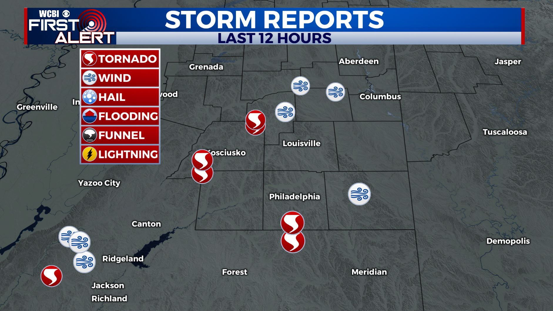
SUMMARY: After a busy night of severe weather Sunday night, our cold front has passed through. It has helped to bring in some cooler, but near average temperatures and drier air into the region as we near the end of 2019. Rain chances though will be coming back in once we ring in 2020 late week.
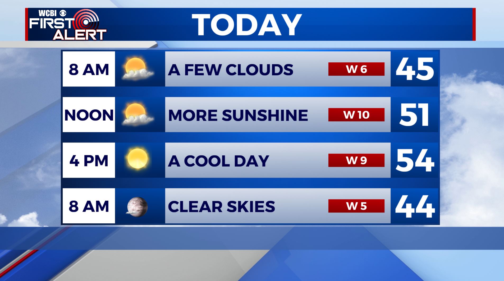
MONDAY: We are waking up to a few clouds this morning, but skies will clear up by late morning. Lots of sunshine by the afternoon with highs in the lower to middle 50s. West winds 5-10 mph.
MONDAY NIGHT: Clear skies with overnight lows down into the middle 30s.
TUESDAY: Another sunny and cool day for New Year’s Eve 2019 with highs in the middle 50s.
TUESDAY NIGHT: Mostly clear skies to ring in the new year with overnight lows on the chilly side in the lower 30s.
WEDNESDAY: Happy New Year 2020!!! We’ll still have some sunshine, but clouds will build back in, but rain would hold off until after sunset. Highs in the middle 50s.
THURSDAY – FRIDAY: We’ll watch for another storm system to push through the region. This could be another heavy rain producer in the area, though timing and impacts still remain uncertain. Best chances for rain and storms would be on Thursday, with some lingering chances into Friday. Highs in the upper 50s to lower 60s.
NEXT WEEKEND: A quiet and mild weekend is ahead for us with mostly sunny skies. Highs in the middle to upper 50s.
STAY WITH @WCBIWEATHER ON FACEBOOK, INSTAGRAM, TWITTER AND ON THE WCBI MOBILE APP.


Leave a Reply