Some sunshine then the return of showers and storms for Monday
SUMMARY: We’re waking up to cloudy skies and a few light sprinkles this Monday morning, but we’ll see a few peeks of sunshine in the afternoon. Rain and storms will move back in tonight into Tuesday morning. Wednesday and Thursday look to be the best days of the upcoming week with near-average temperatures and mostly sunny skies. There’s a slight chance of rain in the forecast for Friday and the weekend.
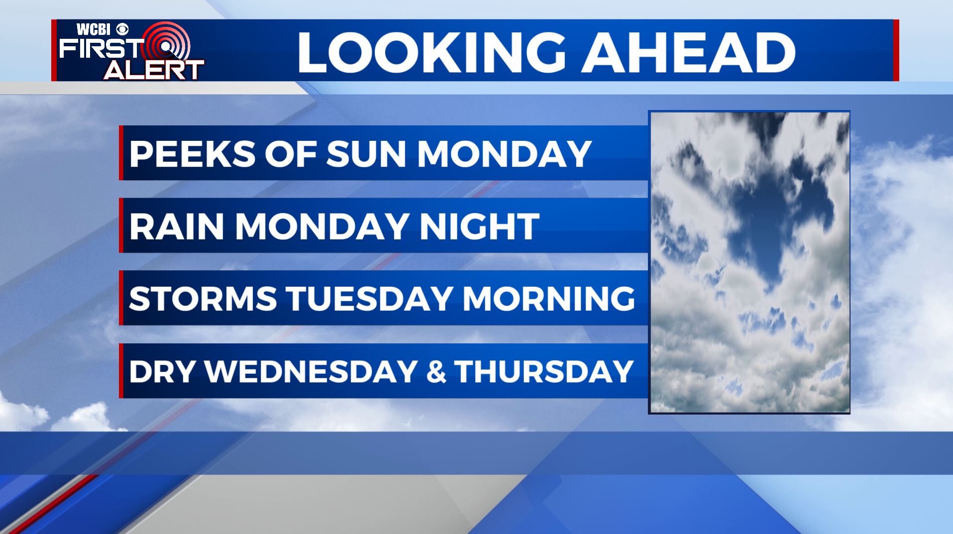
MONDAY: Mostly cloudy and fairly dry aside from a sprinkle or two this morning. A few peeks of sunshine in the afternoon. Highs will be in the lower 70s. NE winds 5-10 mph.
MONDAY NIGHT: Showers and storms will become likely as we get into the evening and overnight as our next storm system approaches. Lows in the 50s.
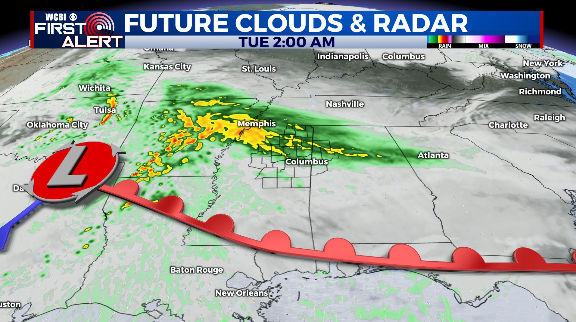
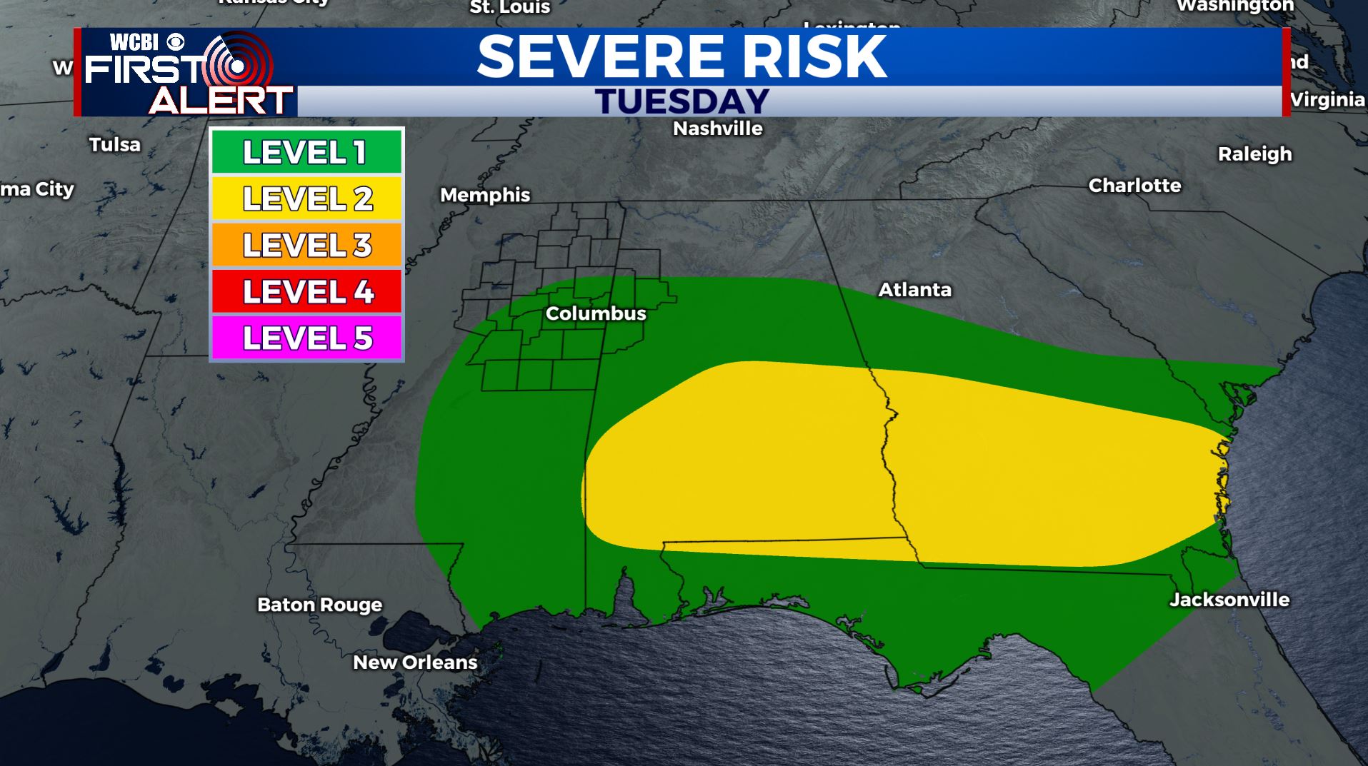
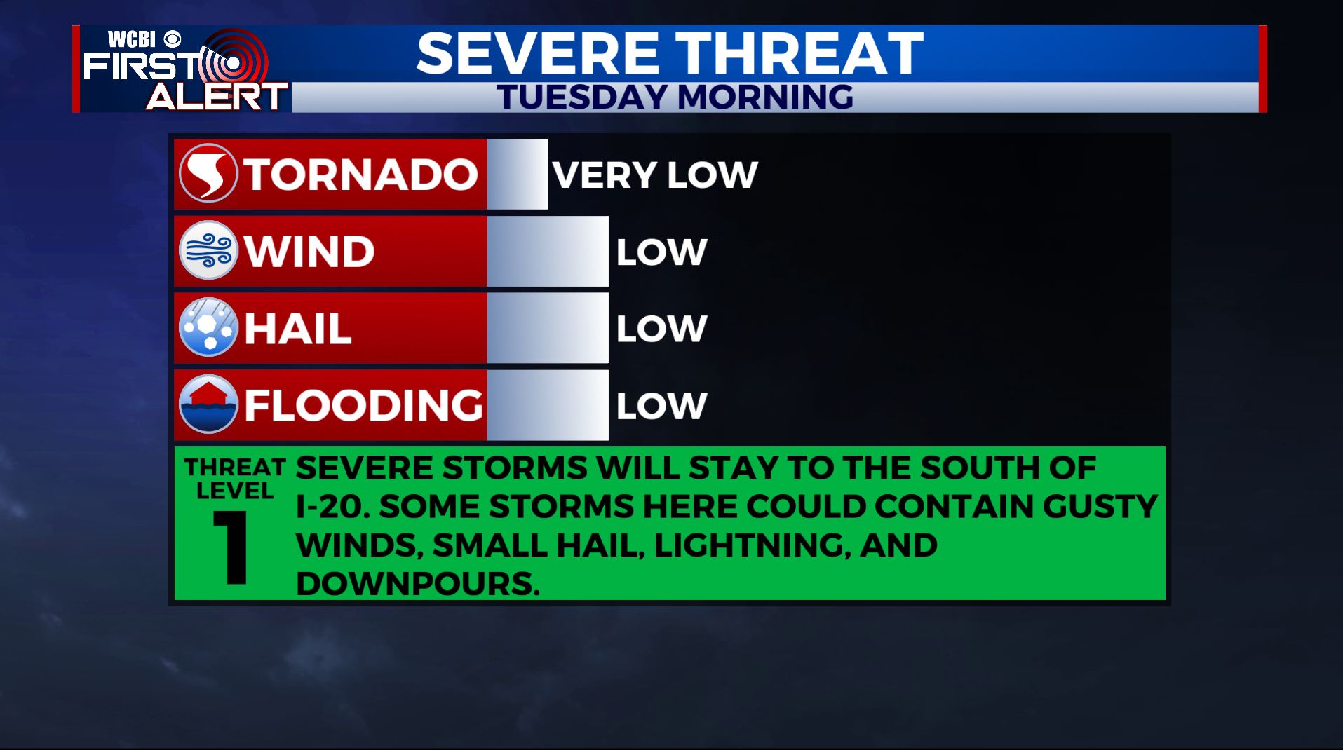
TUESDAY: Rain and storms likely, especially before noon. At this point, severe weather is not a major concern as the warm front will be south of us from the I-20 corridor and south, but we’ll continue to monitor things. Temperatures increasing to only the mid 60s by the afternoon as rain exits.
WEDNESDAY-THURSDAY: Mostly sunny and cooler for the middle part of the week. Highs in the mid 60s to near 70 with overnight lows in the 40s.
FRIDAY-SUNDAY: A slight chance of showers will return to the forecast for Friday, with a few sprinkles lingering into the weekend. Afternoon temperatures will be in the 70s with a few peeks of sunshine at times.
Stay connected with @WCBIWEATHER on Facebook, Twitter, Instagram, and the WCBI News App


Leave a Reply