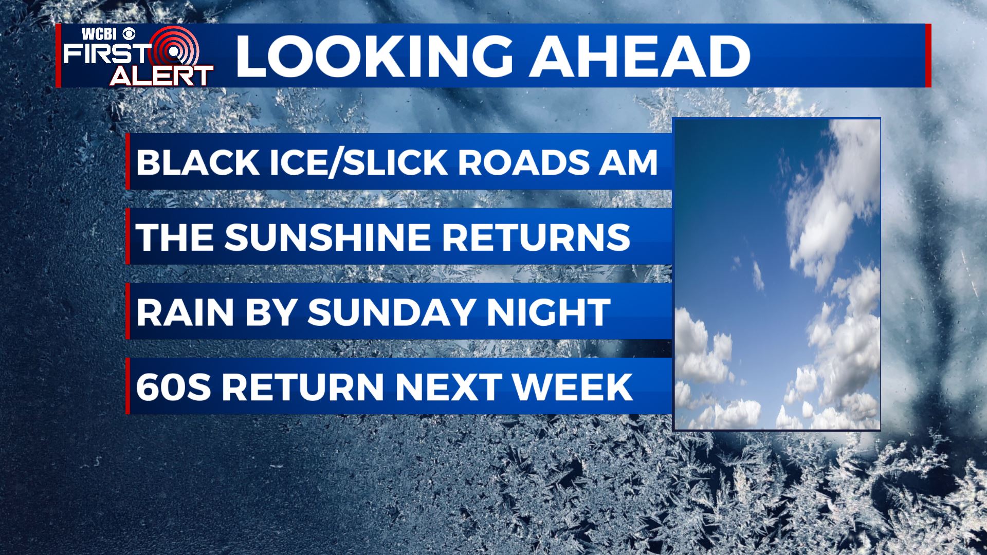
Sunshine returning Friday; Slowly thawing out this weekend
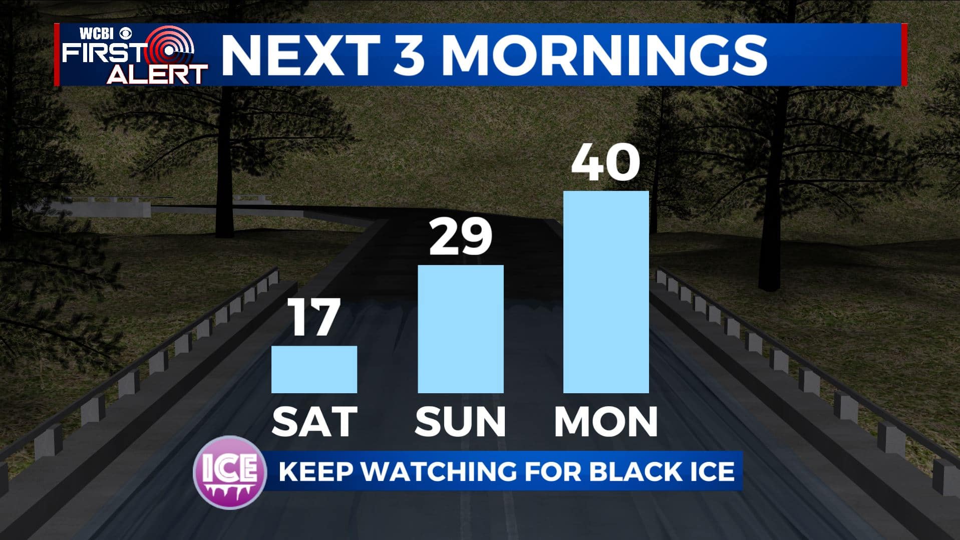
SUMMARY: We are now DONE with wintry weather for now and that will allow us to finally thaw out as we head into the weekend with the sunshine returning for our Friday. Roads will still have some slick spots and black ice concerns during the overnight/early morning hours through Sunday morning. The next chance of rain will come late Sunday night into Monday. Feeling much more like spring with the 60s returning next week for high temperatures.
FRIDAY: It’s once again cold out there to start your day with clouds but the sunshine is returning by the afternoon. Highs in the mid to upper 30s. Winds NW 5-15 mph.
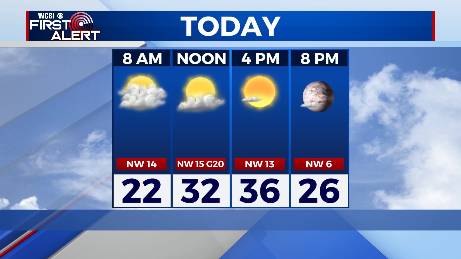
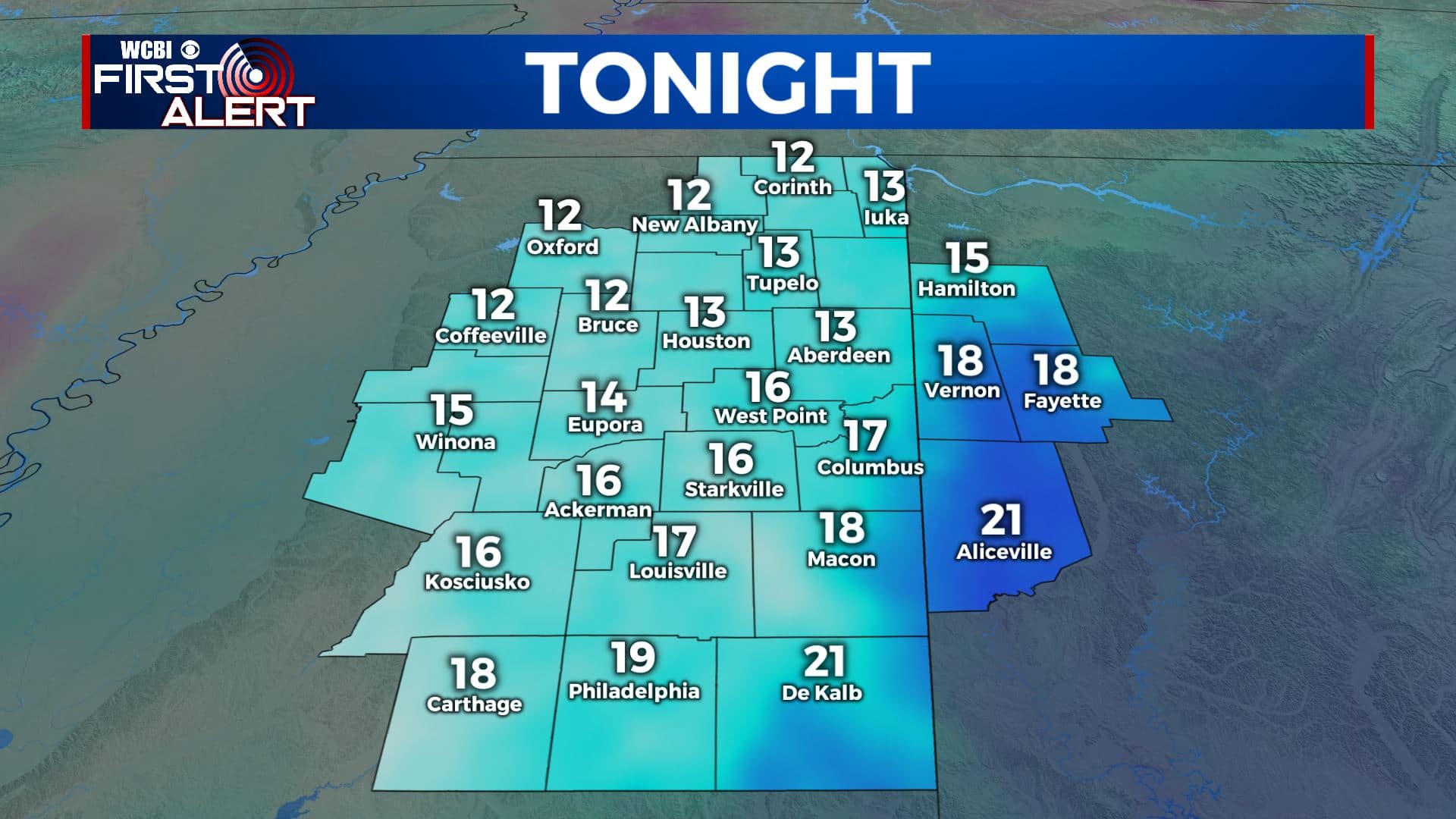
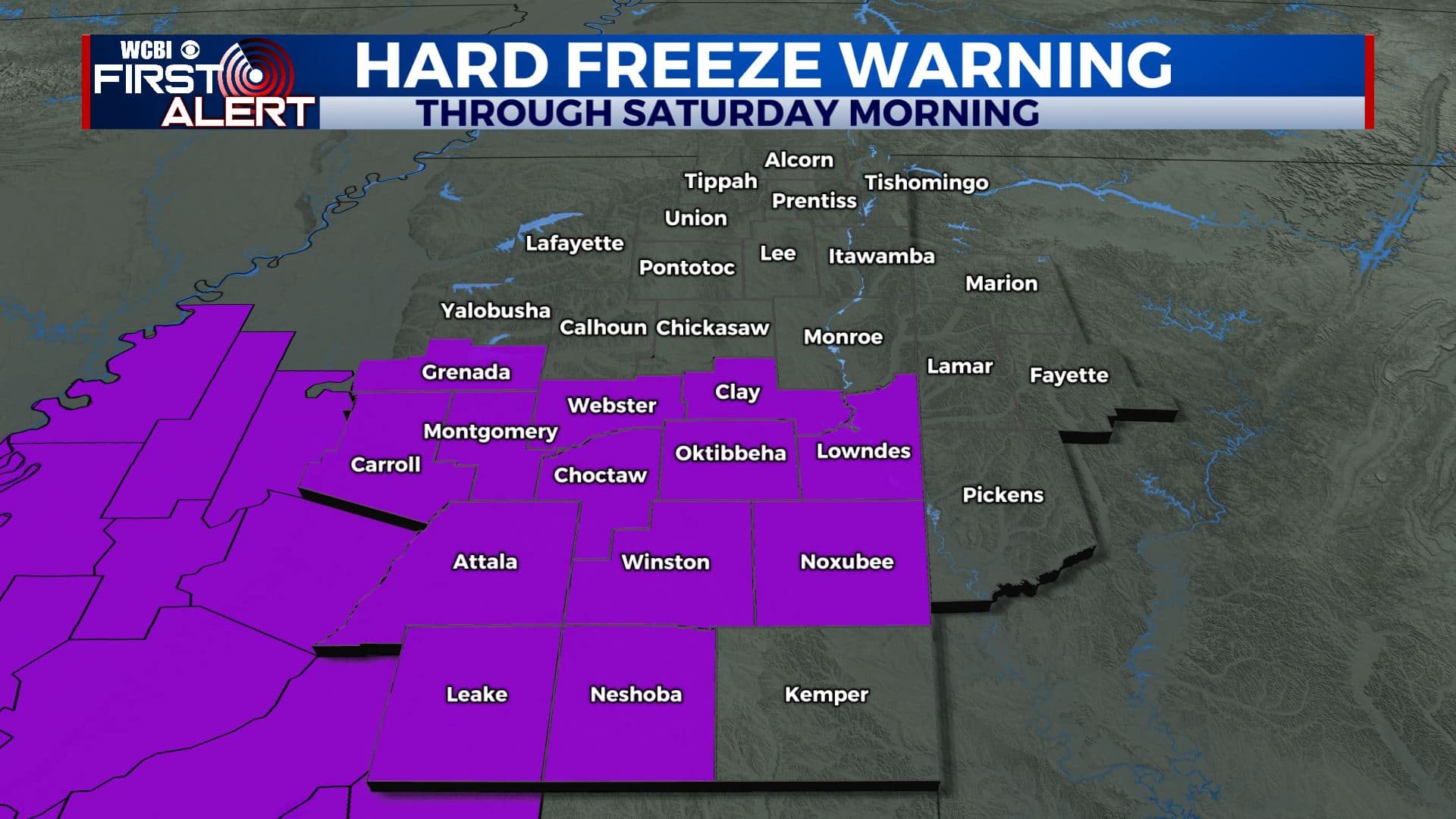
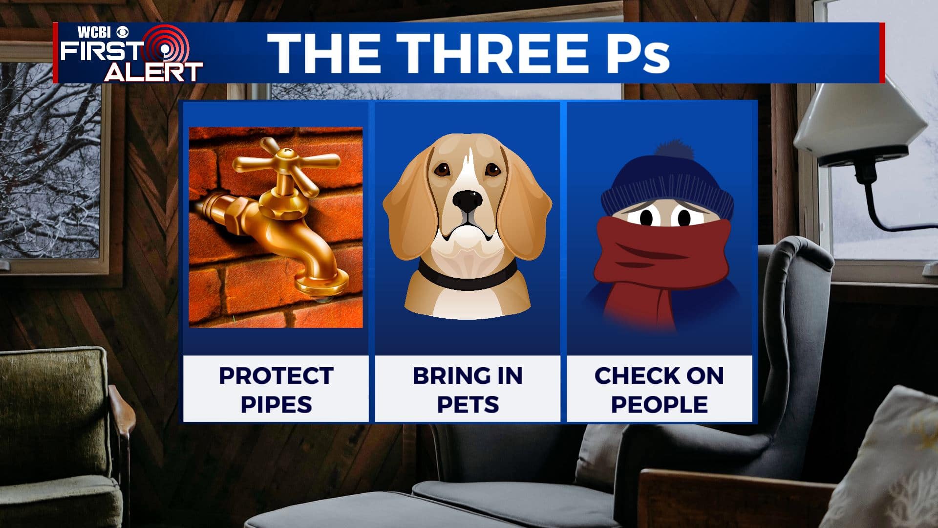
FRIDAY NIGHT: Mostly clear skies and cold. Overnight lows in the teens. Watch for slick spots on roads with moisture freezing up again. With overnight lows once again, falling below freezing tonight, a Hard Freeze Warning will go into effect from 6pm Friday to 9am Saturday. Hard freeze conditions will result in damage to exposed pipes. Find ways to protect your pipes once again and keeping yourself, other people and your pets safe & warm.
SATURDAY: Mostly sunny. Highs in the mid to upper 40s.
SATURDAY NIGHT: Clear skies and cold. Lows in the mid 20s.
SUNDAY: Clouds increase with a few late evening showers possible. Highs in the mid to upper 50s.
SUNDAY NIGHT: Areas of rain. Lows around 40.
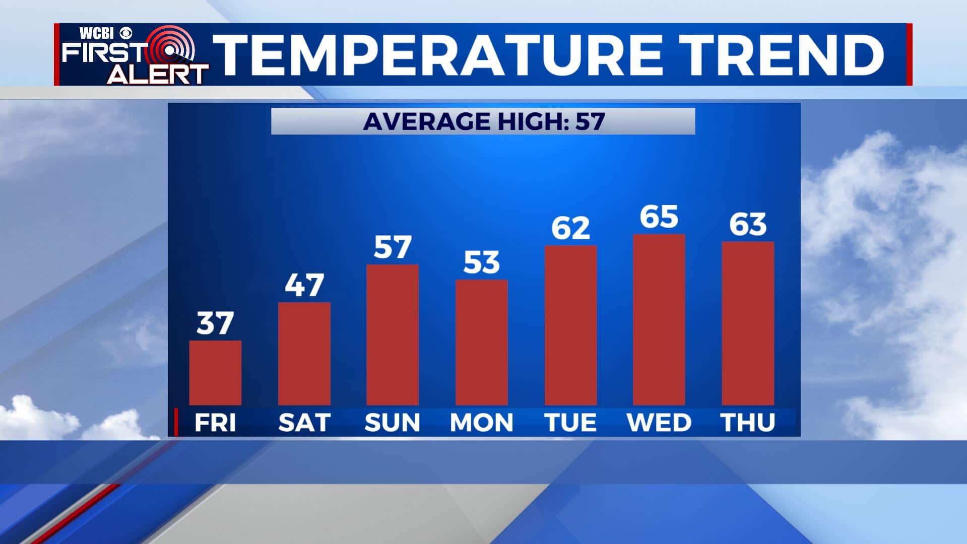
MONDAY: Morning showers then partly cloudy skies. Highs around 50.
TUESDAY: Mostly sunny. High warming back up and more spring-like in the lower to mid 60s.
WEDNESDAY: A mix of sun and clouds. Highs in the mid 60s.
Stay connected with @WCBIWEATHER on Facebook, Twitter, Instagram, and the WCBI News App


Leave a Reply