The 70s and storm chances return this workweek
SUMMARY: Hoping you enjoyed the amazing spring weather this weekend because our weather will be changing up as we head into a new workweek. Monday will still be alright with a mix of sun & a few clouds. Rain and storm chances will return on Tuesday, but we could be dealing with another round of strong to severe storms on Thursday. Heavy rain and flooding will be another concern as well. Stay tuned!
MONDAY: We’ll have more clouds start moving back in for our Monday. We’ll still have some sunshine around so don’t put away those sunglasses. Highs will be a tad warmer as we climb up to the lower 70s as our winds will be a bit breezy coming in from the SE 5-10, gusting up to 20 mph.
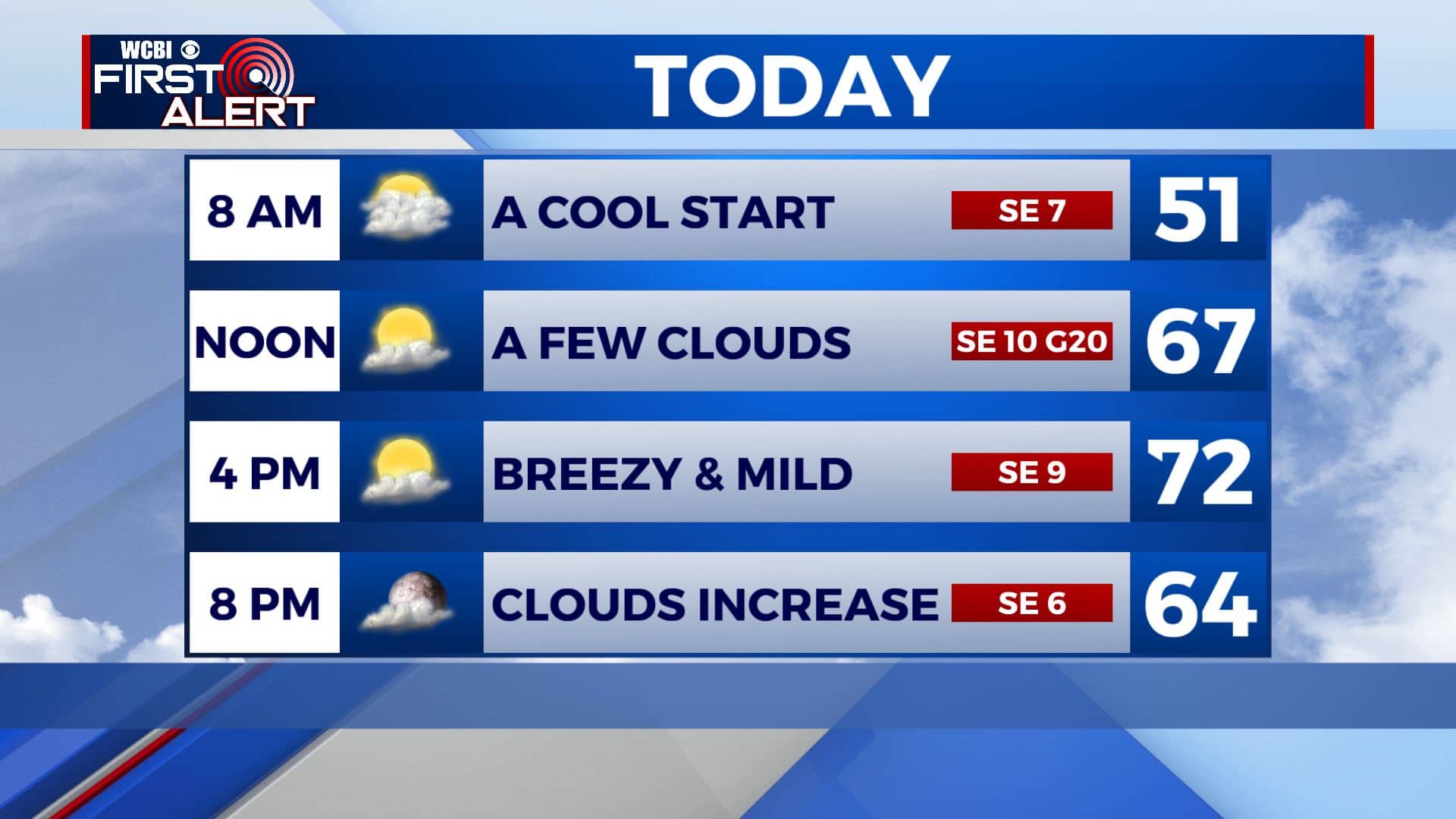
MONDAY NIGHT: Mostly cloudy skies. Overnight lows back down into the 50s.
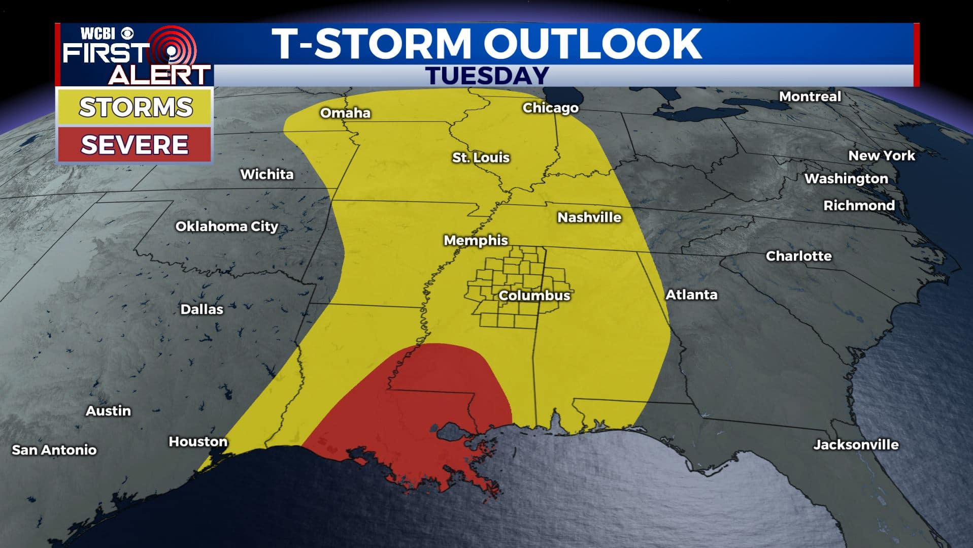
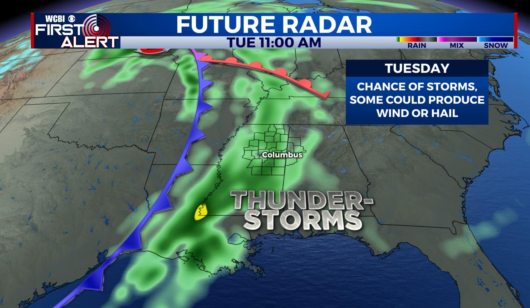
TUESDAY: Our first storm system pushes through the Deep South, bringing us the return of showers & storm chances. While the severe weather threat is relatively low and staying to the south, a few storms could produce hail and gusty winds. Highs in the upper 60s. with Overnight lows in the mid 50s.
WEDNESDAY: Rain showers and a few rumbles of thunder will stick around through Wednesday as well. Highs in the lower to mid 70s. Overnight lows in the lower 60s.
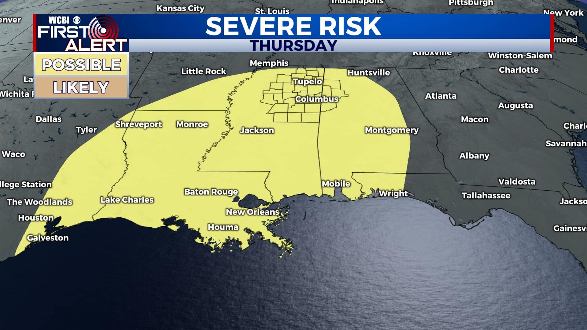
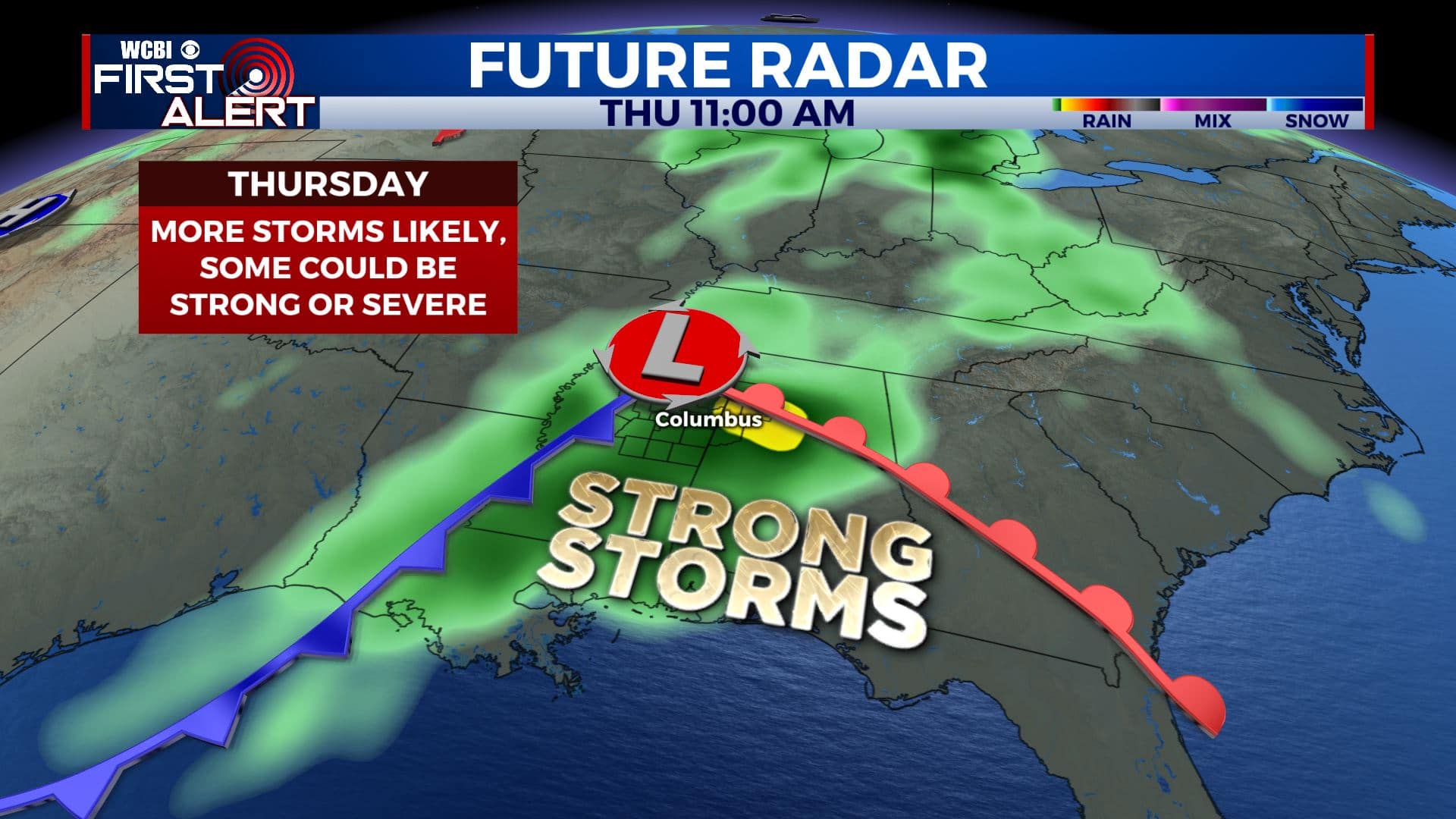
THURSDAY: Our second round of storms will move in late Wednesday night into the day on Thursday. Confidence is continuing to grow that these storms could be strong to severe. Something we’ll have to watch and keep you updated on over the next few days. Many of us could see 2-4″ of rainfall total this week which could lead to some flooding concerns. Highs very warm in mid to upper 70s.
FRIDAY-WEEKEND: Sunshine will return for the end of the week and the weekend with only a slight chance of an isolated shower on Saturday. Highs will remain in the 70s for Friday and Saturday but we could be a little cooler by Sunday. Lows will remain near 50.
Stay connected with @WCBIWEATHER on Facebook, Twitter, Instagram, and the WCBI News App


Leave a Reply