The 80s stick around for the rest of the workweek
SUMMARY: We will stay sunny and above normal with highs in the 80s through at least Thursday. The next cold front is possible by Friday and it may give us some shower and maybe some thunderstorm chances. We’ll be cooling back down to near average for mid-October in the 70s by the weekend.
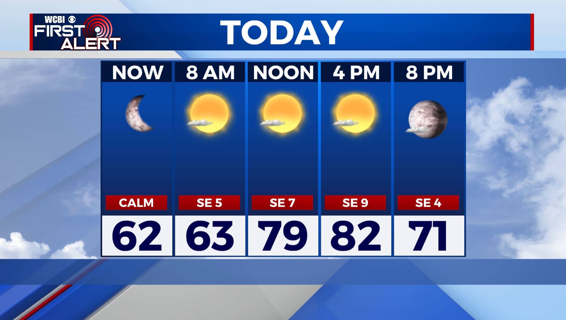
TUESDAY: We are waking up this Tuesday morning to mostly clear skies and temperatures in the upper 50s to lower 60s. We’ll have another mostly sunny and warm day ahead with highs in the lower to mid 80s. SE winds 5-10 mph.
MONDAY NIGHT: Staying mostly clear and quiet. Overnight lows mild in the lower 60s.
WEDNESDAY: Mostly sunny and warm. Highs in the mid 80s. Overnight lows in the mid 60s.
THURSDAY: A mix of sun & clouds and warm. High temperatures staying in the 80s. A chance of a few isolated showers. Lows in the 60s Thursday night.
FRIDAY: Staying warm with highs around 80. Clouds continue to increase with a chance of rain. We’re not looking at a washout, but off-and-on showers are possible, maybe a few rumbles of thunder as well. We’re expecting our next cold front to move through Friday night that will help to clear much of the rain out before the weekend.
WEEKEND: A mix of sun & clouds. A few showers may linger early Saturday with drier conditions more likely on Sunday. Highs back down in the 70s and overnight lows in the upper 50s to near 60.
NEXT WEEK: Looking beyond the forecast, early indications are that another cold front will approach the area early next week and bring us another chance for rain and possibly a few storms. After that, it looks like we could be in for another cool down.
Stay connected with @WCBIWEATHER on Facebook, Twitter, Instagram, and the WCBI News App


Leave a Reply