Tropical Impacts in the Southeast Expected
9AM UPDATE – THE NATIONAL HURRICANE CENTER IS ISSUING UPDATES FOR SUB-TROPICAL STORM ALBERTO. WE’LL HAVE THE LATEST ON WCBI NEWS.
With Hurricane Season officially kicking off June 1st, we’re racing to the starting line with our first tropical disturbance of the year. As of 8AM, Invest 90L looks like it will gain tropical characteristics in the next 48 hours. The National Hurricane Center places the odds at 90%, meaning a tropical depression isn’t far away. If the storm can organize and strengthen into a tropical storm, we’ll get our first named storm of the season, “Tropical Storm Alberto.”
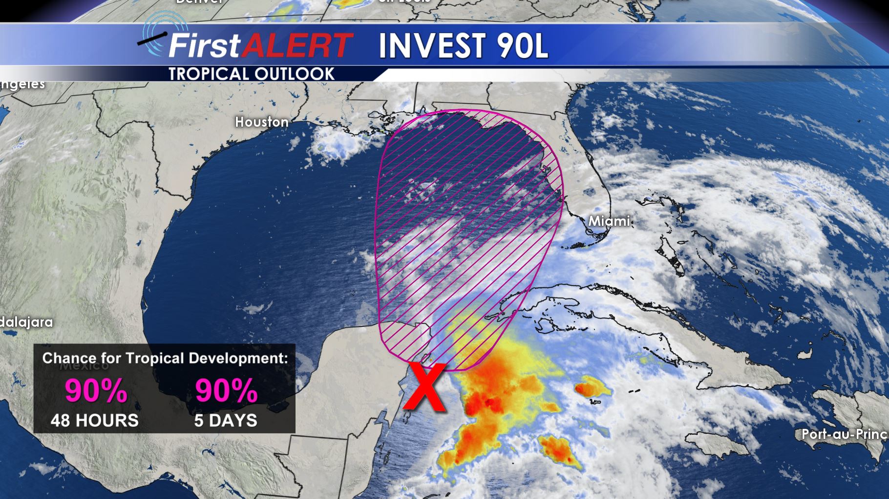
It will take likely the day on Friday for it to organize enough for us to get a better idea on how upper level shear and the warm waters in the Gulf will influence it. As of now, it appears likely that the center of circulation will move north and make landfall somewhere between Southeast Louisiana and Mobile, Alabama. Irregardless of how it strengthens and where it goes, this storm will be known for the heavy rainfall it produces.
The heaviest rain will occur on the eastern side of the center of circulation. That means a more eastern track would lower the rainfall totals in NE Mississippi and West Alabama. But a more westerly track into Louisiana or the Mississippi Gulf Coast means that heavier rain will impact our viewing area. In addition, this will likely be a 3-4 day rain event for areas as the storm struggles to move out of the area. It looks to meander along the coast for a few days before finally lifting out.
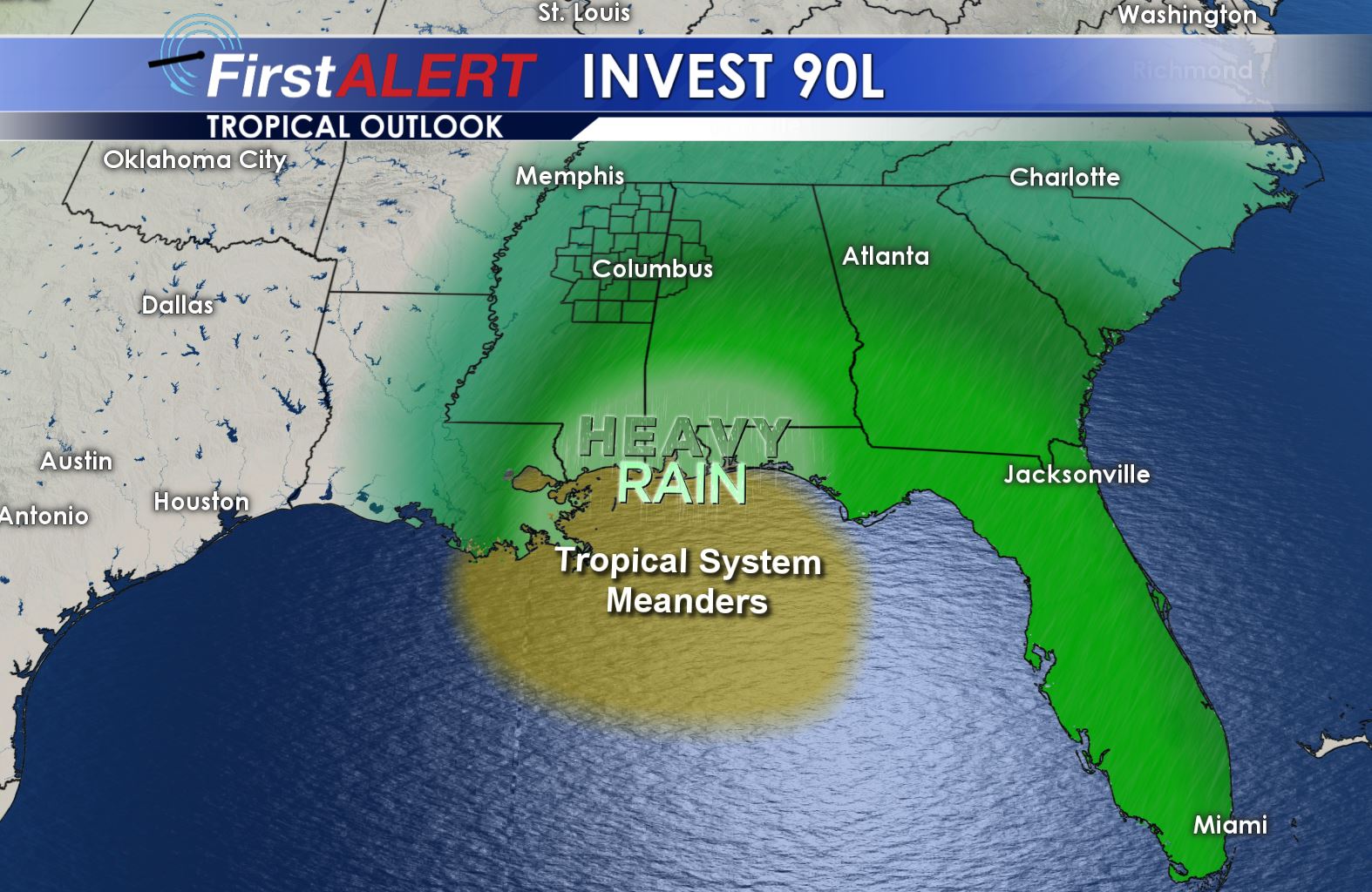
As far as specific impacts for our region, we’ll have to wait and see how the storm tracks. As of now we believe it will bring heavier rain into our area via the more western track of the low. This does not mean everyone will get heavy rain in our viewing area, but the potential is there for some spots to see 2-3 inches where heavier storms pass through. Time will tell how the storm interacts with the Gulf, and things can change. What is known is that the area with the heaviest rainfall along the coast will see 6-12 inches of rain, with locally higher amounts.
You can find our full forecasts updated at WCBI.com/weather 24 hours a day. You can also stay with @WCBIWEATHER on Facebook, Twitter and Instagram, and follow our meteorologists’ social media pages throughout the weekend.


Leave a Reply