Tropical rain Saturday, less active Sunday
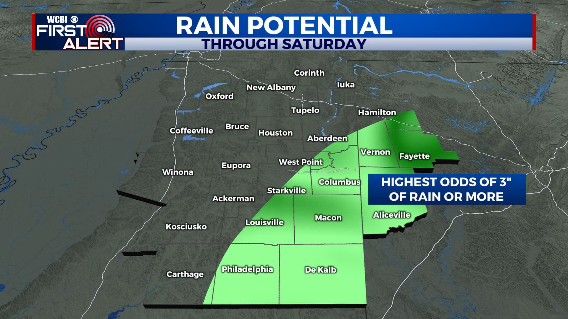
SUMMARY: The remnants of a tropical system will swirl through the area on Saturday. We stand to get a broad range of very little (northwest) to perhaps a few inches (southeast). No significant issues are anticipated locally and the severe weather threat will be along and southeast of I-20/59.
FRIDAY NIGHT: Increasing clouds with some rain possible. Lows around 70. Winds SE 3-10 mph.
SATURDAY: Mostly cloudy with a 70% chance of rain. The most concentrated activity should generally be across our southeastern counties where a few inches may fall. Much lighter amounts can be expected farther northwest. Highs will range from the 70s to low 80s. Winds of 10-15 mph from the SE then NE can be expected with the tropical circulation center moving along the I-20/59 corridor.
SATURDAY NIGHT: Mostly cloudy and humid. Lows in the upper 60s to around 70.
SUNDAY: Becoming partly cloudy. A 30% chance of a few showers and storms. Muggy highs around 90.
MONDAY-TUESDAY: Additional showers and storms are likely out ahead of and during the passage of a cold front. The chance stands at about 70%. We’ll go from near 90 on Monday to the low 80s on Tuesday.
WEDNESDAY-THURSDAY: Partly cloudy. A 20% chance of a shower or storm. Highs in the upper 80s to around 90.
Follow @WCBIWEATHER on Facebook, Twitter, Instagram, and the WCBI News App


Leave a Reply