Typical summertime weather continues this week
SUMMARY: We’ll remain in a typical summertime pattern as we head into a new workweek. It will be hot & humid with highs in the upper 80s to lower 90s. We’ll have daily chances of showers & storms. The best chances will occur midweek so keep the umbrella and rain gear nearby.
MONDAY: We’re waking up to overcast cloudy skies this Monday morning, so it will be hard to see that sunrise. We’ll eventually see a bit of sunshine mixed in with the clouds. Showers & storms will once again pop-up this afternoon. Any stronger storms that form could have some heavy rain, gusty winds and lightning. Highs in the upper 80s.
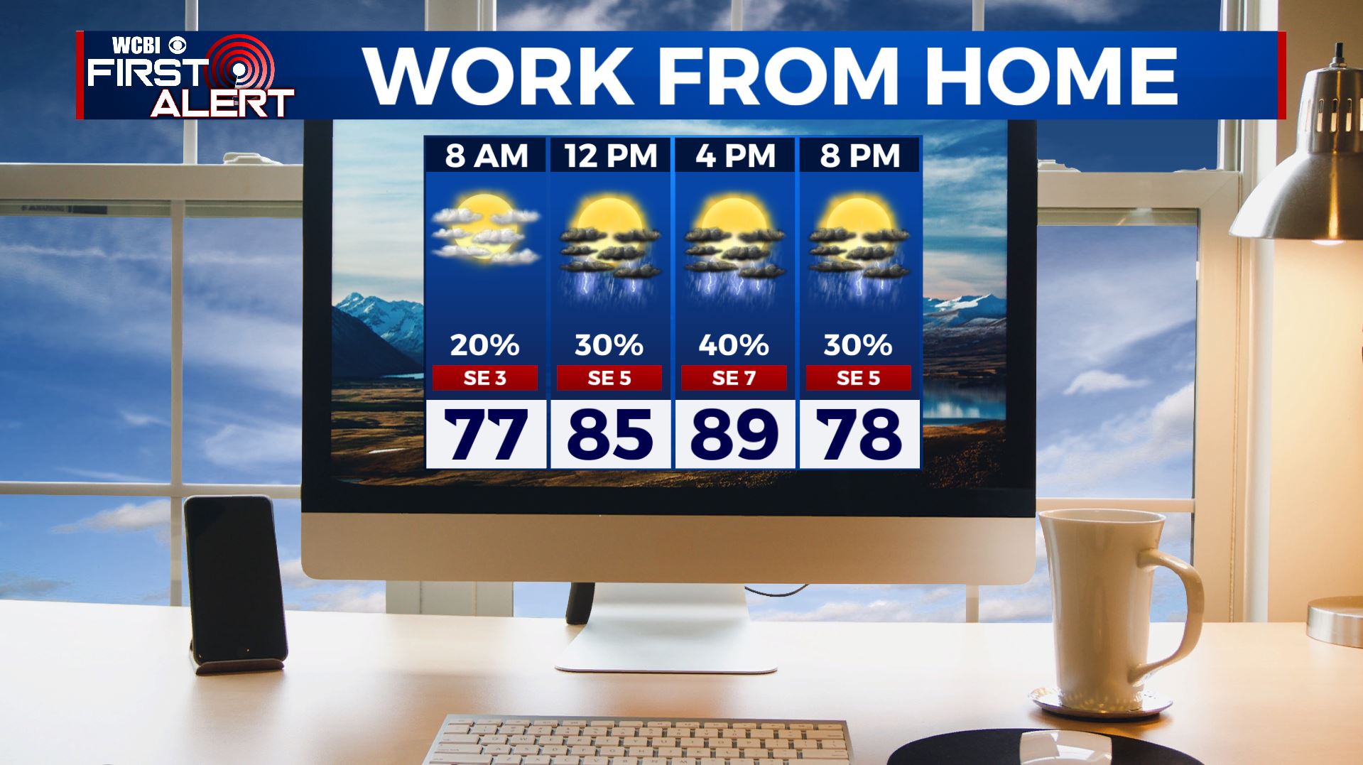
MONDAY NIGHT: We’ll have partly cloudy skies after another round of showers and storms early in the evening. Overnight lows in the low 70s.
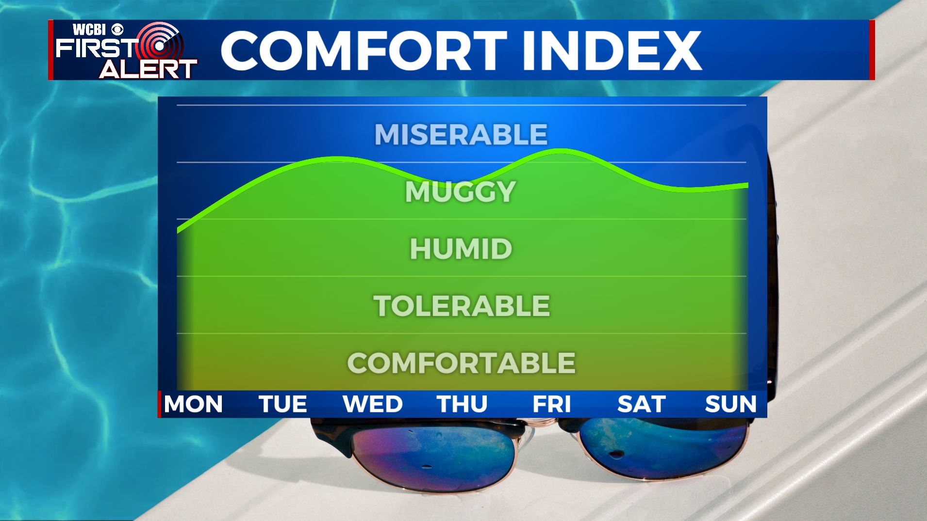
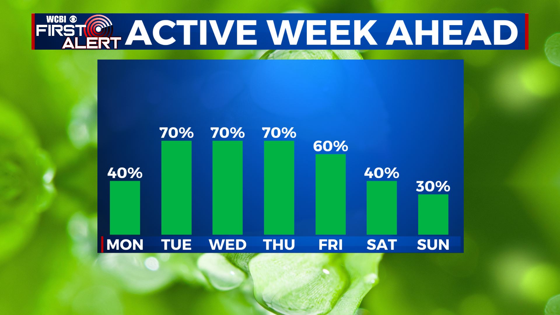
TUESDAY-THURSDAY: Better likely chances for showers and storms for the middle of the workweek as we bump rain chances up to 60%-70%. Some storms could produce heavy rain, which could lead to more flooding concerns and gusty winds. Remaining warm & humid. High temperatures in the upper 80s to lower 90s with overnight lows in the 70s.
FRIDAY-SUNDAY: Rain & storm chances with decrease heading into the weekend. Still expect scattered pop-up chances during the peak daytime heating in the later afternoon/early evening hours. Otherwise, we’ll still be hot and humid with highs back into the lower 90s.
Stay connected with @WCBIWEATHER on Facebook, Twitter, Instagram, and the WCBI News App


Leave a Reply