Unsettled weather pattern continues into the weekend
SUMMARY: An active, wet and potentially stormy weather pattern is staying around for the weekend and it looks to continue through Tuesday. Between 2″ and 6″ of rain could fall during the coming days and that may lead to flooding issues. Keep an eye on the creeks, streams, and rivers over the coming days. Some isolated stronger storms with some hail and gusty winds are also possible from time to time.
FRIDAY: Some rain showers will continue throughout the rest of today. We’re forecasting highs in the 60s but it could end up being warmer if a warm front pushes in from the south faster than expected. Winds SE 5-10 mph.
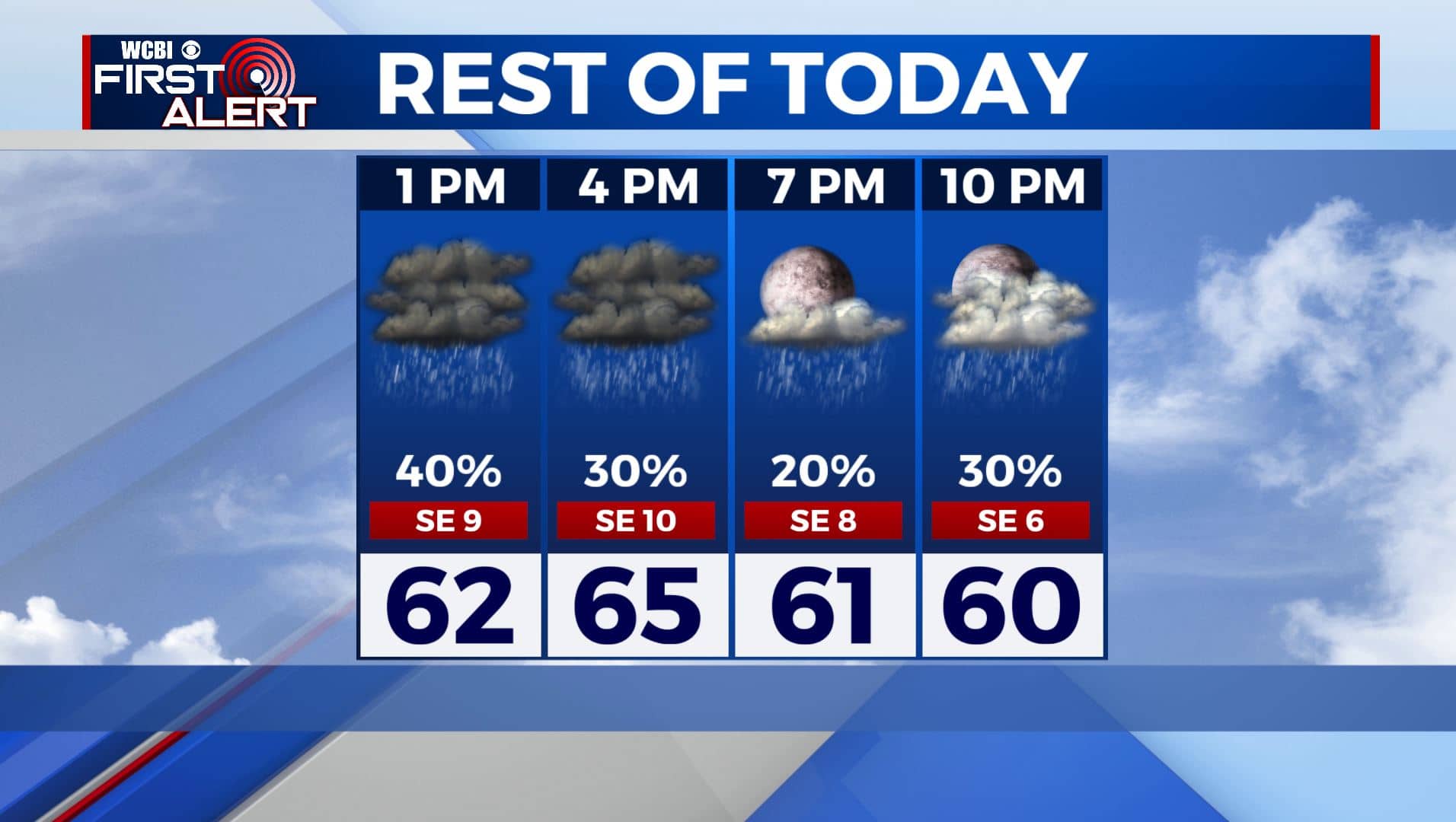
FRIDAY NIGHT: Mostly cloudy and mild. Lows around 60. The chance of some showers will continue during the overnight hours.
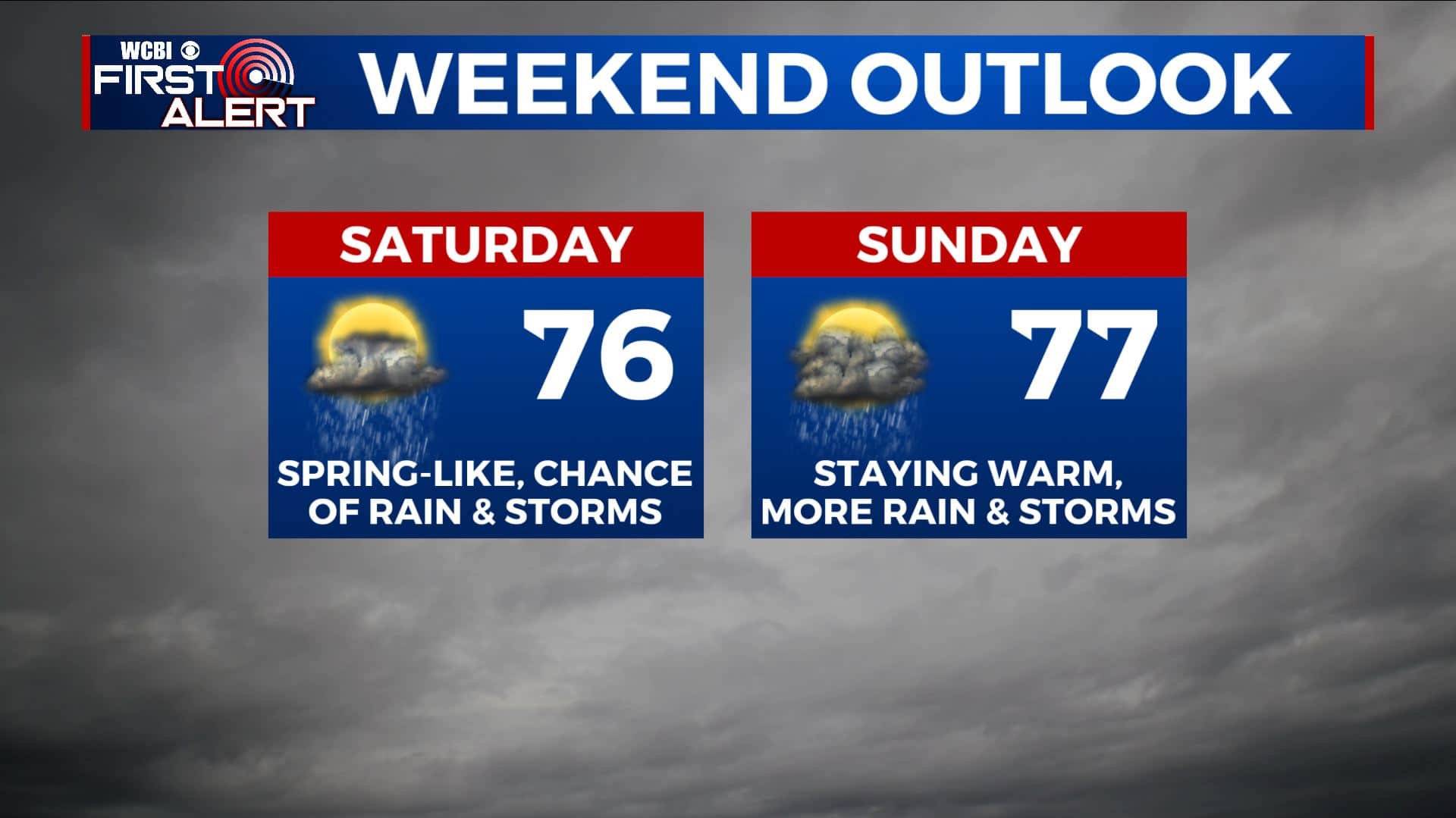
SATURDAY: Mostly cloudy. A continuing chance of rain and thunder. It probably won’t rain the entire day but keep an umbrella close at hand if you have outdoor plans. Spring-like above average highs back up into the mid 70s along with noticeably higher humidity levels.
SATURDAY NIGHT: Warm and humid. Lows in the low to mid 60s. A chance of showers and storms.
SUNDAY: Mostly cloudy. Warm highs in the mid to upper 70s. A good chance of rain and storms, especially during the 2nd half of the day.
MONDAY-TUESDAY: Mostly cloudy. A continued chance of rain and storms each day. Highs in the upper 50s to mid 60s. Overnight lows in the 40s.
WEDNESDAY-THURSDAY: Rain & storm chances look to come to an end by Wednesday. We’ll finally start drying out a bit midweek with a few clouds and more sunshine by Thursday. Highs in the mid to upper 60s.
Stay connected with @WCBIWEATHER on Facebook, Twitter, Instagram, and the WCBI News App


Leave a Reply