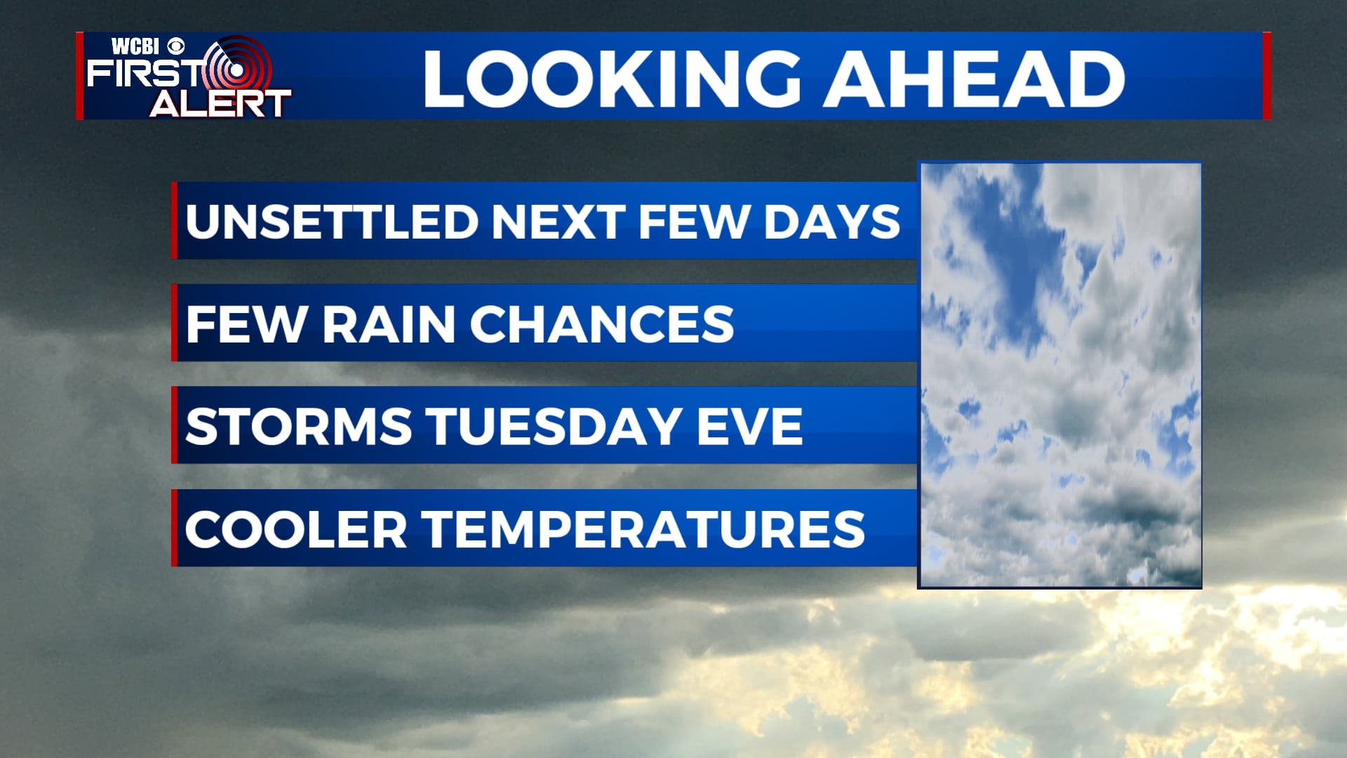
Unsettled weather pattern stays put as we begin new workweek
SUMMARY: The cold front is moving through the area this morning leaving us with some cooler, below average temperatures this week. Another unsettled wet-weather pattern for the first half. We could see some spotty showers on Monday but overall it looks to be fairly cloudy. Our next chance for some showers and thundershowers will be Tuesday afternoon/evening. Severe weather threat will stay top our south. Showers may linger into Wednesday morning before drying out Thursday. Clouds will likely break Thursday afternoon with mostly sunny skies into the weekend.
MONDAY: Some showers may roll over into the early morning hours but we’re mainly looking at overcast skies. The chance for some spotty showers may form throughout the afternoon, but overall, a gloomy Monday. Highs will be much cooler behind our cold front around the upper 60s to lower 70s.
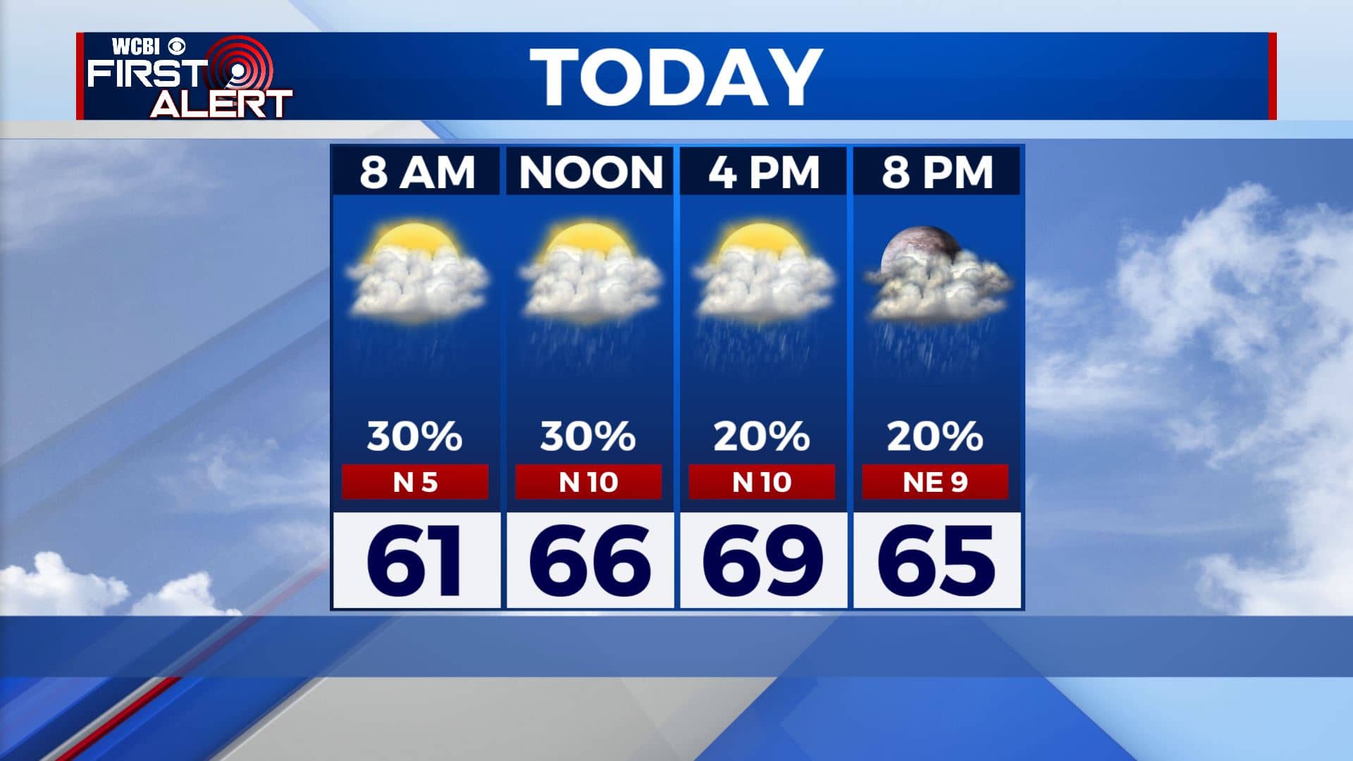
MONDAY NIGHT: Mostly cloudy skies with a stray shower possible. Overnight lows in the 50s.
TUESDAY: Mostly cloudy skies will give way to another chance for some showers and thunderstorms across the area. Severe weather threat looks to stay along and south of I-20. Highs will remain below average in the upper 60s. Overnight lows in the 50s.
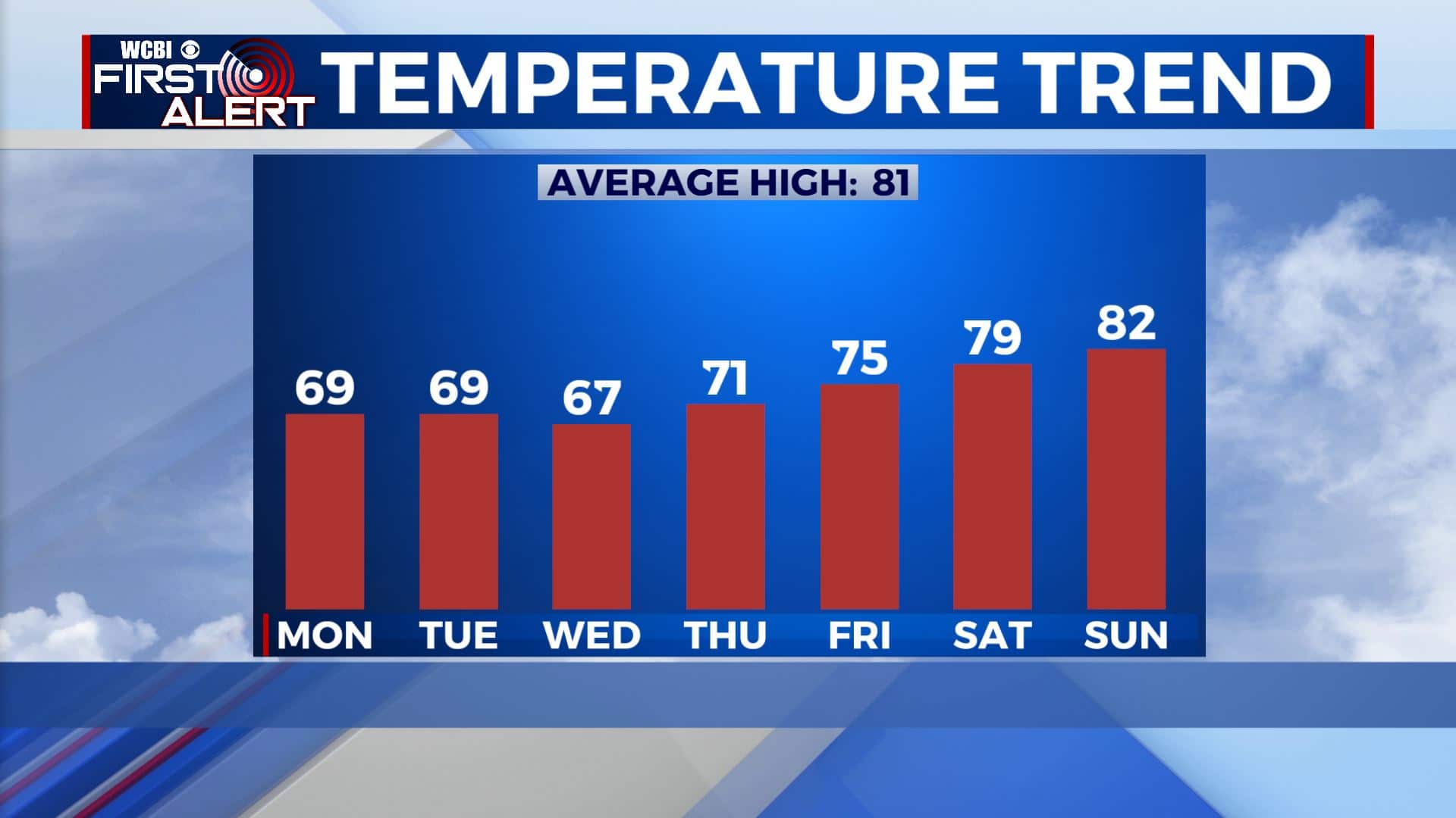
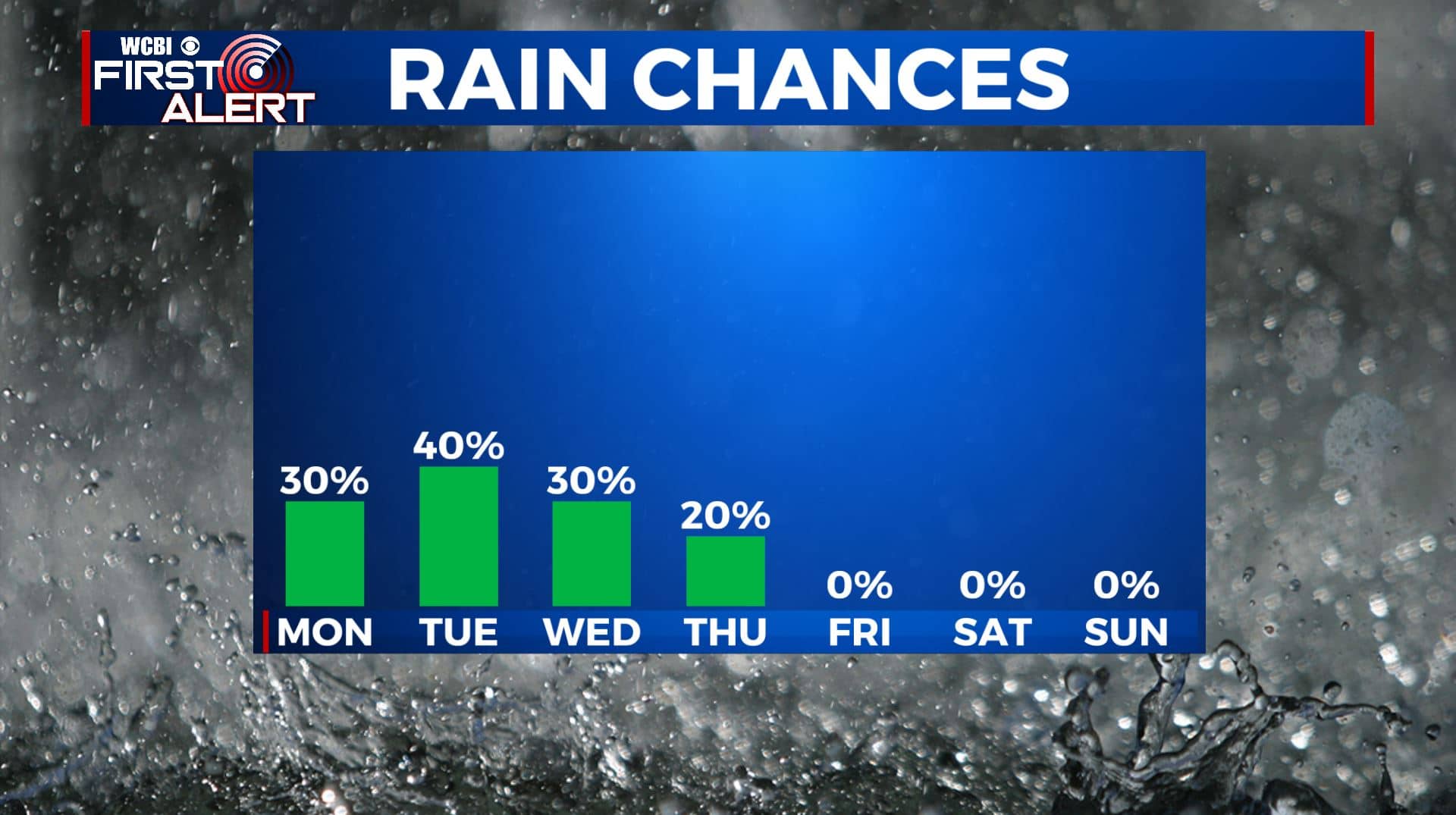
WEDNESDAY: Clouds remain over the area with the potential for some spotty showers in some areas. Highs in the upper 60s and overnight lows in the upper 40s to lower 50s.
THURSDAY: We finally begin to clear out from the shower and storm chances. Clouds should start to break Thursday afternoon. High temperatures will start to go back up into the lower 70s.
FRIDAY-SUNDAY: Much needed sunshine for the weekend. Temperatures continue to warm up from the 70s Friday to the lower 80s Sunday.
Stay connected with @WCBIWEATHER on Facebook, Twitter, Instagram, and the WCBI News App.


Leave a Reply