Up & down pattern developing
SUMMARY: Several cold fronts are on the way over the next week. The front on Thursday will have the best chance to produce rain in our area with rainfall totals between 1/4” and 3/4”. Temperatures will be up and down going forward which is typical during a transition month like November. Colder weather may build in next week.
MONDAY NIGHT: A mix of stars and clouds with lows in the low 40s. Light wind.
ELECTION DAY: Variably cloudy with a stray shower or sprinkle possible. Highs in the mid 60s. Northerly winds 5-10 mph.
TUESDAY NIGHT: Mainly clear and quiet. Lows in the low 40s.
WEDNESDAY: Mostly sunny and pleasant. Highs near 70.
WEDNESDAY NIGHT: Variably cloudy. Lows in the upper 40s to around 50.
THURSDAY: Cloudy with areas of rain developing. The chance of precipitation is 80%. Most rain is currently expected during the afternoon and evening. Highs will be in the 60s.
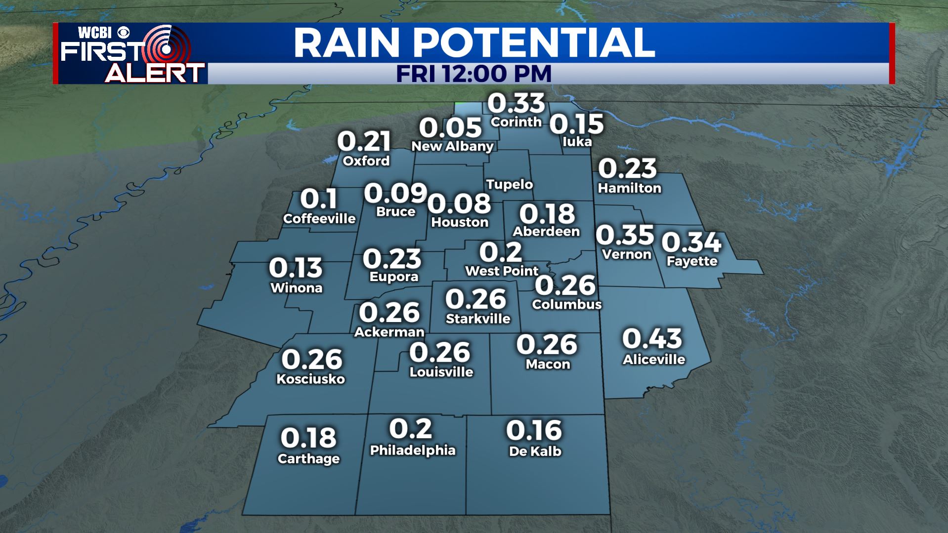
Rain Potential (GFS Model)
FRIDAY: Morning clouds and showers are possible with a clearing trend during the day. Cool highs the upper 40s to lower 50s. No issues are expected for high school football but it will be cool after sunset. Low 30s and upper 20s are possible for lows Friday night.
SATURDAY: Sunny and cool. Highs in the 50s. College football weather looks pretty good in Tuscaloosa and Oxford. Lows around freezing Saturday night.
SUNDAY: Mostly sunny. Highs in the low 60s.
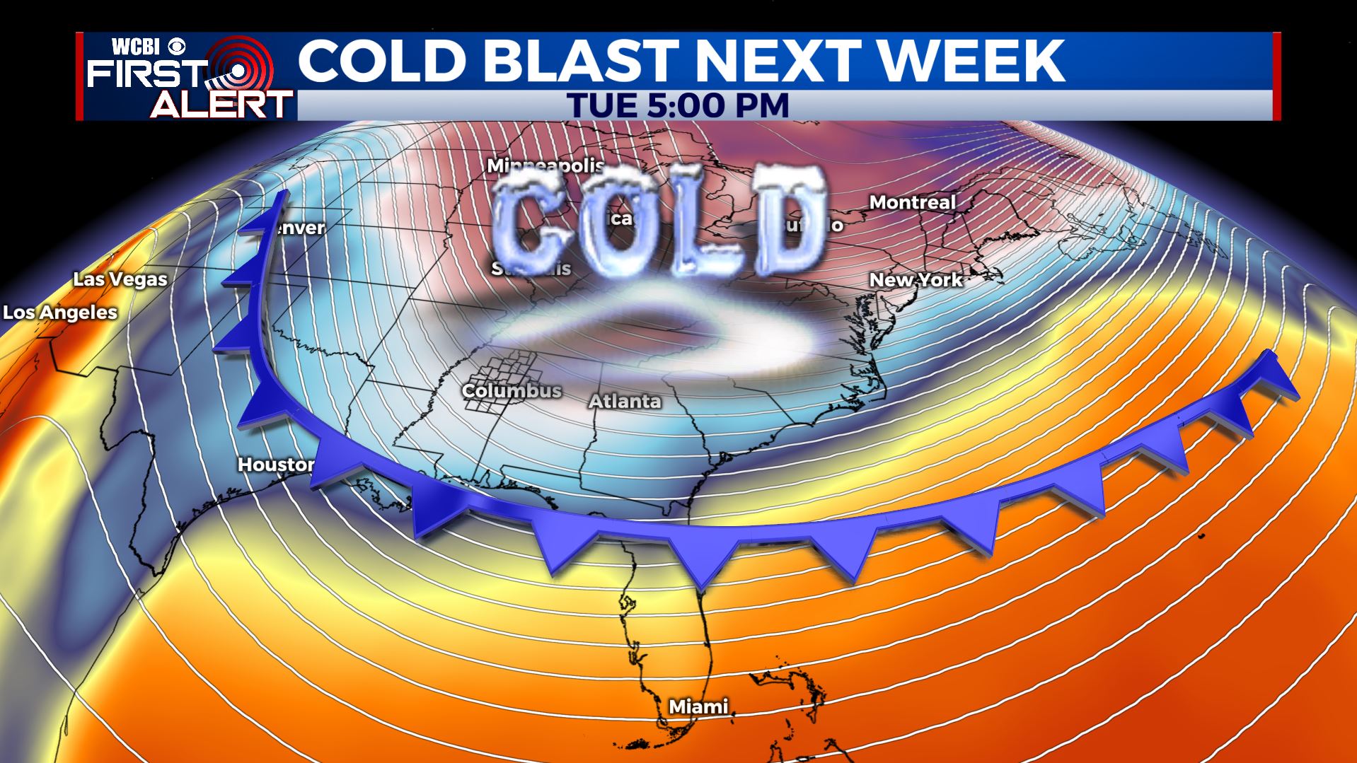
NEXT WEEK: Data suggest a trend towards much colder weather as a big area of Canadian high pressure building into the Lower 48. It may be the coldest stretch of the fall thus far.
Follow @WCBIWEATHER on Facebook, Twitter, Instagram, and the WCBI News app


Leave a Reply