Cold Rain is Coming
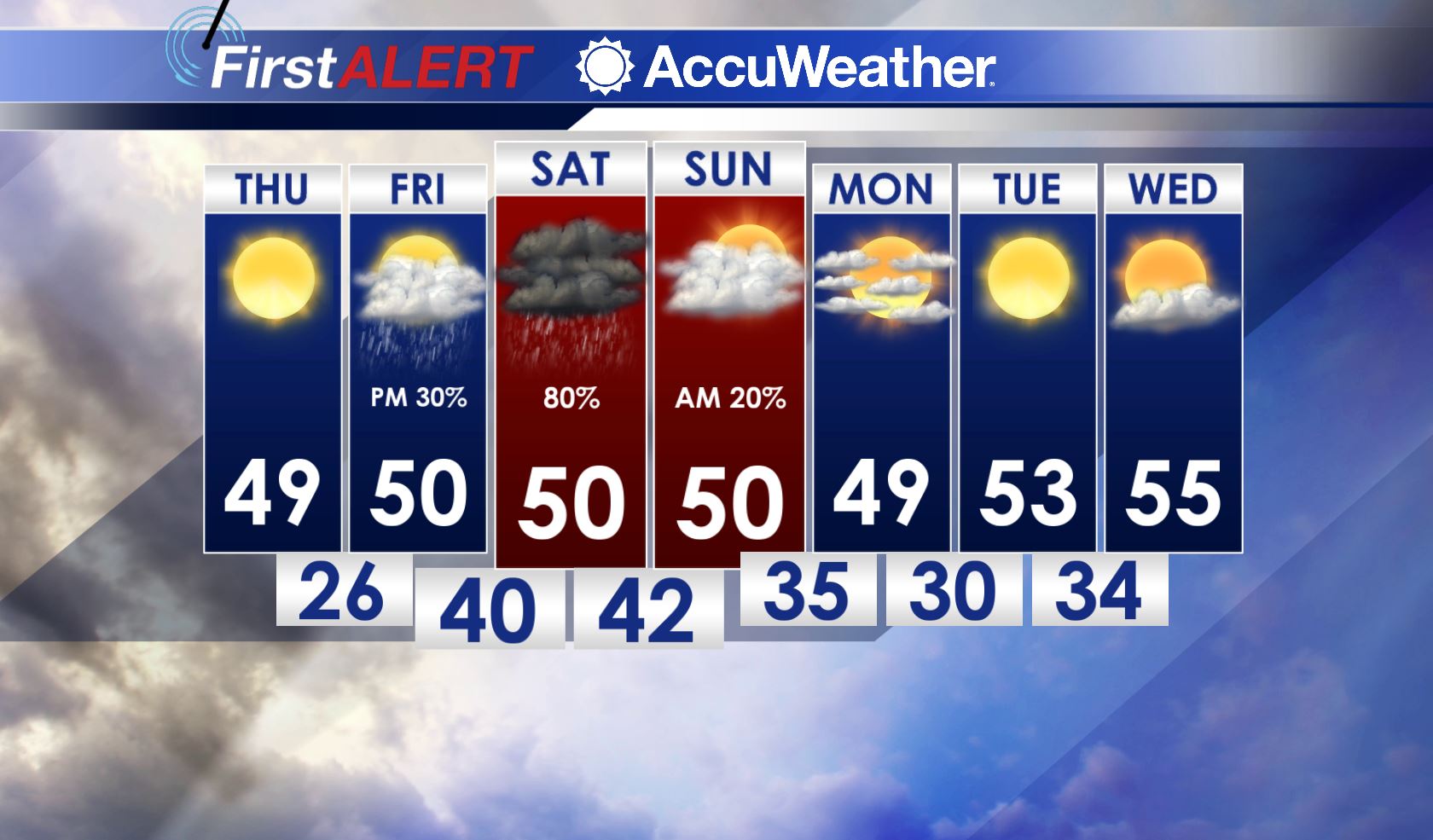
TONIGHT: A mostly clear sky will help temperatures to fall into the mid to upper 20s. Look for northerly winds 5-10 mph.
THURSDAY: Still expecting plenty of sunshine, but clouds pick up a little bit into Thursday Night. Highs during the day are in the upper 40s with a few of us in the lower 50s. Look for lows Thursday Night to fall into the mid to upper 20s with a few of us staying in the low 30s.
FRIDAY: We’ll start the day with more sun than not, but by Friday Night, a mostly cloudy will occur with a few isolated showers moving in during the afternoon and evening hours. Odds look to favor more widespread showers to hold off until after sunset. Highs only in the upper 40s and low 50s with lows Friday Night in the upper 30s and low 40s.
SATURDAY: Looks like another rainy and cool winter day. Expect cloudy skies with rain showers all day long. Some areas could see over an inch of water. Highs will only rise into the upper 40s and low 50s with lows Saturday Night down into the upper 30s and low 40s.
SUNDAY/EARLY NEXT WEEK: Aside from a few AM showers before lunch Sunday, we’re looking to get some sunshine back through midweek again. Look for cold nights and cool days. Highs are in the upper 40s to mid 50s with lows at night in the low 30s, slowly warming up a few degrees every day.
FOLLOW @WCBIWEATHER ON FACEBOOK, INSTAGRAM, TWITTER AND SNAPCHAT.


Leave a Reply