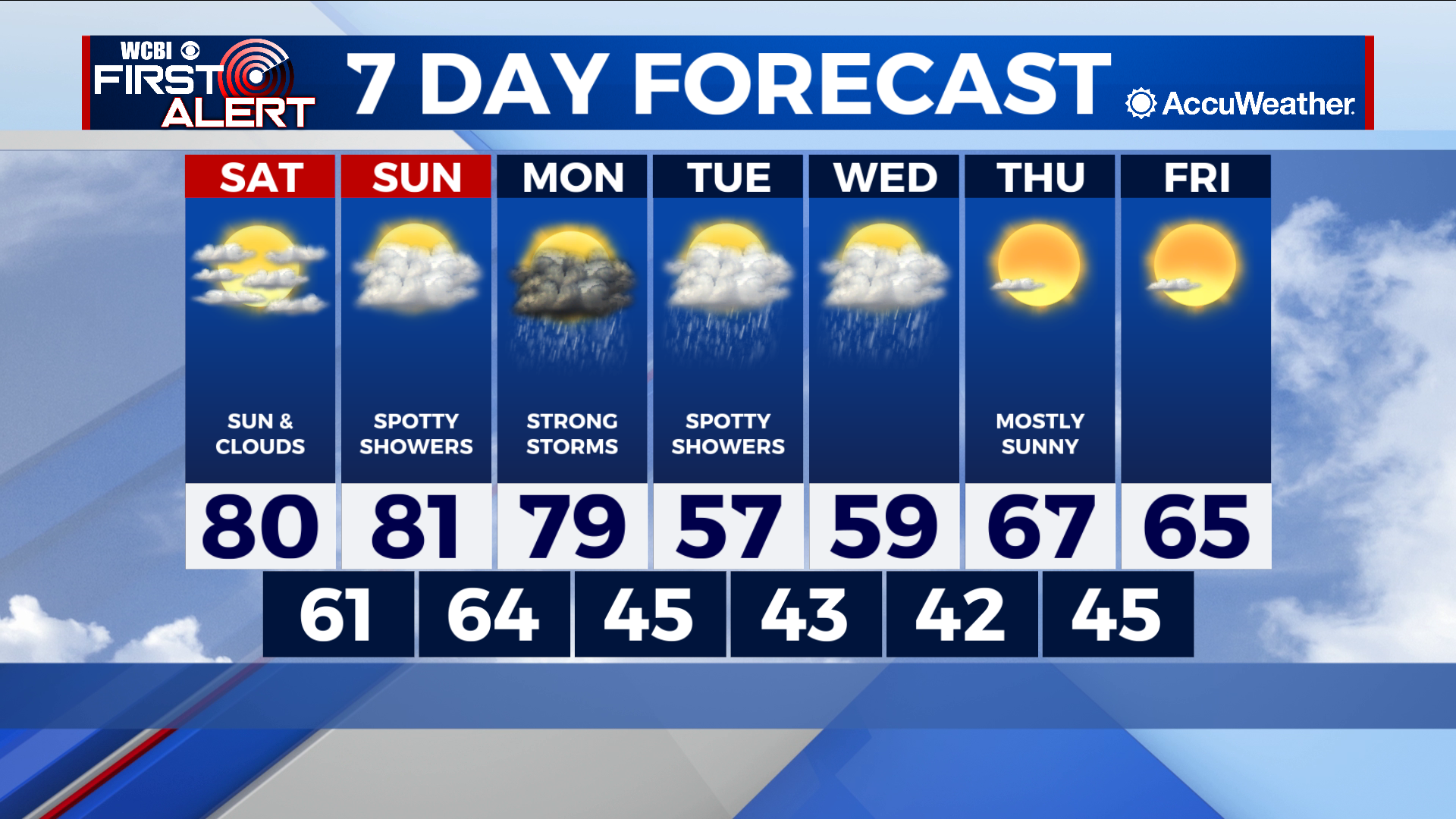
Warm and breezy weekend, stormy start to the workweek
COLUMBUS, Mississippi (WCBI) – SUMMARY: A warm and breezy weekend is in store before our next front brings showers and storms to the region on Monday.
TODAY: Expect a mix of sun and clouds with high temperatures once again near 80 degrees. Winds out of the south at 5-10 mph.
TONIGHT: Mostly cloudy skies. Low of 61 degrees.
TOMORROW: Increasing moisture return will lead to more cloud cover and spotty showers across the region. Chance of rain: 30%, mainly between 1 and 5 PM. Winds out of the south at 10-15 mph.
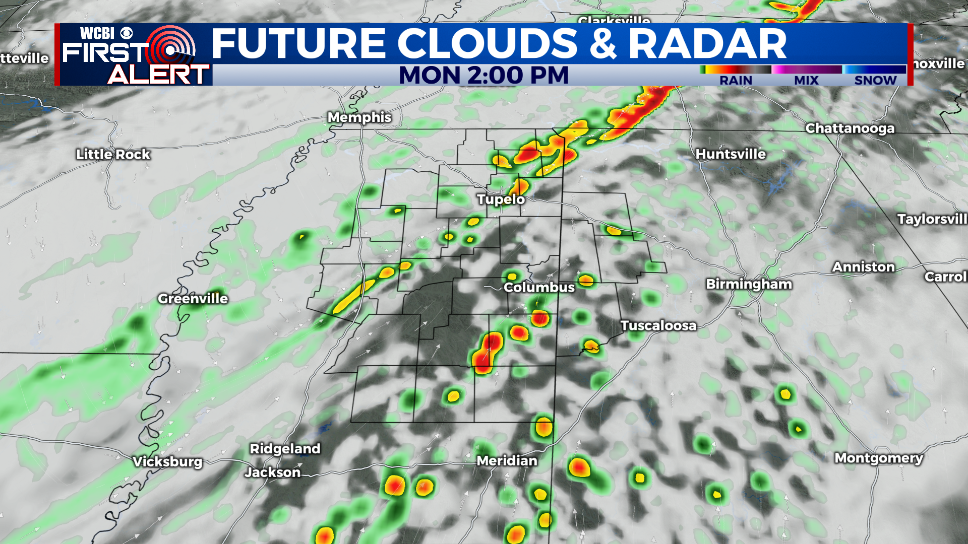
MONDAY: A strong cold front will move through the region during the late morning/early afternoon hours. Showers and thunderstorms are likely, mainly between 11 AM and 6 PM . Some of these storms may become strong to severe, with heavy rain and damaging wind gusts being the main concern. Just be weather-aware and keep the umbrella handy. Here’s an idea of what the radar may look like Monday at 2 PM:
EXTENDED FORECAST: After Monday’s front, Tuesday and Wednesday will be much cooler with highs in the 50s. Isolated shower chances (30%) will hang around for both days. We’ll warm back up by Thursday and Friday. Have a great weekend and enjoy the warm weather!


Leave a Reply