Warm conditions to stick around
SUMMARY: Mild weather will hang around through early next week. It’ll remain breezy at times as well. While a shower is possible Friday & Saturday, the next chance of any heavy rain or strong storm activity will wait until late Sunday or Monday.
WEDNESDAY NIGHT: Clouds and stars. Mild lows in the mid 50s. Southerly winds 5-15 mph.
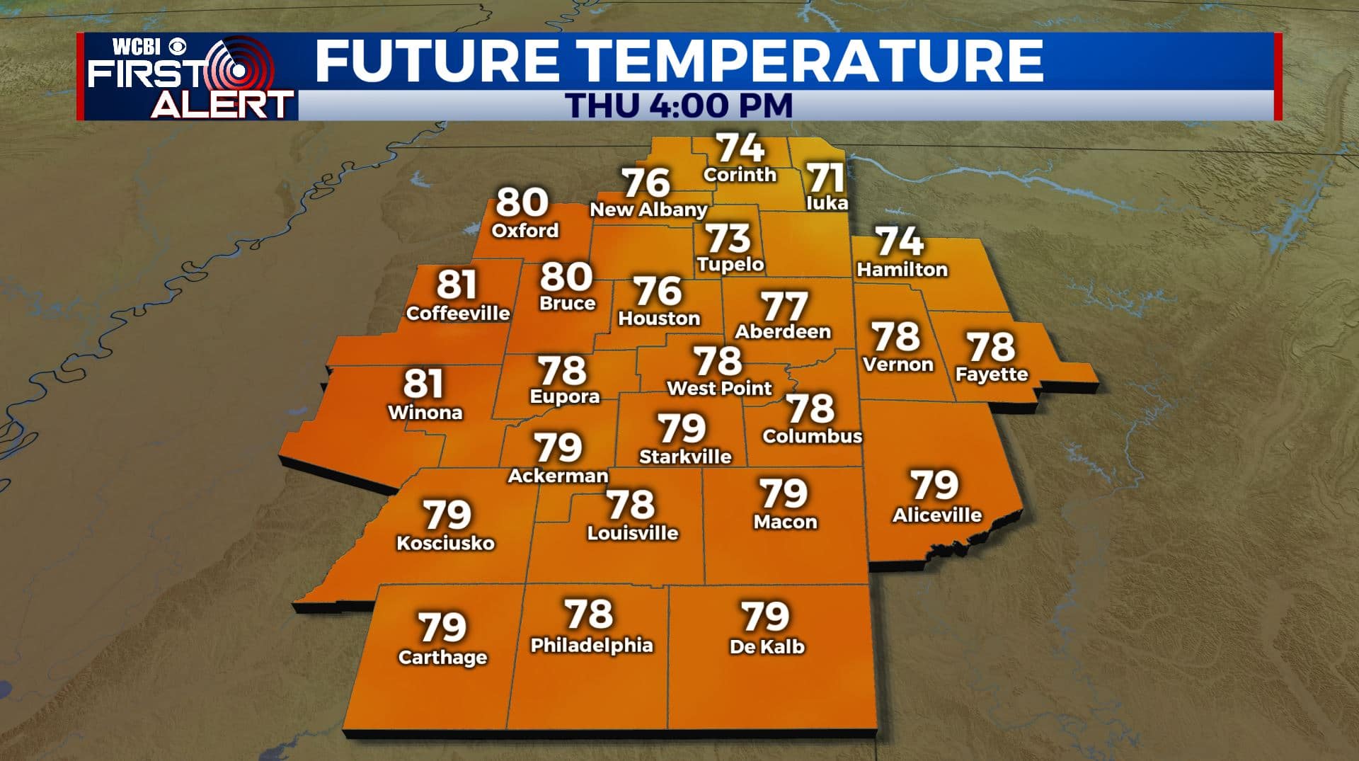
THURSDAY: A mix of sun & clouds. Highs in the mid to upper 70s. Breezy southerly winds 10-20 mph with higher gusts possible.
THURSDAY NIGHT: Variably cloudy and mild. Lows in the mid 50s.
FRIDAY & SATURDAY: Variably cloudy. A slight chance of shower each day. Highs in the upper 70s to around 80 with lows in the 50s.
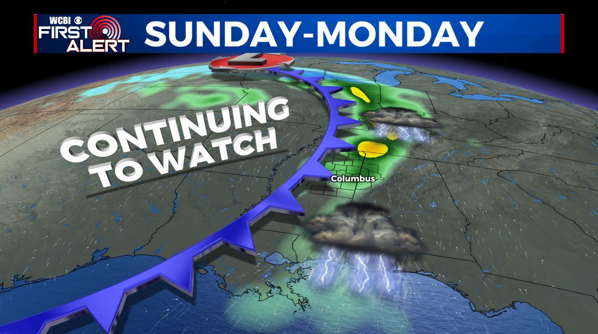
SUNDAY & MONDAY: An area of low pressure and cold front is expected to cross our area at some point. A batch of strong to severe storms is still possible but not a sure bet at this point. We’ll keep on watching how things evolve during the coming days. Highs stay in the 70s with lows in the 50s.
Follow @WCBIWEATHER on Facebook, Twitter, Instagram, and the WCBI News App


Leave a Reply