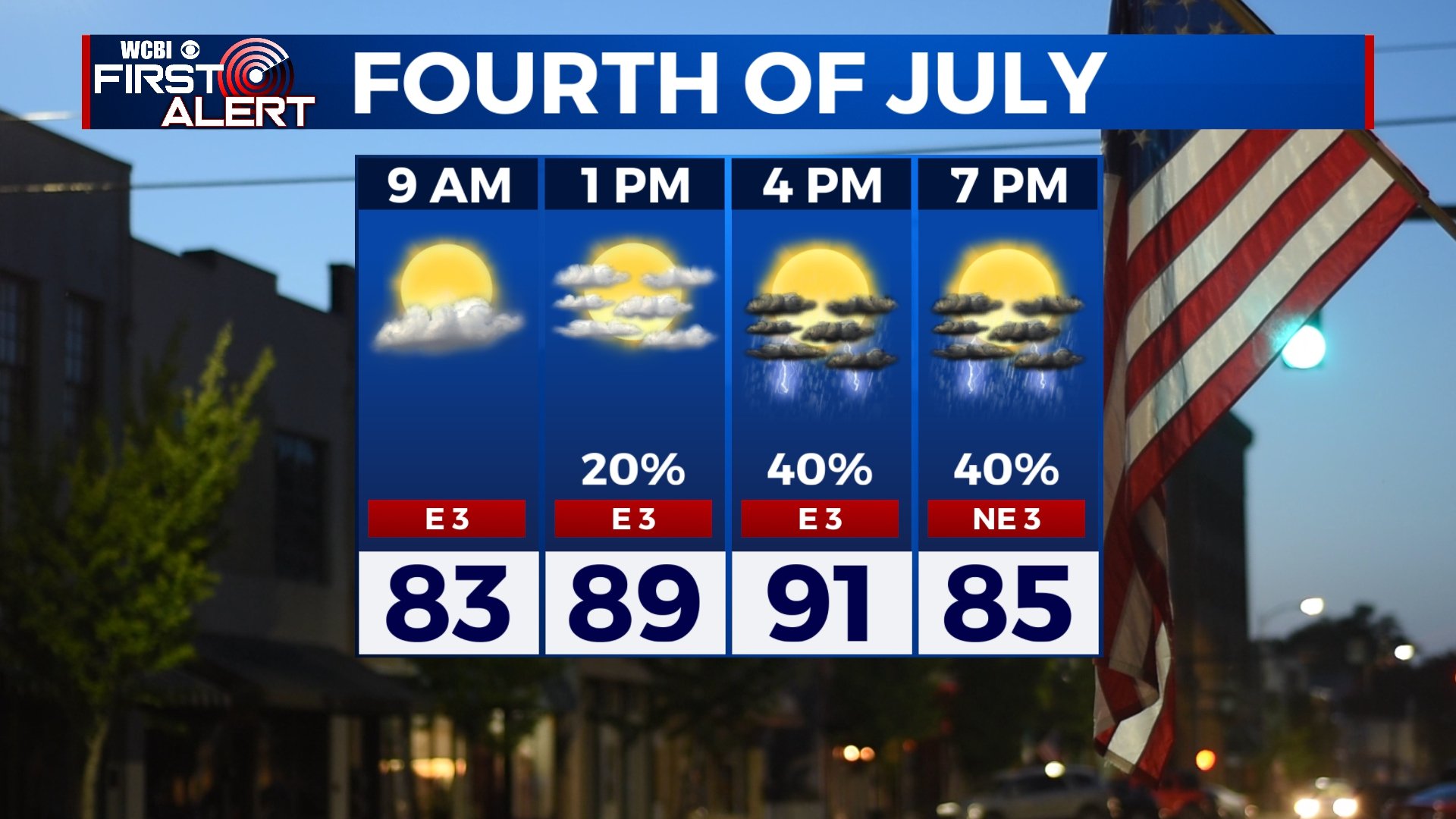
Warm Fourth of July, pop-up storms likely
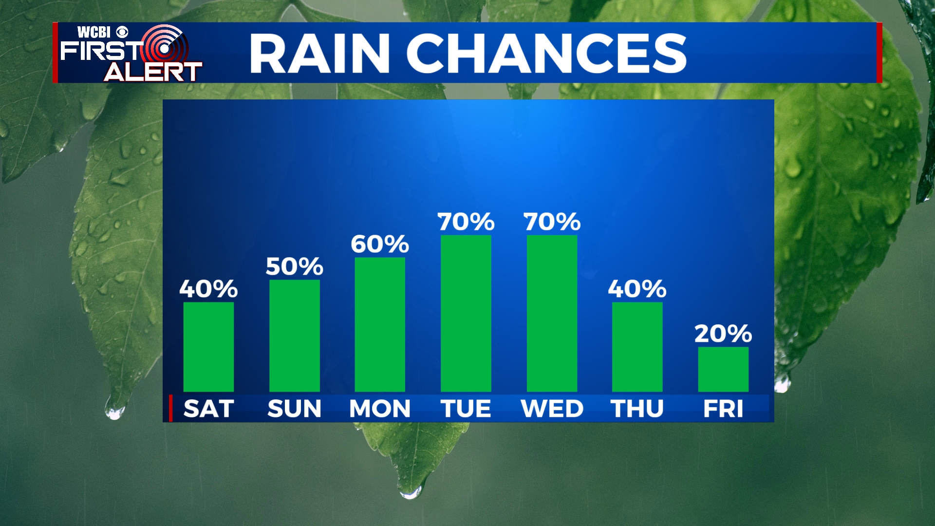
Happy 4th of July weekend! We’re looking at a fairly regular summertime forecast with warm temperatures and chances for pop-up showers and storms. It won’t be a total washout, but storms will be possible. Rain and storm chances increase by next week.
FRIDAY NIGHT: Aside from a shower or storm early, most of the overnight hours will be dry with a few passing clouds. We’ll stay mild and muggy with lows in the low 70s and a light northeasterly wind.
SATURDAY: We’ll start off Independence Day with a few clouds and temperatures in the 80s. Pop-up storms will be possible anytime from about 1pm to 9pm, but any storm should be brief. Your outdoor plans should be able to continue as normal, but you may have to dip inside for a few minutes if a storm pops up near you. Highs will be in the low 90s with light easterly winds.
SATURDAY NIGHT: After 8 or 9pm, any shower or storm activity will dissipate, leaving us dry and mild for fireworks. Temperatures will be in the 70s overnight with a light easterly wind.
SUNDAY: Once again, pop-up storms will be possible through the afternoon and evening. Some storms could produce gusty winds or small hail. If you’re not caught under a storm, expect a mix of sun and clouds with highs near 90.
MONDAY-WEDNESDAY: Rain and storm chances will increase as we get into the week. We’ll bump rain chances up to 60%-70% through Wednesday, so keep the umbrella nearby. Some downpours could be heavy with gusty winds or small hail. Highs will be in the mid to upper 80s with overnight lows in the 70s.
THURSDAY-FRIDAY: Isolated showers and storms will remain possible for the end of the week, but chances look to be lower. We’ll keep Thursday at a 30% chance and Friday at a 20% chance for now. Highs will warm back into the low 90s with morning lows in the low to mid 70s.


Leave a Reply