Warm & humid Thursday followed by some storms for Friday
SUMMARY: We are waking up to some foggy & misty conditions this Thursday morning, but expecting another warm day ahead with a mix of sun & clouds. We’ll have a better chance of showers & storms on Friday, but a nice holiday weekend is ahead.
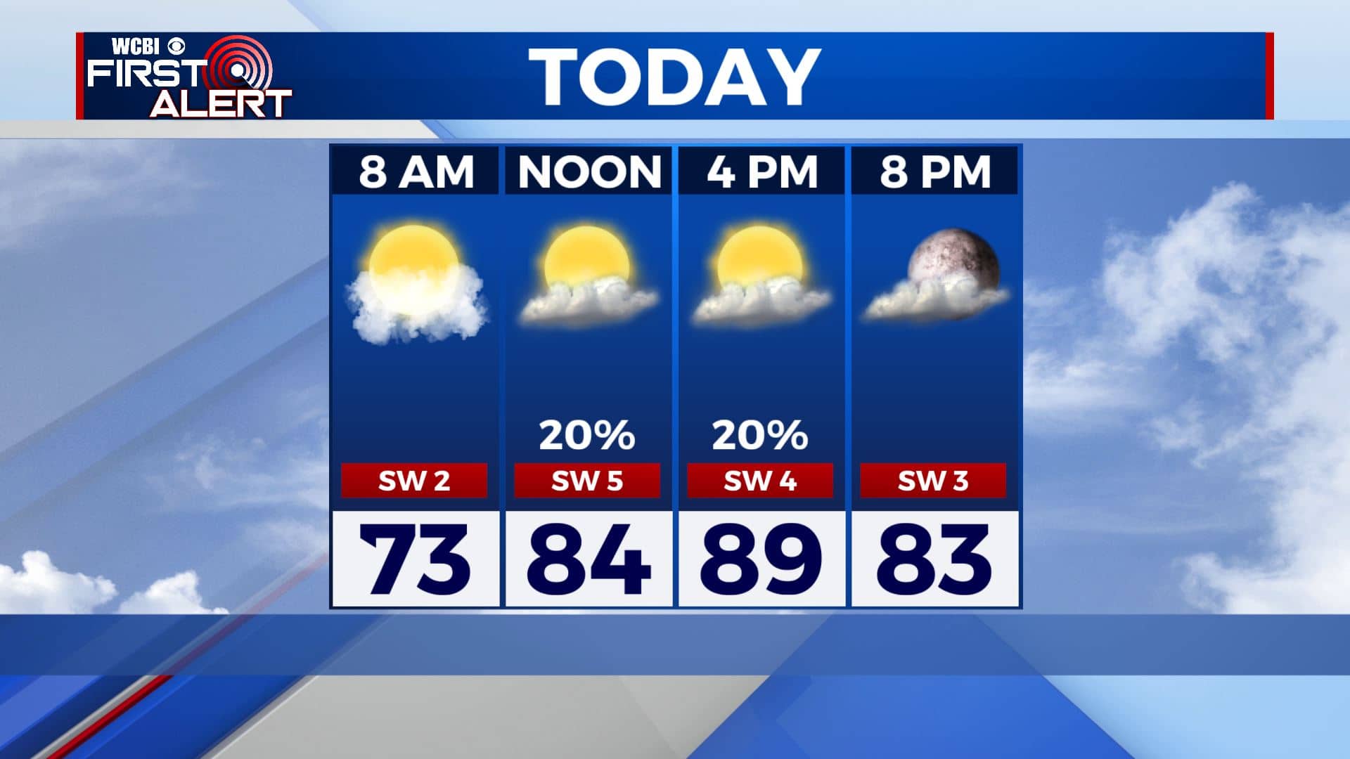
THURSDAY: After dealing with some dense fog in the morning, we’re in for a warm and drier day ahead. A mix of sun & clouds. Only a slight chance of an isolated afternoon shower. Staying warm & humid with highs near 90 degrees.
THURSDAY NIGHT: Clouds moving in later in the night as a cold front approaches the region. Should remain dry, with overnight lows in the upper 60s to near 70 degrees.
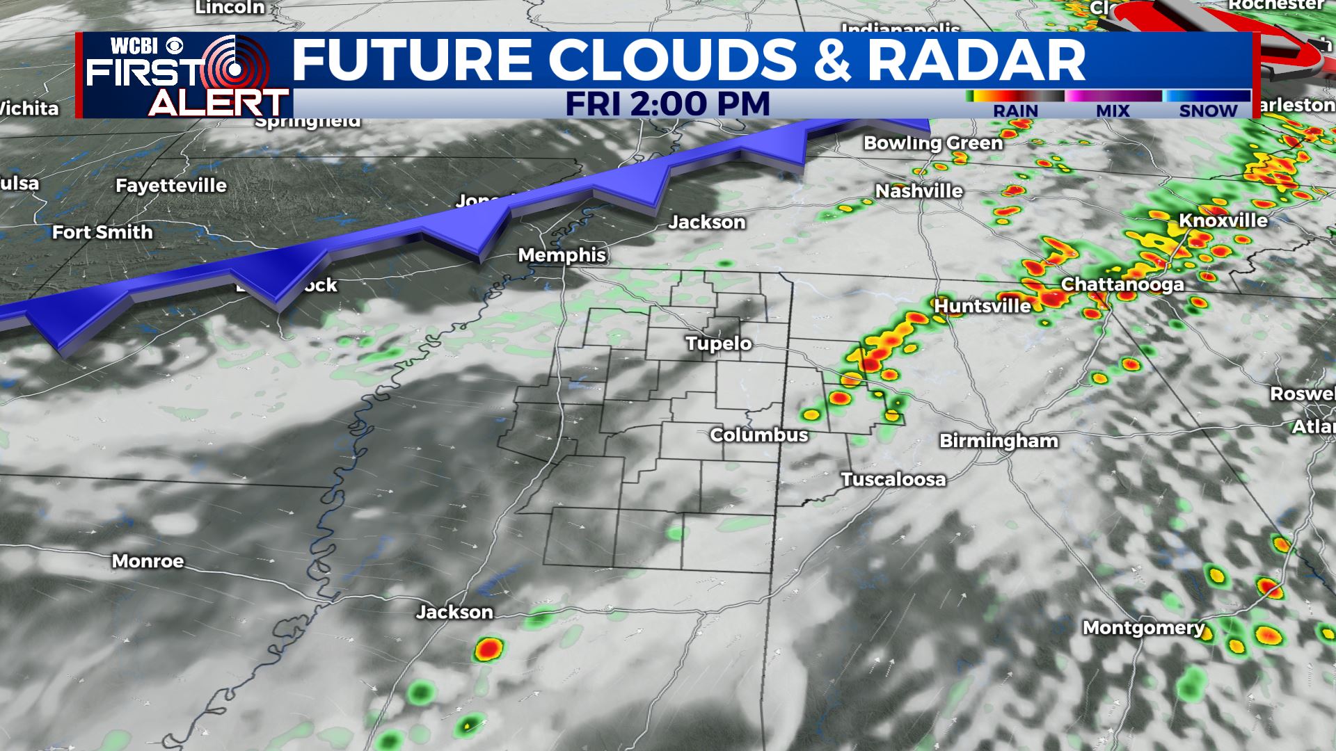
FRIDAY: As the cold front moves through, we will see showers and storms across the area. They are looking to be more scattered in nature at this time but a few could be on the strong side with some heavy downpours and gusty winds. Ahead of the front, temperatures still warm with highs in the mid 80s.
FRIDAY NIGHT: The front will usher in cooler and drier air for Friday night. Lows right around 60.
HOLIDAY WEEKEND: Memorial day weekend is looking fantastic. If we get enough cloud cover on Saturday, we may only top out in the upper 70s with no humidity in the air. Something we’ll have to wait and see. Mostly sunny skies with highs in the lower to mid 80s Sunday & Memorial Day Monday. Nights will be very comfortable with overnight lows in the mid 50s. A nice treat in late May!
EARLY NEXT WEEK: A mix of clouds & sun. On-and-off chances those summertime afternoon showers & storms can be expected. Highs in the mid 80s. Lows in the 60s.
Stay connected with @WCBIWEATHER on Facebook, Twitter, Instagram, and the WCBI News App.


Leave a Reply