Warm & humid winter weekend
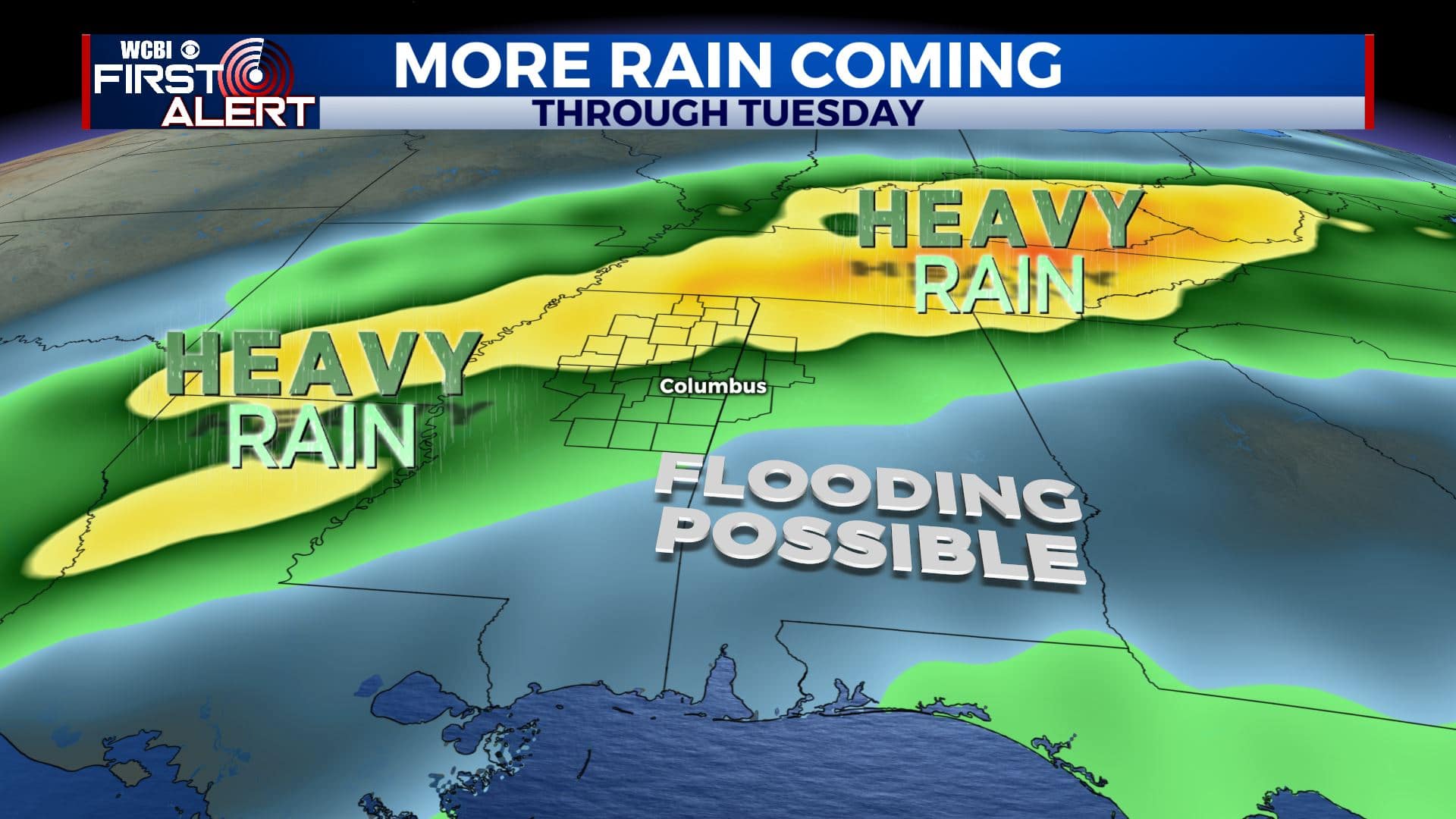
SUMMARY: The last weekend of February will be more spring-like with mild, humid air and rain/storm chances. While some rain is possible Saturday, our best chance of widespread, heavy rain will tend to wait until Sunday afternoon/evening/night. Another 1″ to 3″ of rain (or more) could fall between now and next Tuesday.
SATURDAY: Mostly cloudy and mild. Highs in the 70s with southerly winds 5-10 mph. While a shower or storm could occur at any time, we think the odds of any widespread or heavy rain will remain low. It won’t be a washout but just have an umbrella on standby.
SATURDAY NIGHT: Mostly cloudy and mild. Lows in the mid 60s. A few spotty showers can’t be ruled out.
SUNDAY: Mostly cloudy, breezy, and warm. Highs in the upper 70s. The first half of the day is looking pretty quiet but rain and storm chances will go up during the afternoon and evening. The odds of severe weather continue look low but we can’t totally rule out a strong storm or two at some point.
SUNDAY NIGHT: Areas of rain and thunder. Some rain may be heavy. Lows in the 50s.
MONDAY: Mostly cloudy with area of rain still possible. Highs in the upper 50s.
MONDAY NIGHT: Mostly cloudy with a chance of showers. Lows in the 40s.
TUESDAY: Mostly cloudy. Areas of rain and thunder possible. Highs in the low 60s.
WEDNESDAY: Partly cloudy. Highs in the mid 60s.
Follow @WCBIWEATHER on Facebook, Twitter, Instagram, and the WCBI News App


Leave a Reply