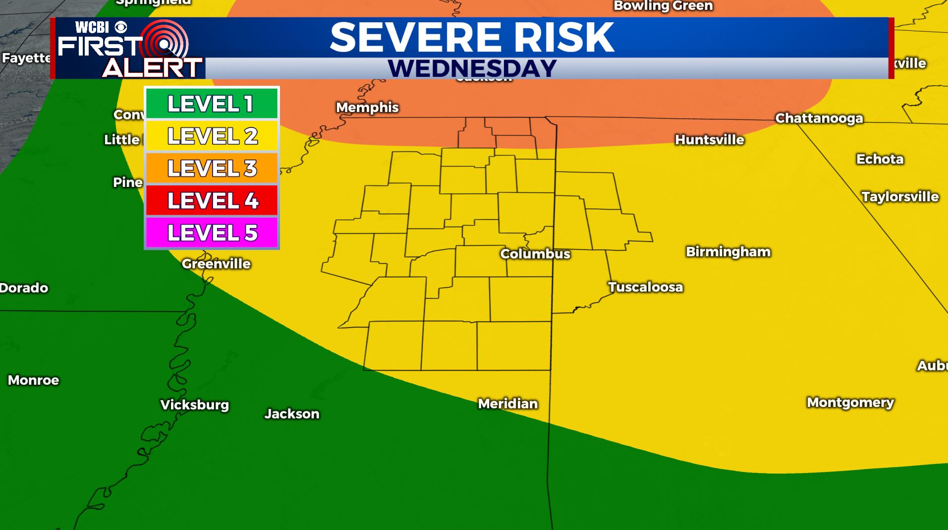
Warm then stormy for your Wednesday
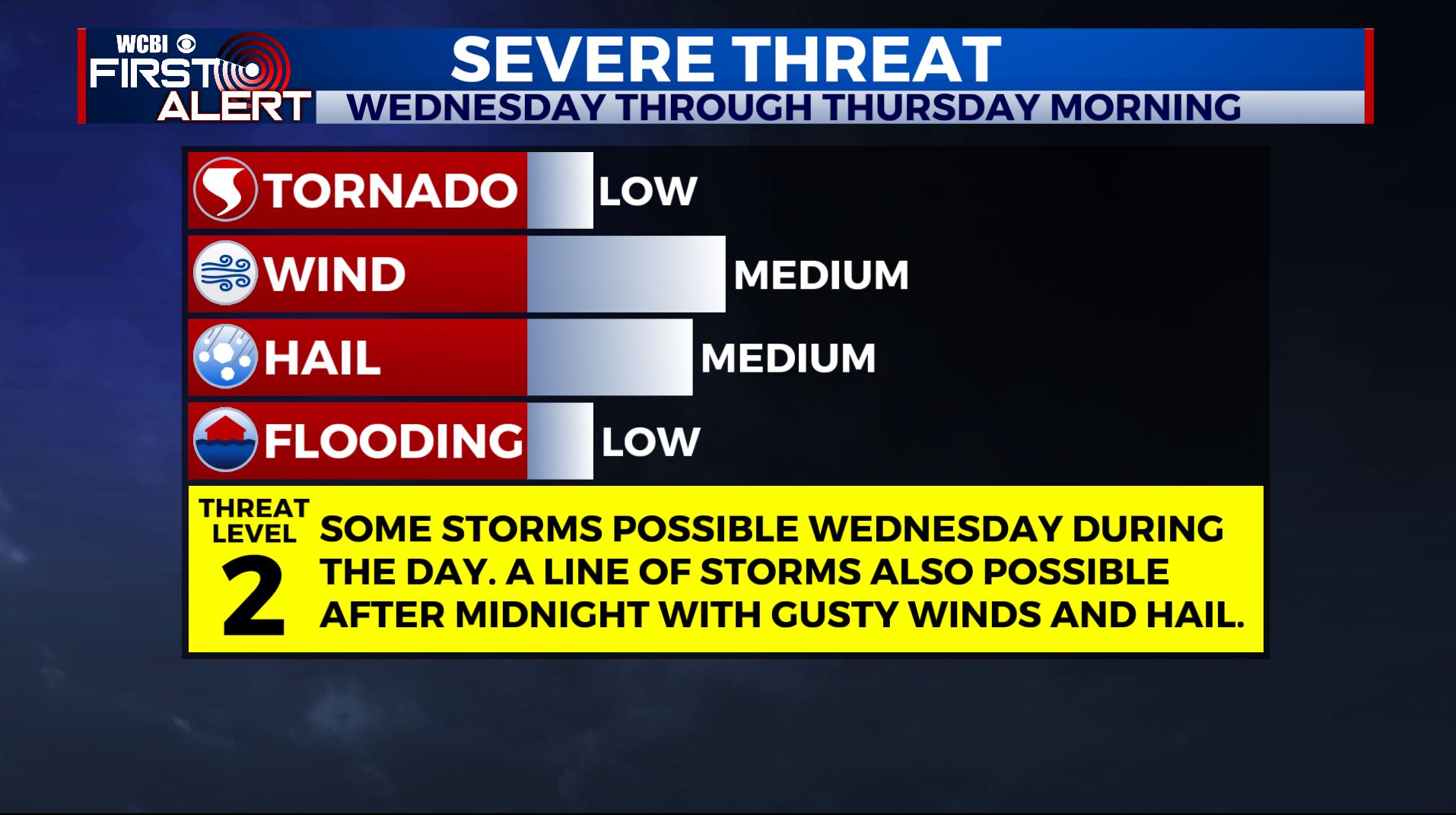
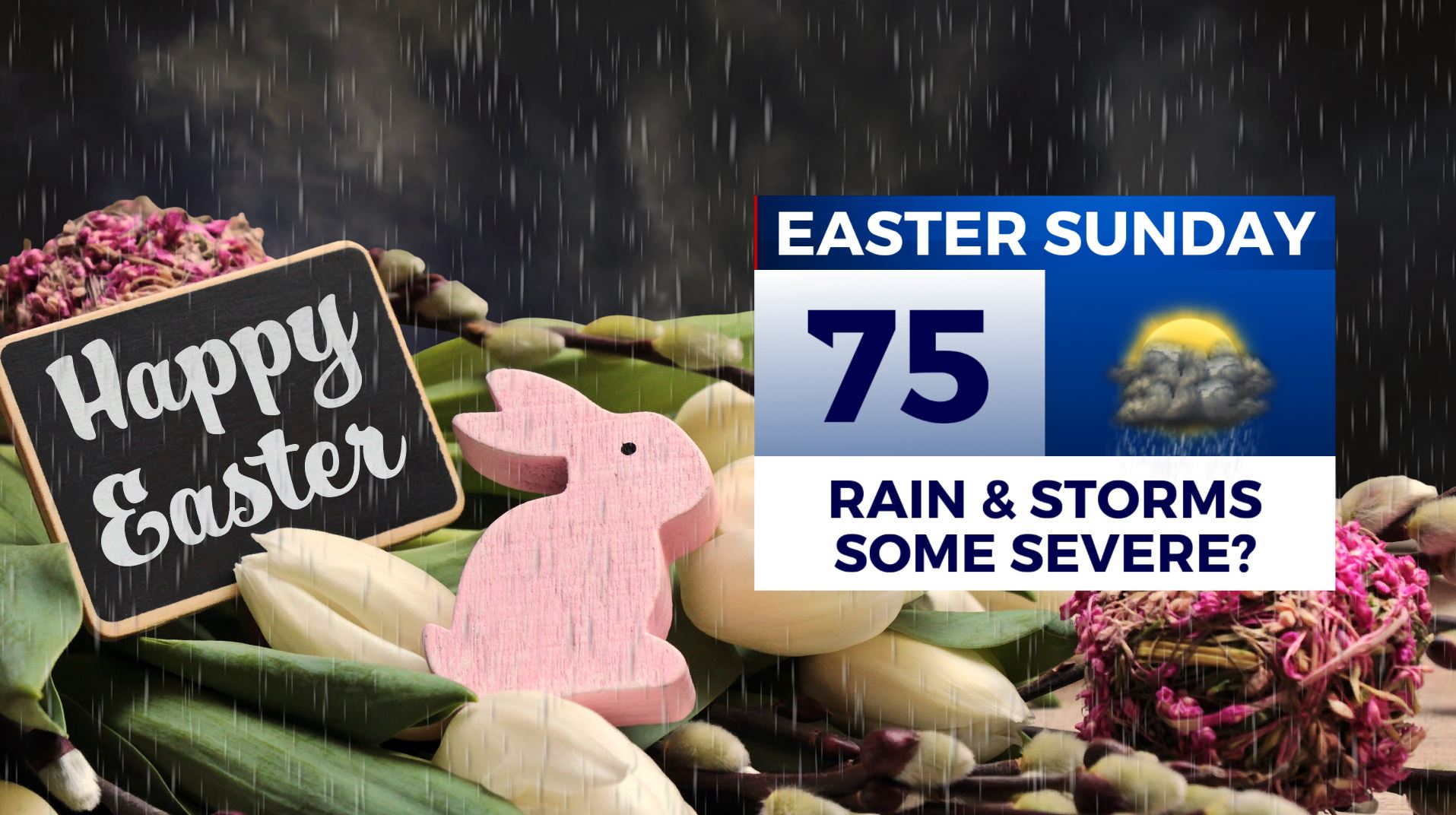
SUMMARY: Above average temperatures and a warm day is ahead for your Wednesday with a few scattered storms possible in our southern counties during the day. Another batch of strong to possible storms storms may move through Wednesday night and early Thursday morning as a strong cold front pushes through. Expect quiet & cooler weather Thursday afternoon through Saturday afternoon. Another wet & stormy system may pass through on Easter Sunday.
WEDNESDAY: Partly sunny with a chance of a few scattered storms during the afternoon. Very warm for early April with highs in the mid 80s.
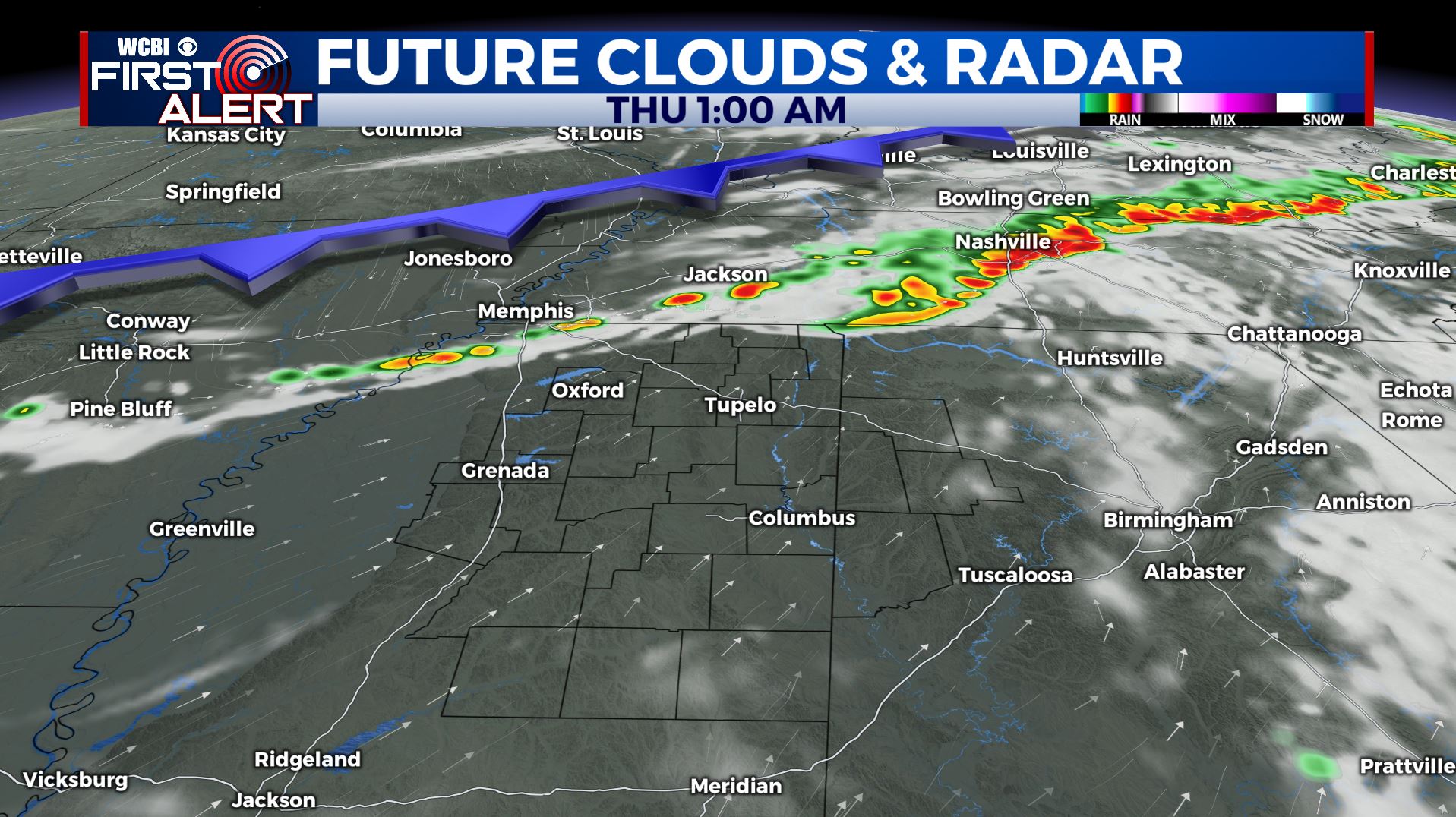
WEDNESDAY NIGHT: A chance for some storms late in the overnight hours. Some stronger storms could have some gusty winds and hail. Something we’ll continue to watch. Lows in the 60s.
THURSDAY: A continuing chance of rain & storms, especially during the first half of the day. Highs much cooler in the lower 70s. Chilly overnight lows in the mid to upper 40s Thursday night.
FRIDAY: A mix of sun & clouds. Cooler with highs in the 60s. Lows in the mid 40s Friday night.
SATURDAY: Increasing clouds. A chance of afternoon and evening showers. Highs in the upper 60s to lower 70s.
EASTER SUNDAY: Areas of rain and storms are possible. Something else we will need to continue to monitor heading into the weekend. Highs in the lower to mid 70s.
EARLY NEXT WEEK: Drier and cooler weather moves in for Monday and Tuesday. Mostly sunny with highs only in the 60s.
Stay connected with @WCBIWEATHER on Facebook, Twitter, Instagram, and the WCBI News App


Leave a Reply