Warm temperatures continue; Rain chances on the way
SUMMARY: The warm, above average temperatures will hang around through Thursday, but slightly cooler temperatures will return by Friday as a cold front will give us a chance of rain and storms by Thursday afternoon and evening. At this point no widespread strong or severe weather is anticipated with this next front. Additional rain may return to the region Sunday into early next week.
WEDNESDAY: More clouds than sun. Very warm with highs in the mid 80s. Winds S 10-15 with higher gusts.
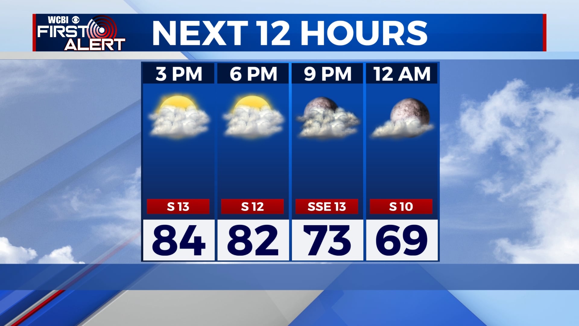
WEDNESDAY NIGHT: Mostly cloudy skies. Mild overnight lows in the mid 60s.
THURSDAY: Mostly cloudy with a chance of afternoon showers and storms with some rumbles of thunder. Highs in the low to mid 80s. Winds SW 10-15 mph, gusting up to 20.
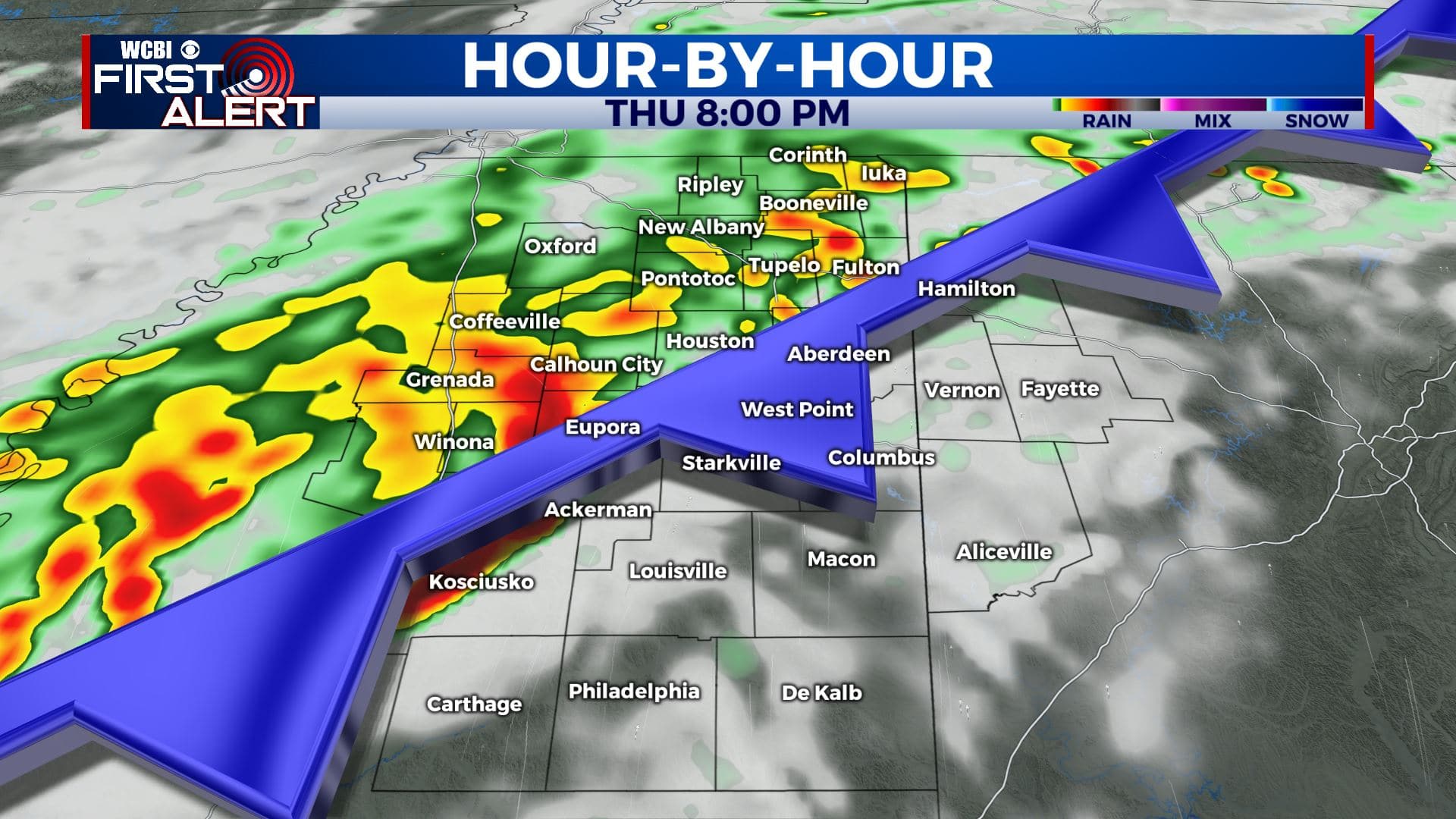
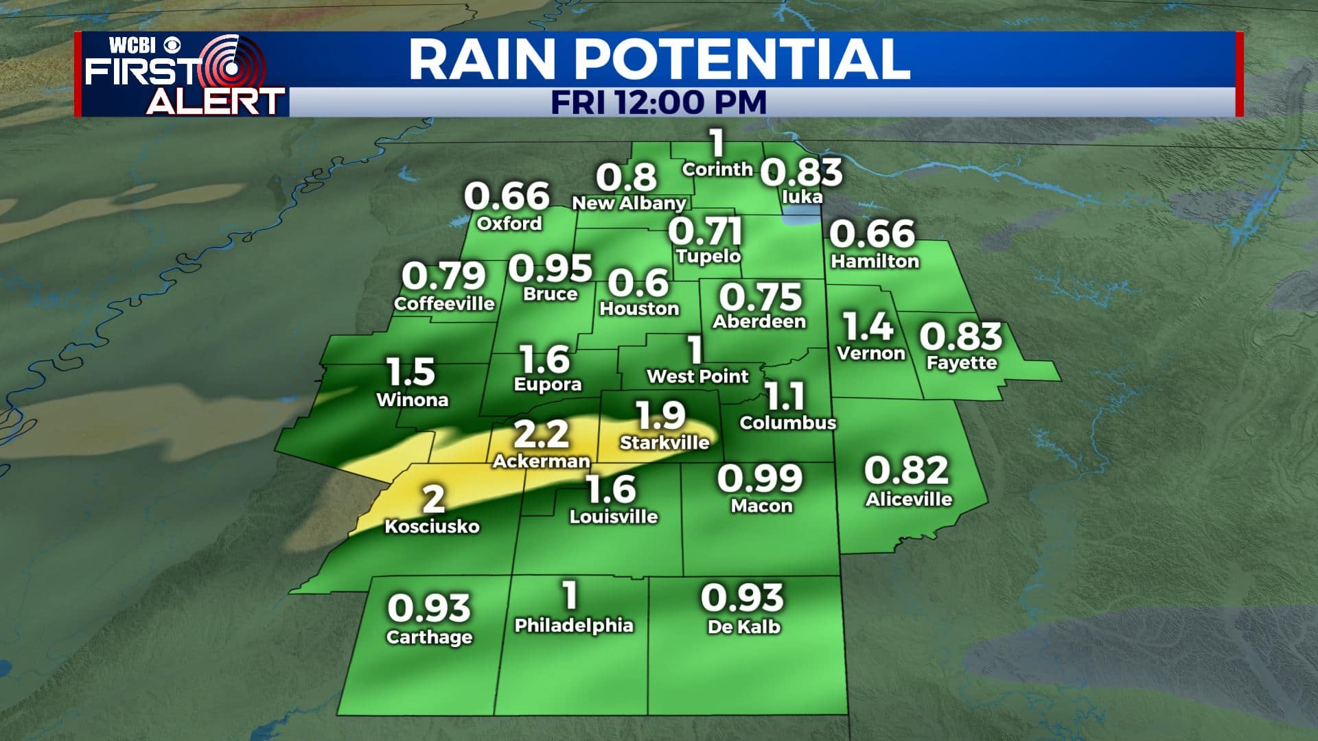
THURSDAY NIGHT: Cloudy with areas of rain possible. Rainfall amounts anywhere from half an inch to two inches. Lows in the upper 50s to lower 60s.
FRIDAY: Morning clouds and rain with sunshine developing during the afternoon. Much cooler with highs in the lower to mid 70s.
SATURDAY: Lots of sunshine with a few clouds. Highs in the mid to upper 70s.
SUNDAY: More clouds than sun. A chance of rain. Highs in the upper 70s to around 80 degrees.
MONDAY & TUESDAY: Mostly cloudy with a chance of rain and storms. Highs in the lower 80s.
Stay connected with @WCBIWEATHER on Facebook, Twitter, Instagram, and the WCBI News App.


Leave a Reply