Warm this weekend before a more active weather pattern returns next week.
COLUMBUS, Mississippi (WCBI) – SUMMARY: A warm weekend is in-store before a more active weather pattern returns next week.
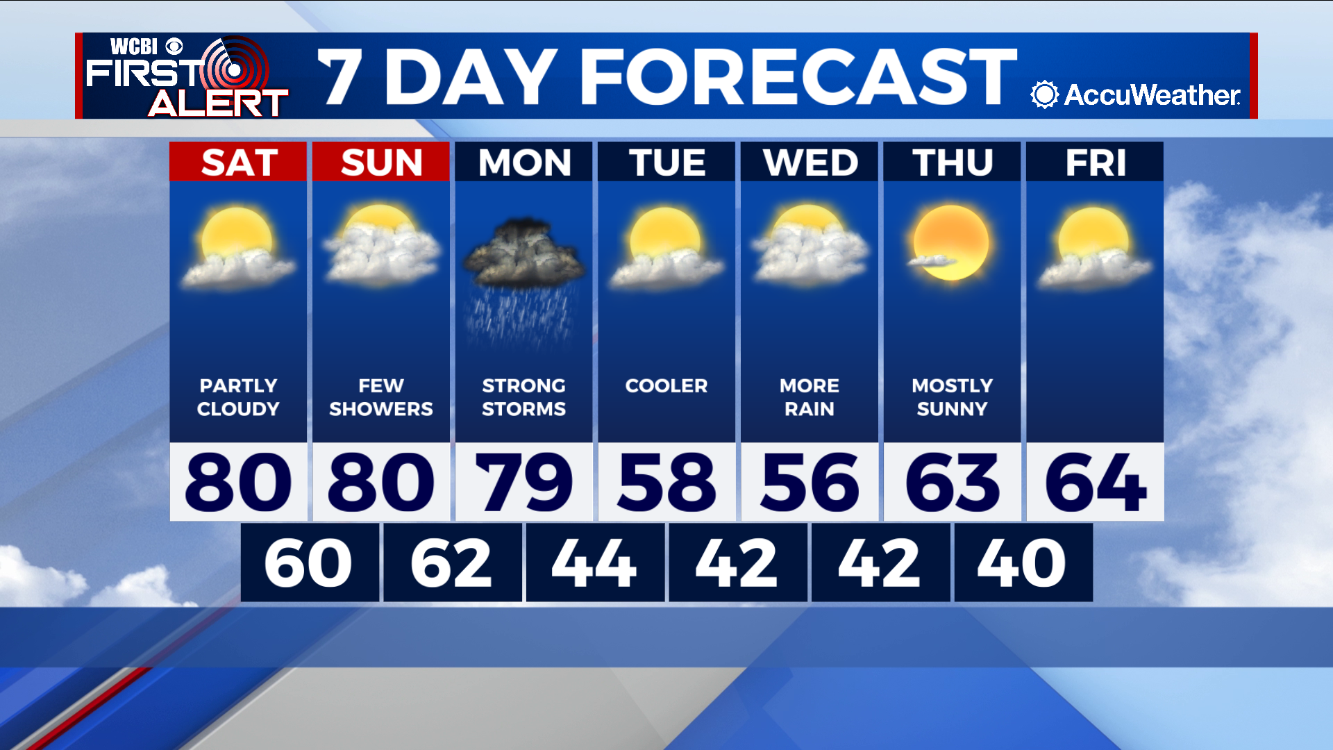
TONIGHT: We’ll see a few passing clouds and it won’t be quite as chilly. Expect lows in the mid to upper 40s with a light south wind.
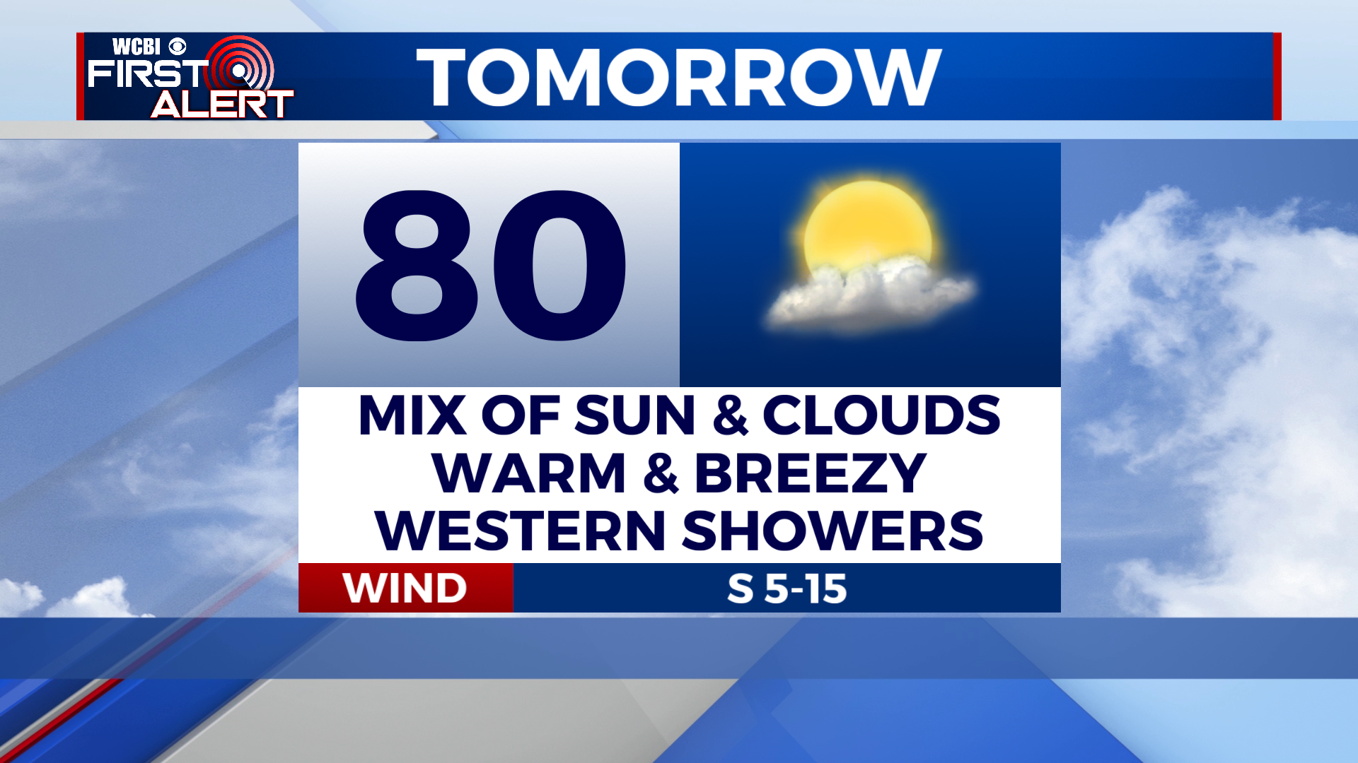
TOMORROW: Expect a mix of sun and clouds across most of the region. An isolated shower is possible in our western communities; especially along and west of I-55 and into the Delta. Highs near 80. Wind: south at 5-15 mph.
SUNDAY: Mostly cloudy skies. Spotty showers will move across the region throughout the day. Some will see rain, some won’t. Chance of rain: 30%. Highs once again near 80. Wind: south at 10-15 mph.
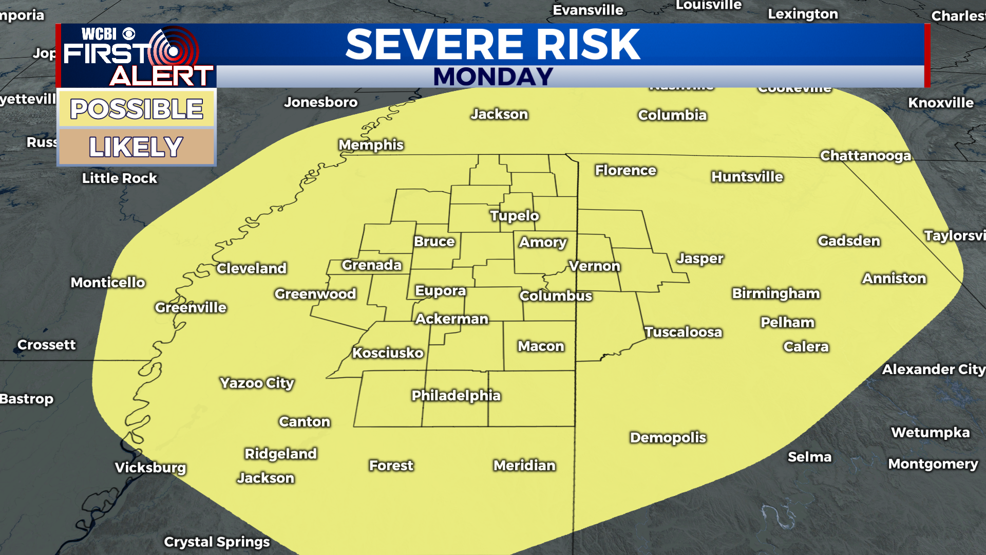
MONDAY: A strong cold front and it’s associated showers/storms will move through the region during the afternoon. The amount of shear, instability, and moisture in place look favorable for strong to severe storms. The Storm Prediction Center currently has the entire region under a level 2 out of 5 “slight” risk for severe weather. Damaging wind gusts look to be the main concern with any organized activity. Chance of rain: 80%.
EXTENDED FORECAST: Tuesday will be noticeably cooler thanks to Monday’s front. Beyond that, forecast confidence is low due to data inconsistency. However, there are indications that a low pressure system will move through the region on Wednesday/Thursday. If this verifies, rain is likely during this time frame, but severe weather is not a concern. With that being said, enjoy the beautiful weather this weekend and we’ll keep you updated on Monday’s severe weather risk!


Leave a Reply