Warm Tue. & Wed., Storms Wed. Night
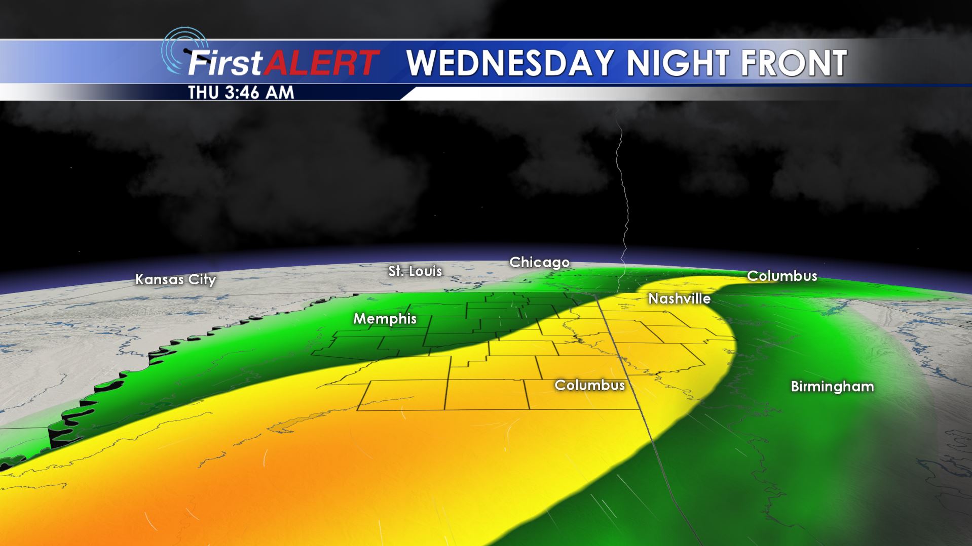
Wednesday Night Front
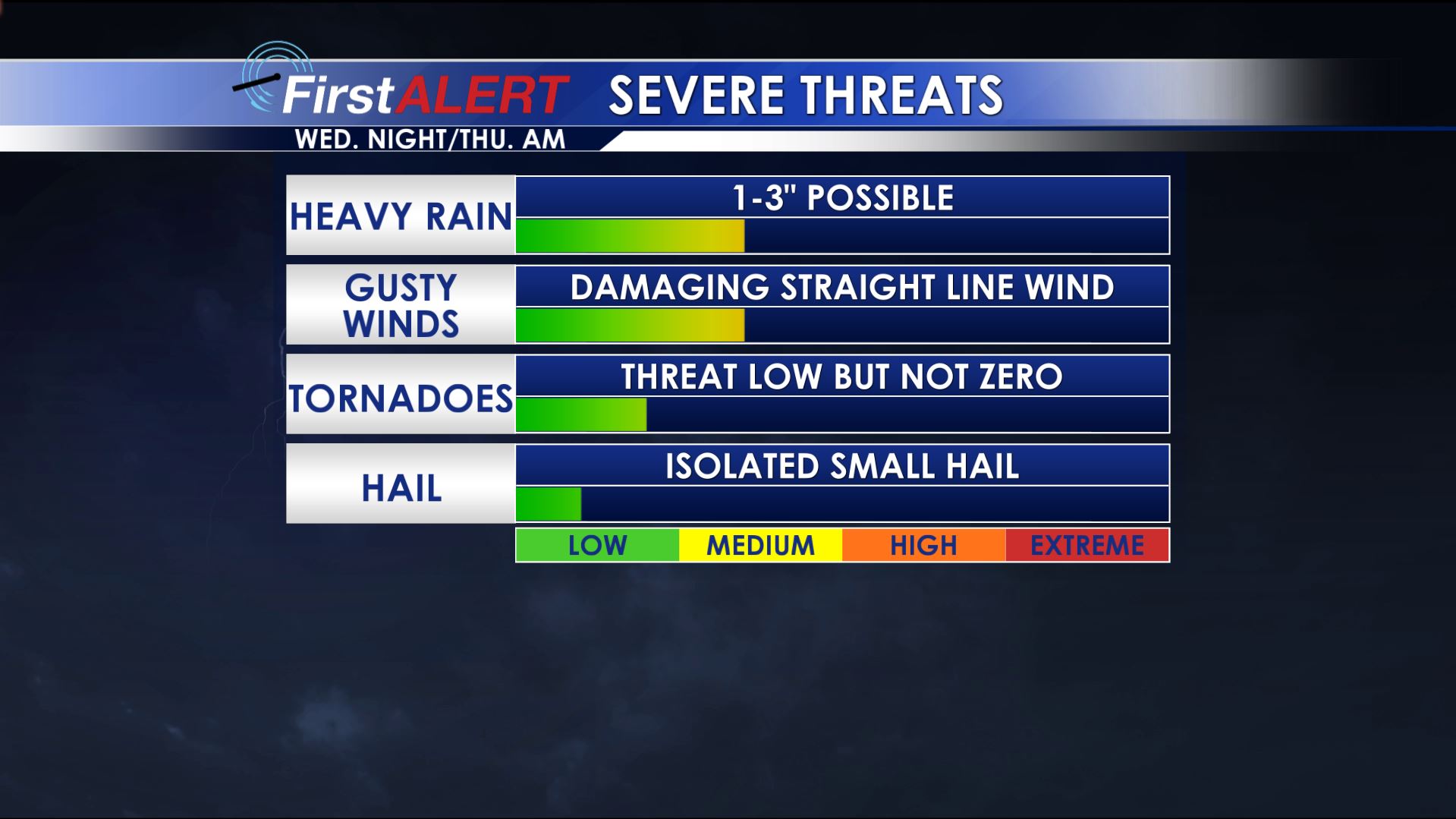
Severe Threat Index
MONDAY NIGHT: Clear and quiet with lows in the upper 40s to around 50.
TUESDAY: Another sunny and warm day is on tap with afternoon highs pushing past 80° in many spots. Southerly winds move into the 5 to 15 mph range.
TUESDAY NIGHT: Variably cloudy and mild conditions are likely. Look for lows in the upper 50s to around 60.
WEDNESDAY: While a few showers are possible during the daylight hours, most of Halloween Day should be mainly dry, breezy, and warm with highs around 80. Some wind gusts may be over 15 mph.
WEDNESDAY EVENING/NIGHT: Odds of rain and storms are increasing as a cold front moves our way. We’re currently thinking the highest odds for rain will hold off until AFTER trick-or-treating concludes in most spots. Some strong storm activity is certainly possible during the night and into Thursday morning with damaging wind gusts and heavy rain the main threats. We’ll be sure to monitor things close over the next few days.
THURSDAY: Lingering showers and storms are likely. Total rain with the front may range from 1” to 3” or more. Highs dip back into the mid to upper 60s.
FRIDAY: A few more showers are possible as an upper air disturbance crosses the Twin States. Highs stay in the 60s.
Follow @WCBIWEATHER on Facebook, Twitter, Instagram, and Snapchat


Leave a Reply