Warm & unsettled start to the work week
SUNDAY NIGHT: Mostly cloudy with showers and storms possible. A low end tornado threat will linger across far north MS during the night. Lows in the 60s.
MONDAY: Partly to mostly cloudy with a 20-30% chance a few showers or storms during the day. Most spots probably won’t have much rain to worry about. Winds SSW 10-15 mph. Muggy highs in the mid 80s.
MONDAY NIGHT: Mostly cloudy with a few showers or storms possible late in the night. Lows in the low 70s.
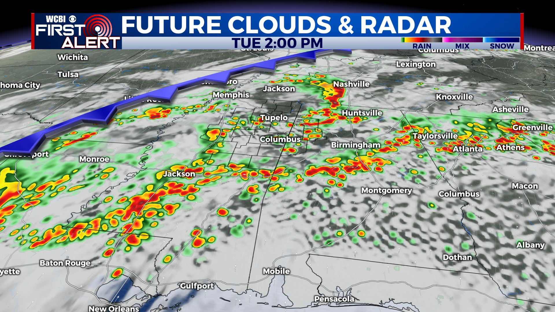
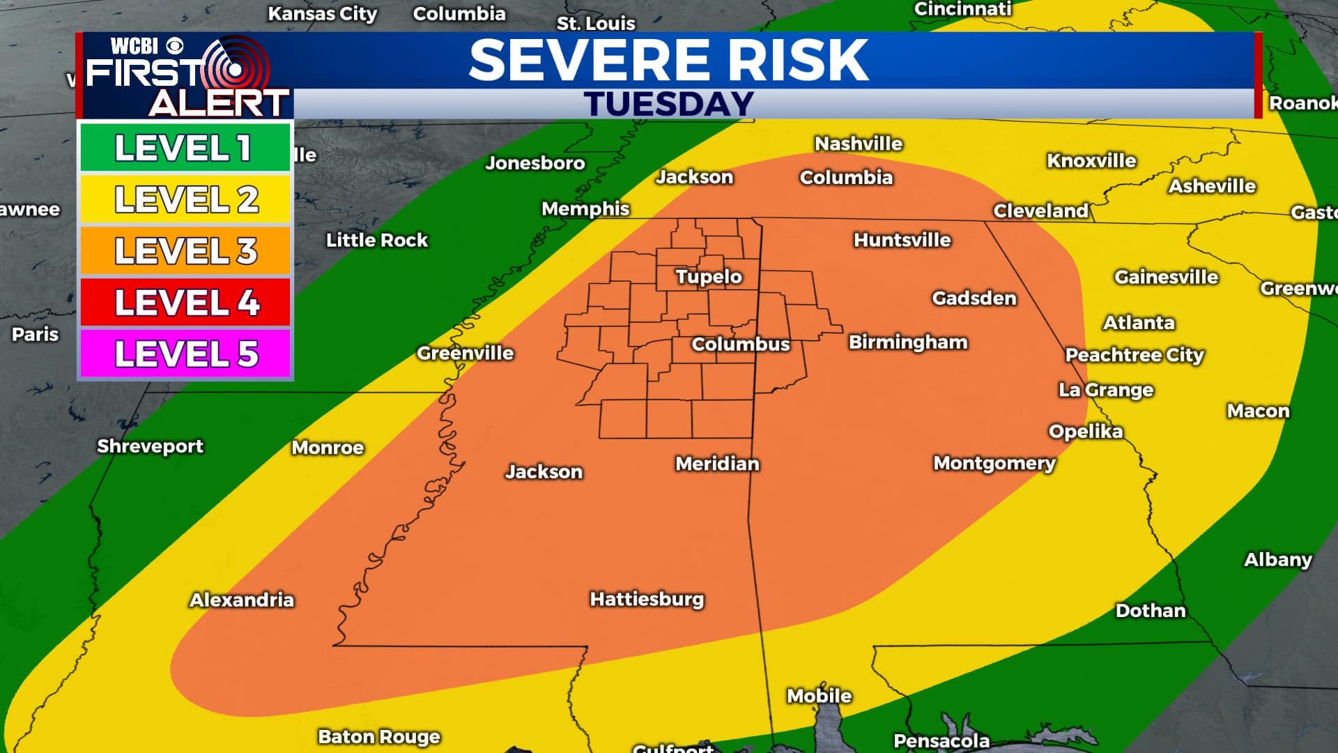
TUESDAY: Areas of rain and storms. More strong to severe storms are possible with a cold front moving into the region. Highs in the low 80s. Lows in the 50s Tuesday night.
WEDNESDAY: Turing partly cloudy with drier air filtering back in from the north. Highs in the mid 70s. Lows in the low 50s Wednesday night.
THURSDAY: Partly cloudy with a slight chance of a few afternoon showers. Highs in the mid 70s. Lows in the low 50s Thursday night.
FRIDAY: Partly cloudy. Highs in the mid 70s. Lows around 50 Friday night.
SATURDAY: Sun & clouds. Highs around 80. Lows in the upper 50s Saturday night.
SUNDAY: A chance of showers and storms. Highs in the low 80s.
Follow @WCBIWEATHER on Facebook, Twitter, Instagram, and the WCBI News App


Leave a Reply