Warm Wednesday, storms possible
SUMMARY: Unseasonably warm air returns for Wednesday with a few scattered storms possible during the day. Another batch of strong storms storms may move through Wednesday night and early Thursday morning with a cold front. Expect quiet weather Thursday afternoon through Saturday afternoon. Another wet & stormy system may pass through on Easter Sunday.
TUESDAY NIGHT: Partly to mostly cloudy. A few showers may linger. Lows in the 60s.
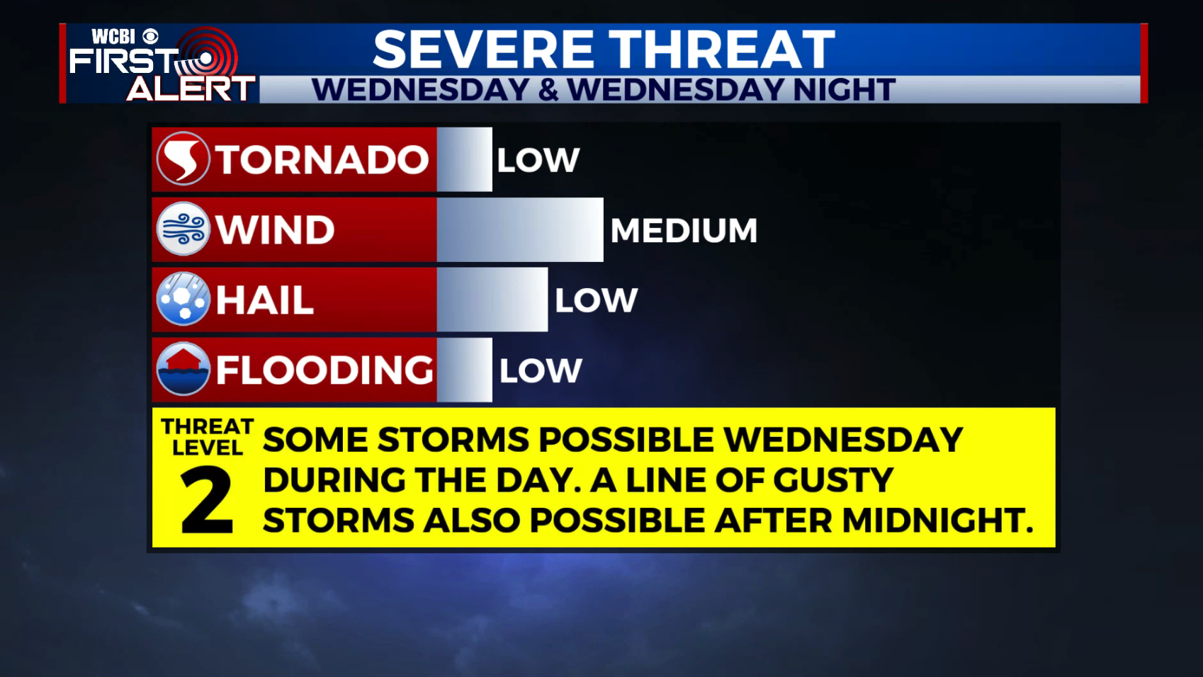
WEDNESDAY: Turning partly cloudy with a 30% chance of a few storms during the day. Very warm for early April with highs in the mid to upper 80s.
WEDNESDAY NIGHT: A chance for some gusty storms after midnight as a cold front moves in from the north. Lows in the 60s.
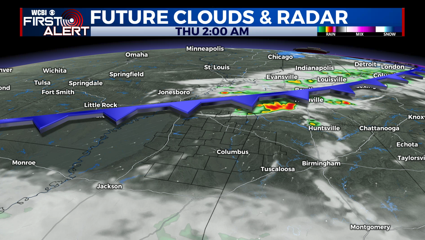
THURSDAY: Some early morning storms are possible with a mix of sun and clouds for most of the day. Cooler highs in the low 70s.
THURSDAY NIGHT: Partly cloudy and cool. Lows in the mid to upper 40s.
FRIDAY: Sun & clouds. Cooler highs in the mid 60s.
FRIDAY NIGHT: Chilly. Lows in the upper 30s to lower 40s.
SATURDAY: Variably cloudy. Some showers are possible late in the day and into the evening. Highs near 70.
EASTER SUNDAY: Areas of rain and storms. Some strong to severe weather is possible in the region but it’s too early to be specific as to who may see what. Stay tuned. Highs in the 70s.
Follow @WCBIWEATHER on Facebook, Twitter, Instagram, and on the WCBI News App


Leave a Reply