Warm Wednesday then turning colder
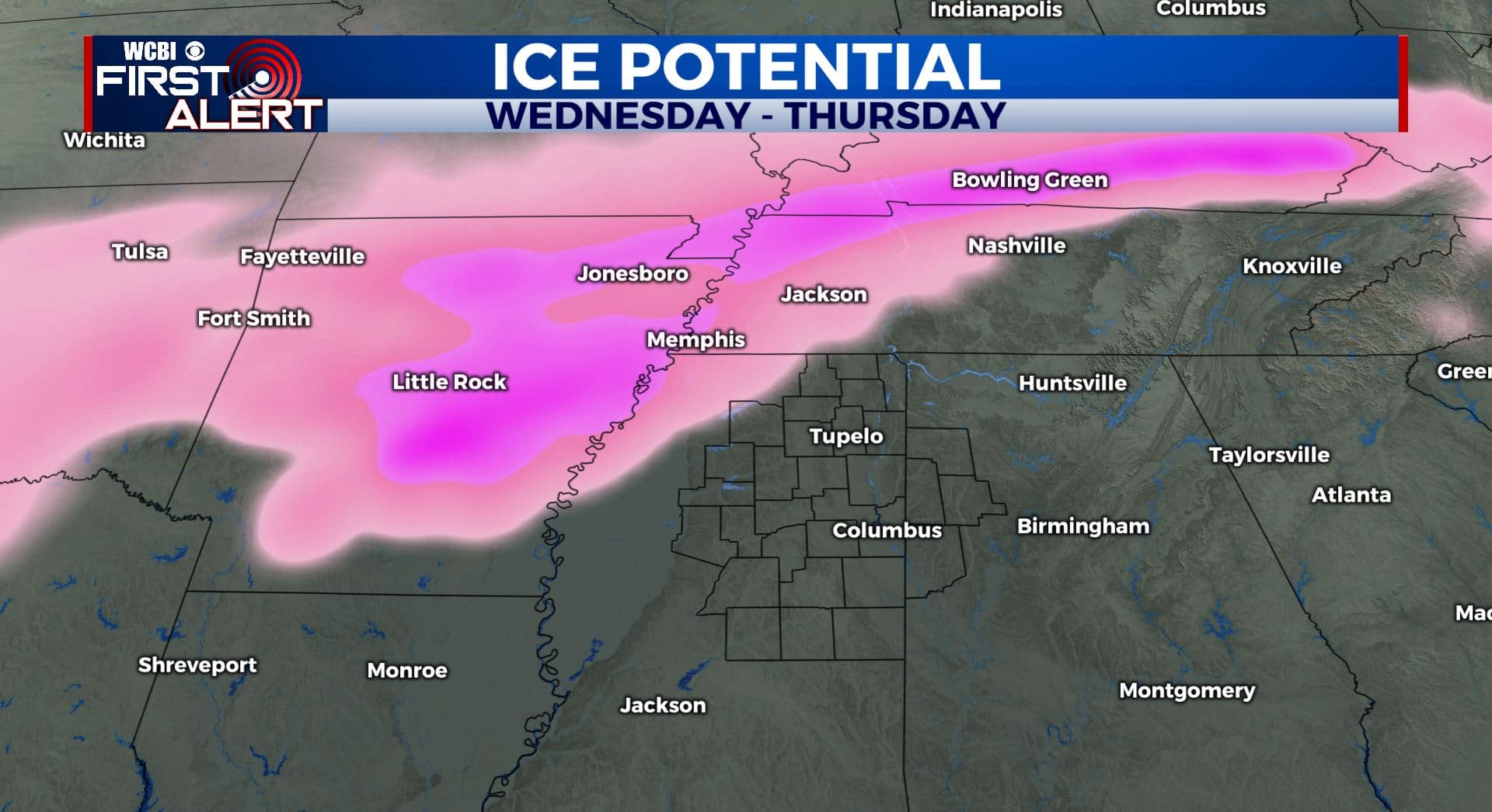
SUMMARY: Spring-like air will last through Wednesday. A cold front will bring a good chance of rain to the WCBI coverage area starting Wednesday night lasting into Friday. Freezing rain will be a concern JUST to our northwest towards Memphis over the next 2 days but we expect all liquid here at this point.
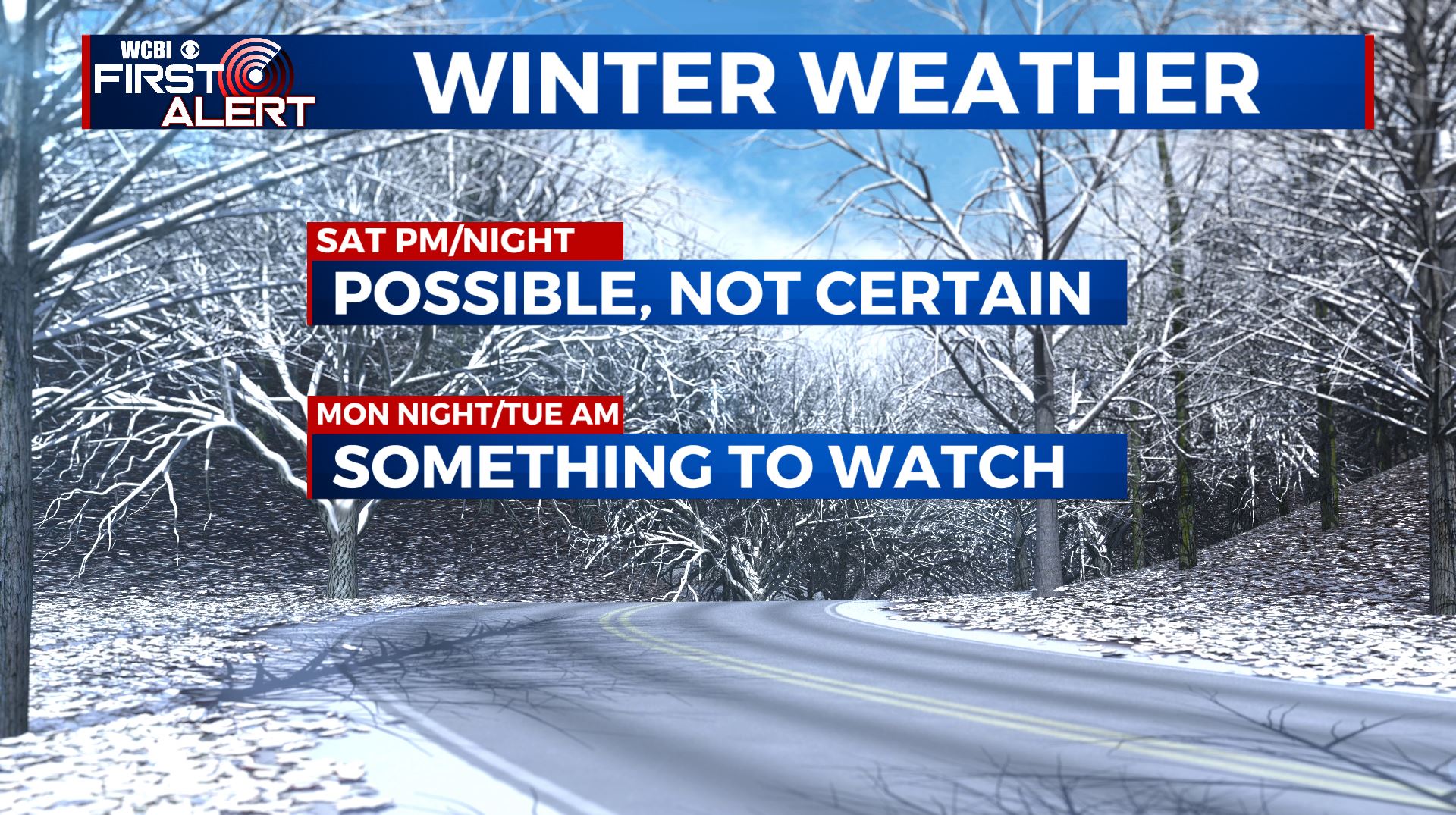
Some wintry weather chances do exist here for the weekend and early next week with the cold air lingering in place. It’s definitely something we’ll be watching closely.
TUESDAY NIGHT: Mostly cloudy. Lows in the mid 40s. Light wind and variable winds.
WEDNESDAY: Mostly cloudy. Unseasonably mild highs well into mid to upper 60s across the southern 1/2 of the area. Cooler 50s may be found closer to the Tennessee border. Winds SE 3-8 mph. A few showers are possible during the day but the chance is just 20%.
WEDNESDAY NIGHT: Cloudy with areas of rain developing. Lows in the 40s to low 50s.
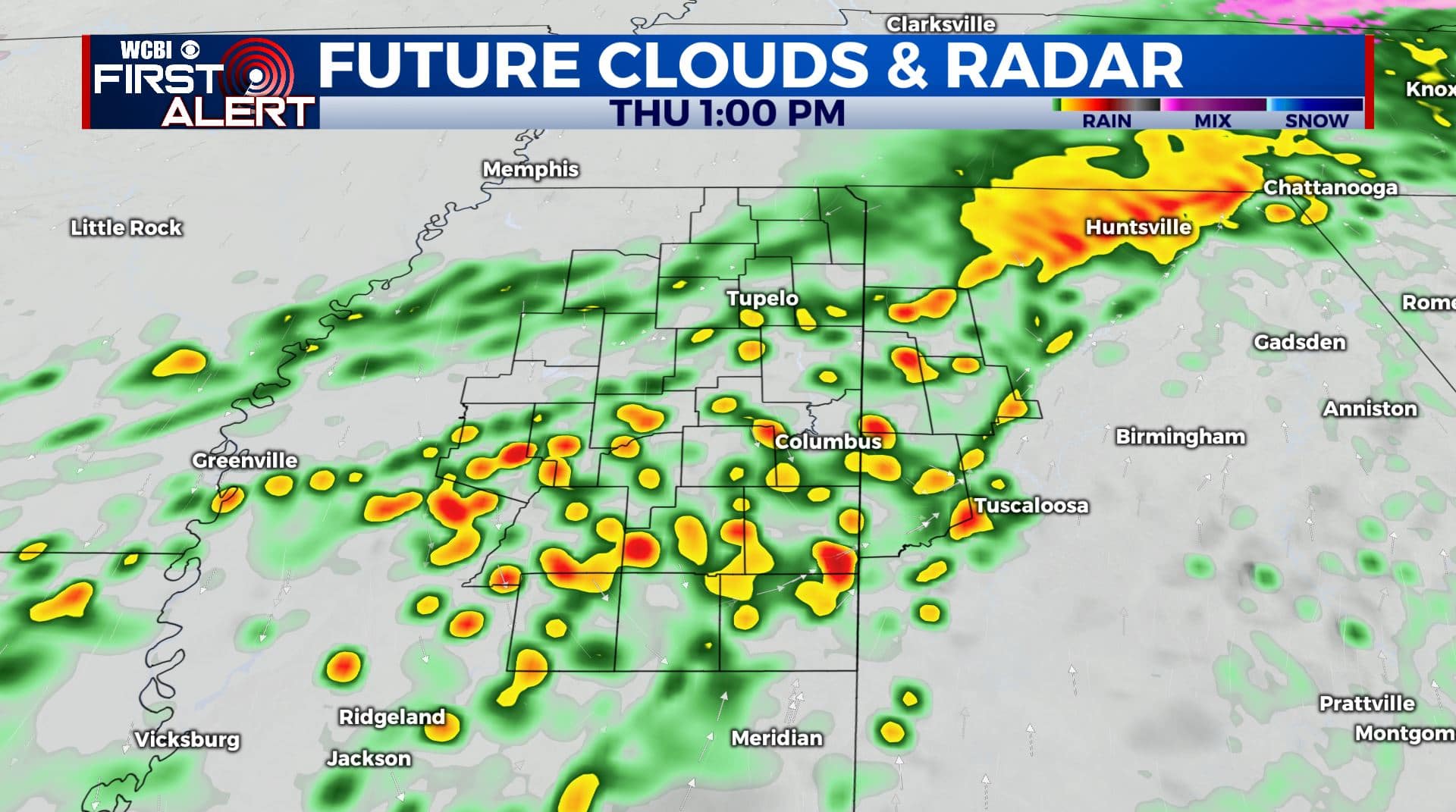
THURSDAY: Areas of rain. Mild 50s and/or low 60s early in the day with gradually falling temperatures during the afternoon. Northerly winds 5-15 mph. The chance of rain is near 100%.
THURSDAY NIGHT: Cloud with rain continuing. Lows in the mid to upper 30s.
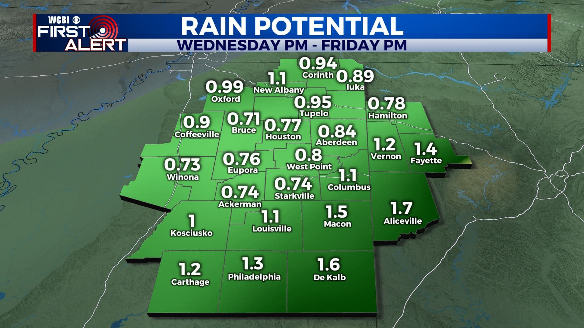
FRIDAY: Mostly cloudy. Lingering rain showers should gradually come to an end. Highs in the 40s. Total rainfall between 1/2″ to close 2″.
FRIDAY NIGHT: Mostly cloudy. Lows in the 30s.
SATURDAY: Mostly cloudy. Highs in the 30s and 40s.
SATURDAY NIGHT: Mostly cloudy. A chance of some wintry weather. Lows in the 20s.
SUNDAY: Mostly cloudy, brisk, and cold. Highs in the mid 30s.
SUNDAY NIGHT: Mostly cloudy. Cold. Lows in the low 20s.
MONDAY: Mostly cloudy. Cold. Highs in the mid 30s.
MONDAY NIGHT/TUESDAY: An area of low pressure could produce a better chance of wintry weather across the region. All types of weather remain possible. Lows in the 20s Monday night with 30s for highs on Tuesday.
Follow @WCBIWEATHER on Facebook, Twitter, Instagram, and the WCBI News App


Leave a Reply