Warm, windy and a bit stormy for our Monday
SUMMARY: An active Monday is ahead for us here in north Mississippi and west Alabama thanks to fog this morning then a warm & windy afternoon followed by showers and storms after sunset. Tuesday will be dry but more showers are possible by Wednesday and again by the weekend with cooler but near average temperatures.
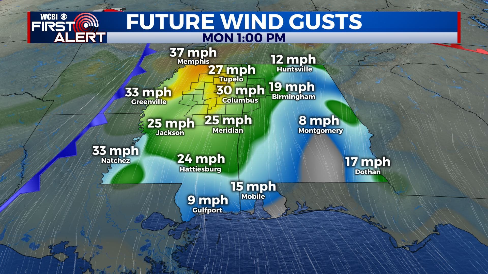
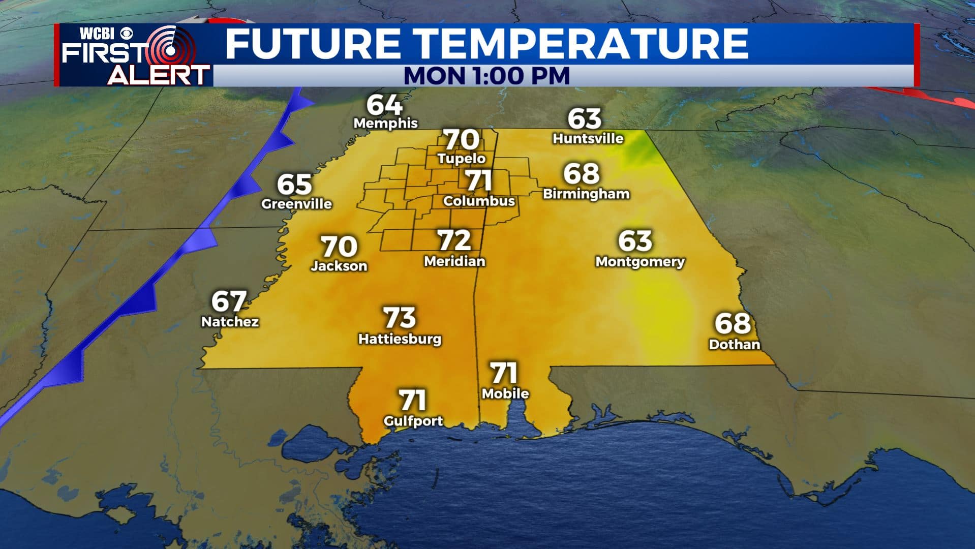
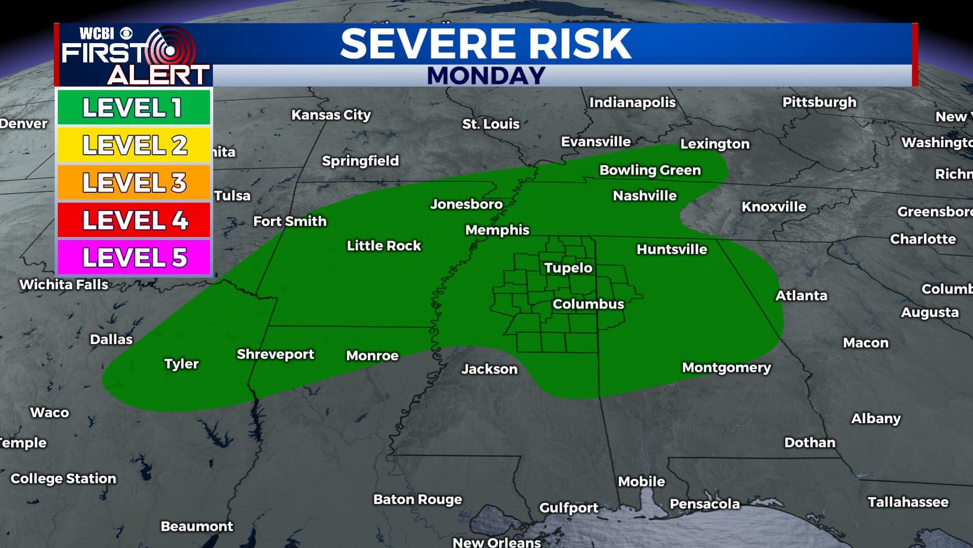
MONDAY: A warm front has lifted to our north, which will allow for a warm and windy Monday for us. Highs will be warmer and above average for late January in the lower 70s with gusty SSW winds 10-20 sustained up to 30 mph. We’ll also have a chance of showers & storms after sunset as a cold front will push through the region.
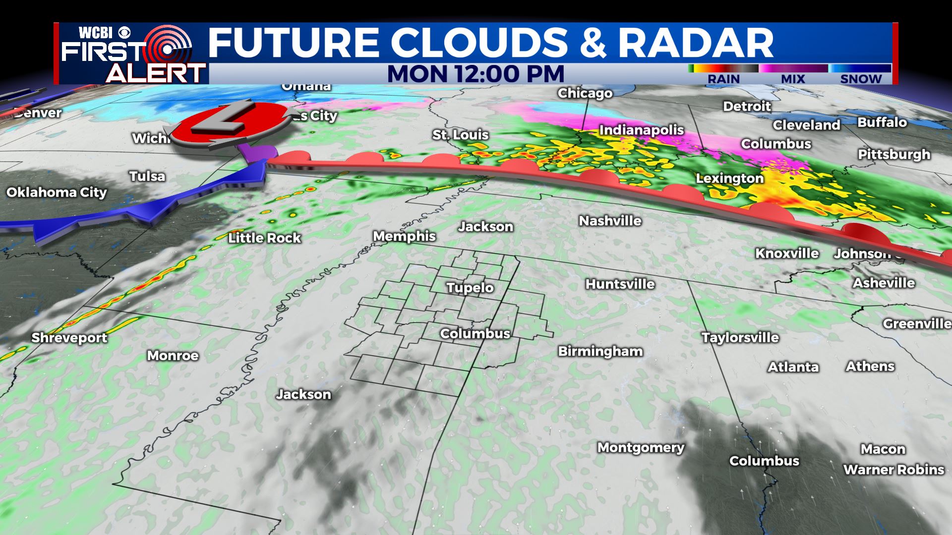
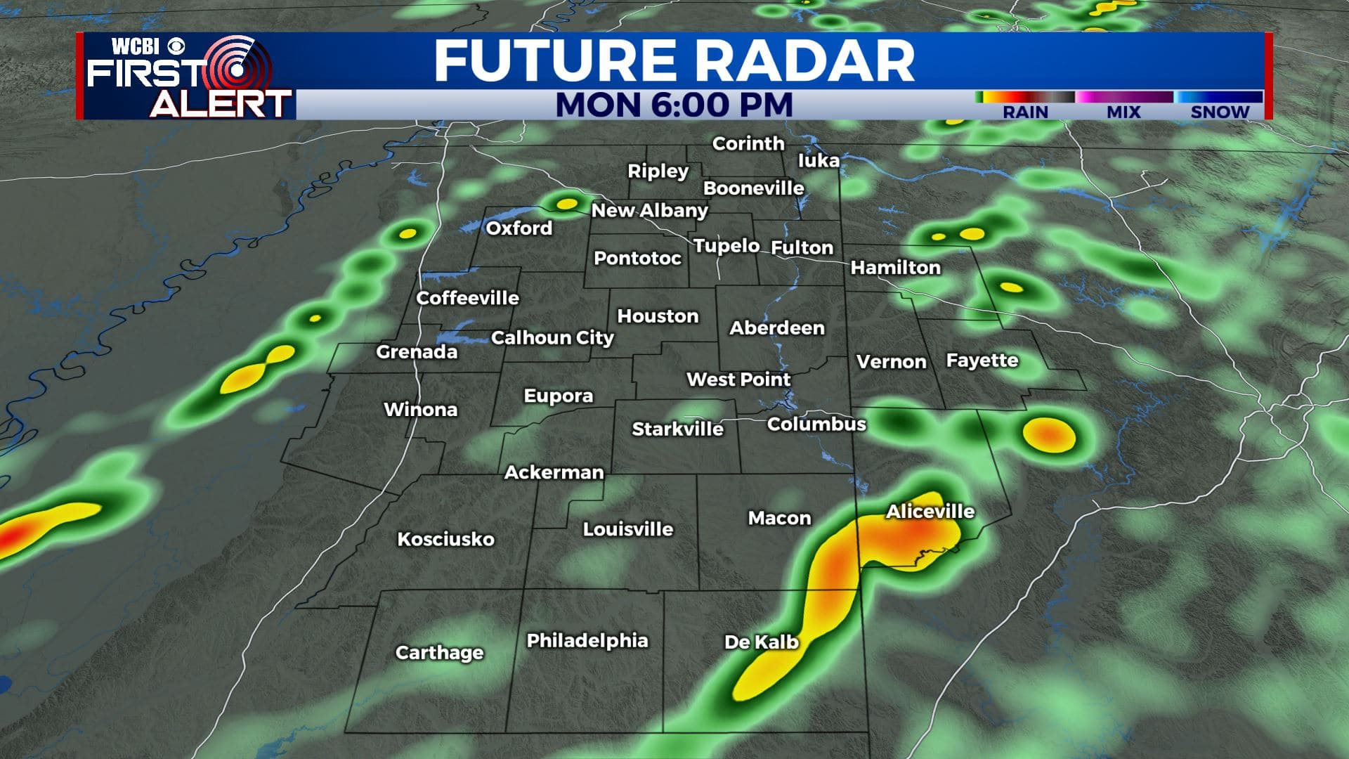
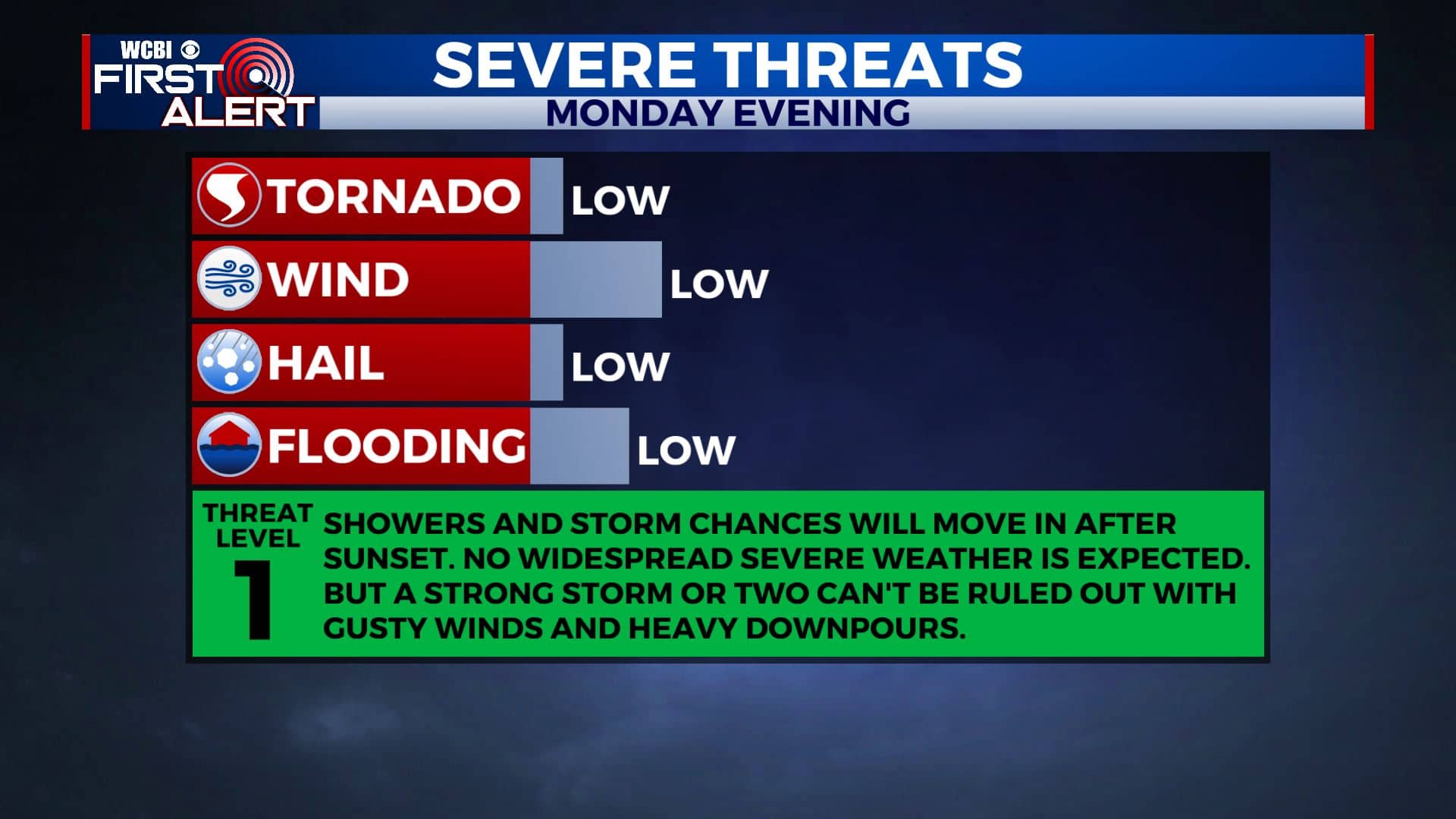
MONDAY NIGHT: Showers and storm chances will continue through late evening. No widespread severe weather is expected. But a strong storm or two can’t be ruled out with gusty winds and heavy downpours. Showers and cloud cover should be out of our area by morning. Overnight lows near 50.
TUESDAY: We’ll have drier weather with a mix of sun and clouds. Temperatures will remain above normal with highs in the upper 60s. Overnight lows in the mid 40s.
WEDNESDAY: More off-and-on again chances of showers are possible throughout the day. Highs will be in the mid 50s.
THURSDAY-FRIDAY: We’ll have mostly sunny skies to end the workweek. Cooler though with highs in the upper 40s to lower 50s.
WEEKEND: Most of Saturday looks dry, but some rain could move in Saturday night into early Sunday morning. High temperatures will be in the lower 60s.
Stay connected with @WCBIWEATHER on Facebook, Twitter, Instagram, and the WCBI News App


Leave a Reply