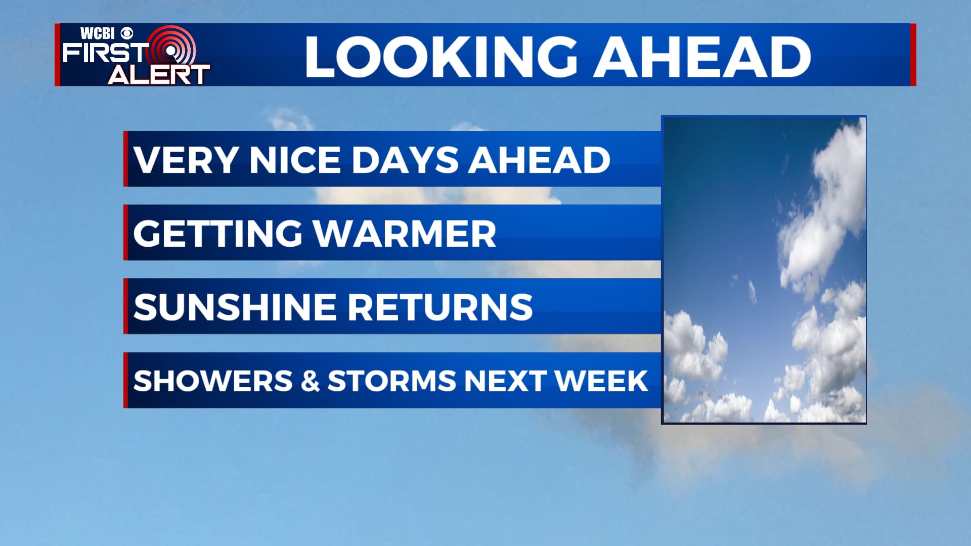
Warmer temperatures as returning as we end the workweek
SUMMARY: Rain chances finally moves out of the region. Temperatures warming back up into the weekend as the 70s and 80s make a comeback. The sunny skies will last through most of the weekend before another chance for some showers and storms returns to the forecast next week.
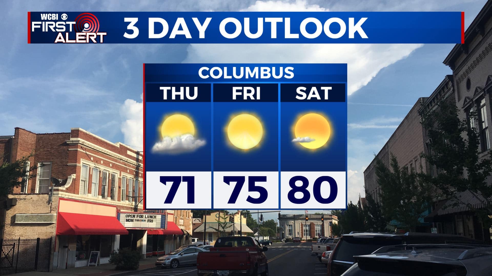
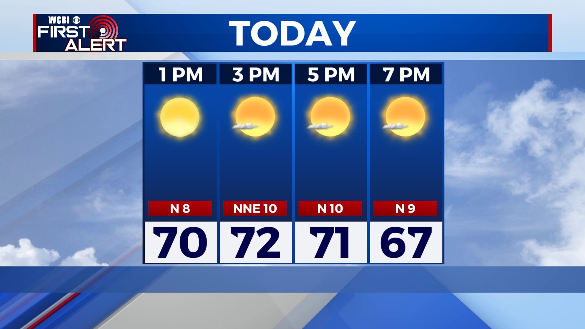
THURSDAY: We’ll start off our day with mix of sun & clouds as we finally start drying out as high pressure builds in. More sunshine by the afternoon. Highs in the lower to mid 70s. North winds 5-10 mph.
THURSDAY NIGHT: Mostly clear skies with cooler overnight lows around 50 degrees.
FRIDAY: Mostly sunny skies. Highs in the mid 70s. Lows in the low 50s Friday night.
SATURDAY: Getting warmer with highs projected to be in the low 80s and mostly sunny skies. Overnight lows in the 50s.
SUNDAY: Continuing to get warmer with plenty of sunshine and highs in the low-to-mid 80s. Overnight lows in the 60s.
NEXT WEEK: High pressure shifts east and brings in our next chance for some showers and thunderstorms for the first half of the week. Highs remain warm in the mid 80s.
Stay connected with @WCBIWEATHER on Facebook, Twitter, Instagram, and the WCBI News App.


Leave a Reply