Warmer Weekend & A “Spooky” Halloween Forecast
SUNDAY: The sun that we saw Saturday will continue on into Sunday! Our temperatures will be a good 10 degrees warmer as well! We will top out in the upper 80’s, with a few locations seeing lower 80’s for highs. We will remain dry on Sunday, with winds out of the west-southwest between 12 to 18 MPH. Some gusts over 20 MPH could be possible during the evening.
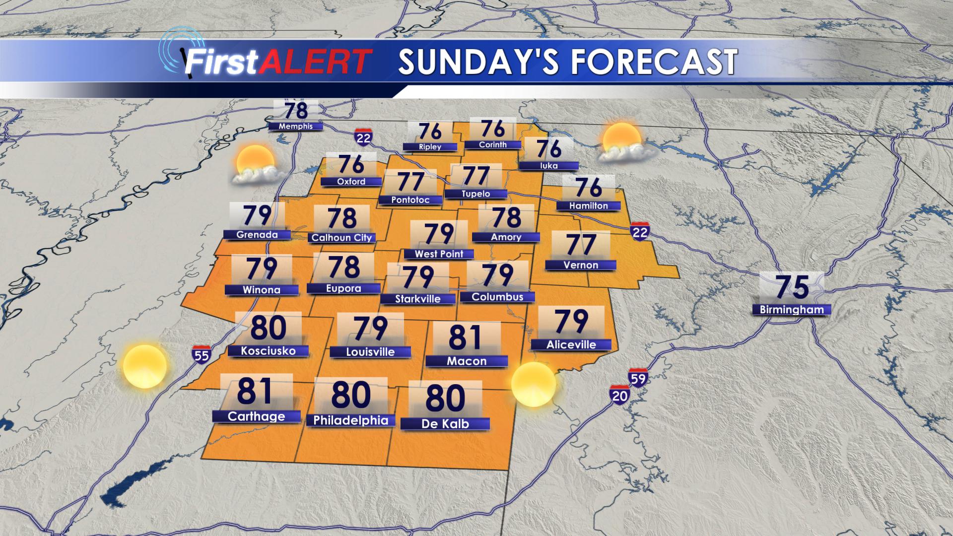
Sunday’s Highs
MONDAY-TUESDAY: The sunshine and warmth will last through the first part of the work-week! The sun will continue to shine during the day on Monday and Tuesday, allowing high temperatures to range from the middle 70’s on Monday, to the lower 80’s on Tuesday! Overnight lows will warm from the lower 50’s Monday night, to the lower 60’s on Tuesday night. Winds out of the south-southeast keep us warm, but will also move some moisture into our area. As we head into the overnight hours on Tuesday, clouds will begin to increase as our next weather system approaches the area.
WEDNESDAY(HALLOWEEN) – THURSDAY: A cold front will bring us widespread showers and storms throughout the day on Wednesday. We could see anywhere from 0.50″ to 1.00″ of rain from Wednesday morning through Thursday evening. Highs will remain in the upper 70’s on Wednesday, but as we go into Thursday, our highs will drop a good 10 degrees, topping out in the middle to upper 60’s. Overnight lows will also drop from the middle 50’s Wednesday night, to the middle 40’s Thursday night. Winds will shift from the south to the northwest, helping to usher in the cooler air.
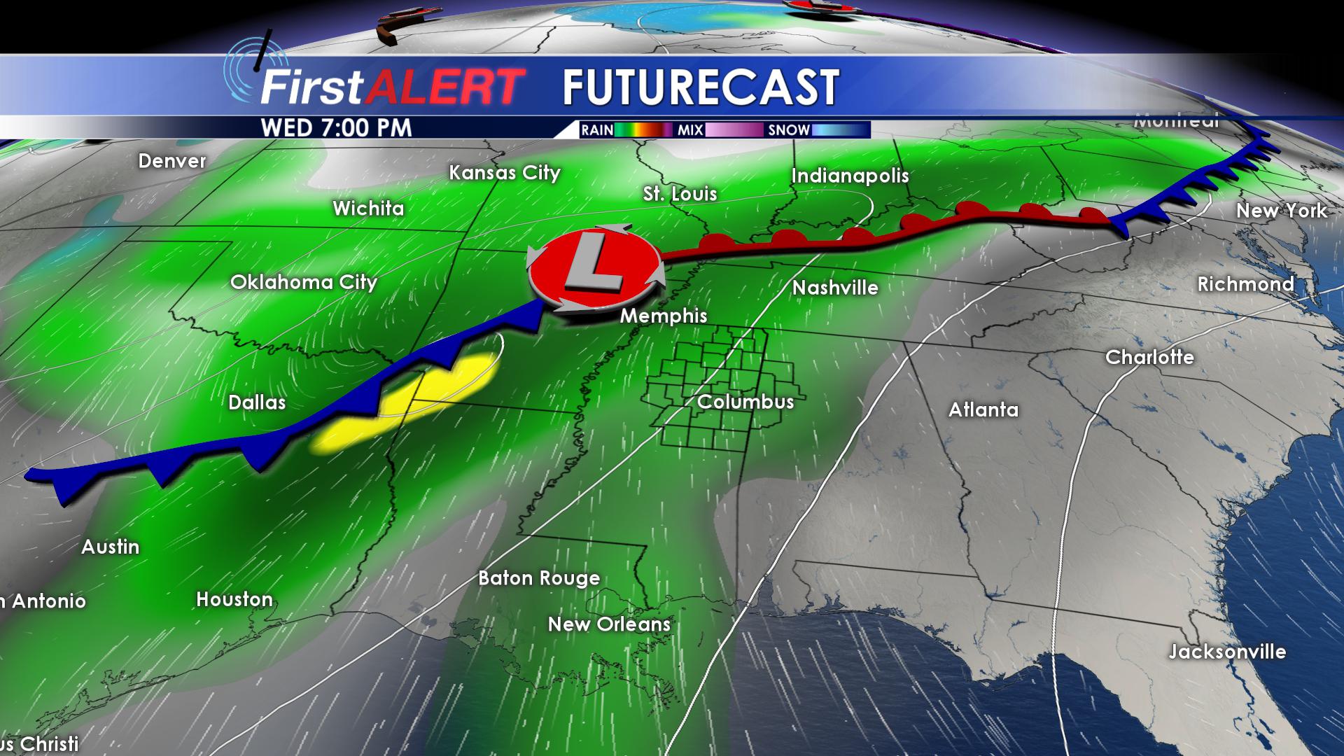
Wet on Halloween Night
FRIDAY-SATURDAY: We will dry out as we head into the weekend. We will remain cool with highs on both Friday and Saturday struggling to make it into the mid 60’s. We will remain in the middle to upper 40’s overnight. Rain chances for Friday and Saturday will remain near zero, with calm winds.
FOLLOW @WCBIWEATHER on Facebook, Twitter, Instagram and Snapchat!


Leave a Reply